

more stats
3.6 miles
Distance
503 ft
Climb
-402 ft
Descent
00:31:38
Avg time
101 ft
Altitude change
338 ft
Altitude min
532 ft
Altitude max
431 ft
Altitude start
531 ft
Altitude end
0.5%
Grade
-18.8%
Grade max
20.6%
Grade min
2 miles
Distance climb
1 mile
Distance down
4,521 ft
Distance flat
00:31:38
Avg time

Lonely Hunter Details

  • Activities
    • Mountain Bike
    • Hike
    • Trail Running
  • Riding Area
    Standing Boy Trails
    Columbus, Georgia
  • Difficulty Rating
  • Local Popularity
    70 in Mountain Biking heatmap [+]
    • 65 in Trail Running
    • 5 in Hiking
  • Global Ranking
    #68163 in Mountain Biking [+]
    • #140370 in Trail Running
    • #296413 in Hiking
  • State Ranking
    #341 in Mountain Biking · Georgia [+]
    • #675 in Trail Running
    • #1,388 in Hiking
  • Hiking SAC Scale
    T2 Mountain Hiking
  • Trail Type
    Singletrack
  • Bike Type
    AM, XC
  • Direction
    Both Directions
  • Physical Rating
    Moderate
  • Trail Visibility
    Always easy to follow
  • Season
    All Year
  • Dogs Allowed
    Yes
  • eBike Allowed
  • TTFs on Trail
    Berm, Drop, Jump, Rock Garden
  • Year Opened
    2020
  • Land Owner
    DNR

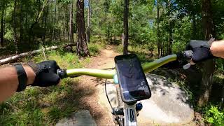
Lonely Hunter is an intermediate trail with rollers, berms, rocks, and flow. The trail also edges up against Lake Oliver twice along the way. Check the kiosk for more info.

Access Info

Take a left onto the first gravel road off of Old River Road and there will be a gravel parking lot on the right where the trail starts. Do not park on Old River Road. To go counter-clockwise the trail starts from the access road to the left of where the south side of Bimini runs into the gravel road (not at the hub). When you make a left where Bimini meets the gravel road you'll start going up a hill and eventually Lonely Hunter will be on your right. To go clockwise you leave the parking lot to the left of the kiosk and head right down the gravel road. Eventually you'll enter the trail on the right after you've crossed the dam.

Disclaimer

You must have a GA State Parks ParkPass, annual or daily.

Trail Supporters

Traditionally Indigenous Territory

Recent Activity on Trail

Past Week
  • 1 rides
  • 8 miles average
6 Months
  • 14 rides
  • 15 miles avg distance
All
  • 168 rides
  • Last: Nov 12, 2026
c1c2c3c4
January
February
March
April
May
June
July
August
September
October
November
December
Status:
on Sep 26, 2026
Ideal
Avg: 4.24 (3 votes)
Your vote: 0

view (1,047)
close
      Directions to lonely-hunter trailhead (32.574460, -85.040570)

      Photos

      10 more »
      mtb
      180 |
      Sep 24, 2022 @ 2:06pm
      Sep 24, 2022
      mtb
      143 |
      May 15, 2021 @ 7:03pm
      May 15, 2021
      mtb
      188 |
      May 15, 2021 @ 7:02pm
      May 15, 2021
      mtb
      203 |
      Oct 3, 2020 @ 9:35am
      Oct 3, 2020

      Videos

      1 more »
      POV - Lonely Hunter - Standing Boy Trails -...
      mtb
      1:10:51 | 371 | Jul 12, 2021 , Columbus
      4.7 ★★★★★
      3 Ratings
      5 ★ 67%
      4 ★ 33%
      3 ★
      2 ★
      1 ★

      5 Reviews & Comments

      ajriding ajriding
      Trail builder did a great job on this trail, and the rocks are excellent. The rocks, big ones, 2-3 foot wide rocks, are well-places to control erosion in the ditches, yet offer a fun feature at the same time. These are big rocks, rideable, and in other places are placed for the enjoyment of riding technical things. The beginner riders have blazed cheater trails around the rocks so if you are scared then you have bail-outs from like-minded newbie riders built in. Ride the rocks! By no means is it a rock garden. Trail is in great shape, and I appreciate that there is water control devices and features every 50 feet on hills. The trail crew does a good job and puts in a lot of work.
      ajriding ajriding
      Fun trails. Rocks , yes. I would never characterize this trail as "rock gardens", none of the trails are best described as rock gardens or "tons of rocks". Dismiss such comments, these are rank beginners comments. I was surprised overall on all the trails how mountainous they felt with deep valleys and ridges that looked like North Ga trails. Plenty of climbing if you want it but not so much like a real mountain. All trails are fun whether rated green, blue or black. Ride them all.
      tacobravo tacobravo
      Nice trail going either direction. Both directions require climbing out. There are multiple sections of rock gardens but not enough to say its too difficult. The rock gardens at Tie Snake Upper are much more technical and numerous.

      We hope you've been enjoying Trailforks!

      Create a FREE account to view all trail reviews and much more.

      • By williedTF Pro CVA SORBA & contributors
      • #308004 - 1,684 views

      Frequently Asked Questions

      ▼ Where is Lonely Hunter located?
      Lonely Hunter is located in Standing Boy Trails, Columbus, Georgia, United States. It is part of the Standing Boy Trails trail network. The trailhead is located at coordinates 32.57446, -85.04057.
      ▼ How hard is Lonely Hunter?
      Lonely Hunter is rated as Blue difficulty. The physical rating is Moderate. The average grade is 0.5%.
      ▼ What is the elevation gain for Lonely Hunter?
      Lonely Hunter has 503 ft of elevation gain. The trail has 402 ft of elevation descent. The elevation ranges from 338 ft to 532 ft.
      ▼ Is Lonely Hunter a point to point trail?
      Lonely Hunter is not a point to point trail. The direction is Both Directions. The trail type is singletrack.
      ▼ How long is Lonely Hunter?
      Lonely Hunter is 3.6 miles long. The trail type is singletrack.
      ▼ Are dogs allowed on Lonely Hunter?
      Yes, dogs are allowed on Lonely Hunter. Please keep dogs on a leash where required and clean up after them.
      ▼ When is the best time of year to ride Lonely Hunter?
      Lonely Hunter is best visited during: All Year.
      ▼ How do I access Lonely Hunter? Where is the closest parking trailhead?
      The closest parking and trailhead locations to Lonely Hunter are: View all parking locations in the area.
      ▼ How long does it take to ride Lonely Hunter?
      Based on recorded activities, it takes an average of 32 minutes to ride Lonely Hunter. The trail is 3.6 miles long. Actual times will vary based on fitness level, conditions, and pace. View recent activity logs for more details.
      ▼ How busy is Lonely Hunter?
      Lonely Hunter is a very popular trail. There have been 954 recorded activities on this trail. The trail has received 1,047 check-ins. View recent activity on this trail.

      Hit the Trail

      Open in App

      Get this trail on your phone instantly.

      open trail in app

      Download Trail

      Save to wishlist, Garmin & download.
      save the trail

      Find Related Routes

      Find routes and users activities that include this trail.
      find routes for this trail

      You must enter a description before submitting.