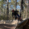
more stats
2.1 miles
Distance
133 ft
Climb
-117 ft
Descent
00:13:06
Avg time
14 ft
Altitude change
957 ft
Altitude min
1,059 ft
Altitude max
1,041 ft
Altitude start
1,056 ft
Altitude end
0.1%
Grade
-14.2%
Grade max
14.6%
Grade min
4,488 ft
Distance climb
3,330 ft
Distance down
3,379 ft
Distance flat
00:13:06
Avg time

Long Details

  • Activities
    • Mountain Bike
    • E-Bike
  • Riding Area
    Holston Creek Park
    Inman, South Carolina
  • Difficulty Rating
  • Voted Difficulty
    Green (2 votes)
  • Local Popularity
    60 in Mountain Biking heatmap [+]
    • 60 in E-Biking
  • Global Ranking
    #94291 in Mountain Biking [+]
    • #43505 in E-Biking
  • State Ranking
    #134 in Mountain Biking · South Carolina [+]
    • #21 in E-Biking
  • Trail Type
    Singletrack
  • Bike Type
    XC
  • Direction
    One Direction
  • Climb Difficulty
    Green
  • Physical Rating
    Easy
  • Trail Visibility
    Always easy to follow
  • eBike Allowed
    Yes up to Class 1
  • TTFs on Trail
    Berm, Jump, Pump Track
  • Year Opened
    2017
  • Land Owner

Great beginner/family trail good enough to keep any level rider entertained. Wide tread and lack of roots make this a great trail to take beginners. Wide trail corridor and tread is suitable for Adaptive Mountain Bikes.

Hours:
0700 - 2100

Disclaimer

One-Way clockwise direction only, No dogs or foot traffic on trail.

Tags
BermsJumpsPicnic spotPump track

Local Trail Association

Recent Activity on Trail

Past Week
  • 1 rides
  • 11 miles average
6 Months
  • 50 rides
  • 9 miles avg distance
All
  • 388 rides
  • Last: Nov 15, 2026
c1c2c3c4
January
February
March
April
May
June
July
August
September
October
November
December
update trails status or condition

Long Trail Reports

statusdatedescription
Nov 15, 2026 @ 1:36pm (America/New_York)
2 days
Sep 14, 2026 @ 7:47pm (America/New_York)
Sep 14, 2026
Some mud and wetter sections after the recent rain but mostly good dirt. I cleared several fallen branches from the trail. Just a little bit of...
Sep 2, 2026 @ 6:31pm (America/New_York)
Sep 2, 2026
First time here. Very dry but clear. Could use some grooming on the berms, but an excellent ride!
Apr 13, 2025 @ 2:53pm
Apr 13, 2025
Feb 26, 2025 @ 2:08pm
Feb 26, 2025
more »
Status:
on Nov 15, 2026
Dry
Avg: 4.27 (6 votes)
Your vote: 0

view (3,986)
close
      Directions to long-92290 trailhead (35.059330, -82.166840)

      Photos

      19 more »
      mtb
      105 |
      Jun 29, 2021 @ 2:31pm
      Jun 29, 2021
      mtb
      150 |
      Oct 18, 2020 @ 5:01pm
      Oct 18, 2020
      mtb
      104 |
      Oct 18, 2020 @ 5:01pm
      Oct 18, 2020
      mtb
      168 |
      Oct 18, 2020 @ 5:00pm
      Oct 18, 2020

      Videos

      2 more »
      Holston Creek Park - Mountain Bikes!
      mtb
      0:33 | 803 | Oct 17, 2020 , Inman
      Holston Creek Mountain Biking
      mtb
      14:37 | 2487 | Jun 18, 2020 , Inman

      Routes with this trail

      more »
      ★ 3.4 • 3 miles • 139 ft • 2 •
      A typical loop around HCP.
      4.7 ★★★★★
      6 Ratings
      5 ★ 67%
      4 ★ 33%
      3 ★
      2 ★
      1 ★

      3 Reviews & Comments

      Trav1 Trav1
      So happy to have found this place as many trails in NC deal with thaw/freeze issues in Jan/Feb but this trail was in very good condition at the end of Jan.
      Mostly flat, so good for beginners but fun for those advanced as well as you can work on corning and speed, and the trail even has a few berms. 🤙
      Monopolizedinc Monopolizedinc
      SAMBA hosts a beginner group ride on the first Saturday of the month that is open to all ages and experience levels. Usally starting 9am or 10am depending on the season. Check out the our Facebook page for the monthly calendar.
      boxx620
      Great trail for kids and beginners. Very smooth terrain. The end of the loop has some gradual uphill but nothing crazy.

      We hope you've been enjoying Trailforks!

      Create a FREE account to view all trail reviews and much more.

      • By Ccouch5859TF Pro & contributors
      • #92290 - 3,640 views

      Frequently Asked Questions

      ▼ Where is Long located?
      Long is located in Holston Creek Park, Inman, South Carolina, United States. It is part of the Holston Creek Park trail network. The trailhead is located at coordinates 35.05933, -82.16684.
      ▼ How hard is Long?
      Long is rated as Green difficulty. The physical rating is Easy. The average grade is 0.1%. The climb difficulty is rated Green.
      ▼ What is the elevation gain for Long?
      Long has 133 ft of elevation gain. The trail has 117 ft of elevation descent. The elevation ranges from 957 ft to 1,059 ft.
      ▼ Is Long a point to point trail?
      Yes, Long is a point to point trail. The direction is One Direction. The trail type is singletrack.
      ▼ How long is Long?
      Long is 2.1 miles long. The trail type is singletrack.
      ▼ Are dogs allowed on Long?
      There is no information about dogs being allowed on Long. Check with local trail managers or the trail page for the latest access rules.
      ▼ When is the best time of year to ride Long?
      Based on activity log data, the most popular months to ride Long are:
      • August (41 activities)
      • September (28 activities)
      • July (24 activities)
      Check the reports page for current trail conditions.
      ▼ How do I access Long? Where is the closest parking trailhead?
      The closest parking and trailhead locations to Long are: View all parking locations in the area.
      ▼ How long does it take to ride Long?
      Based on recorded activities, it takes an average of 13 minutes to ride Long. The trail is 2.1 miles long. Actual times will vary based on fitness level, conditions, and pace. View recent activity logs for more details.
      ▼ How busy is Long?
      Long is a moderately popular trail. There have been 2,139 recorded activities on this trail. The trail has received 3,986 check-ins. View recent activity on this trail.

      Hit the Trail

      Open in App

      Get this trail on your phone instantly.

      open trail in app

      Download Trail

      Save to wishlist, Garmin & download.
      save the trail

      Find Related Routes

      Find routes and users activities that include this trail.
      find routes for this trail

      You must enter a description before submitting.