more stats
2,972 ft
Distance
-206 ft
Descent
00:04:45
Avg time
-206 ft
Altitude change
312 ft
Altitude min
517 ft
Altitude max
517 ft
Altitude start
312 ft
Altitude end
-6.9%
Grade
-22%
Grade max
1.9%
Grade min
85 ft
Distance climb
2,579 ft
Distance down
308 ft
Distance flat
00:04:45
Avg time

Lorikeet (4) Details

  • Activities
    • Mountain Bike
    • E-Bike
    • Adaptive Bike
  • Riding Area
  • AKA
    Ball Buster
  • Difficulty Rating
  • Voted Difficulty
    Blue (7 votes)
  • Local Popularity
    95 in Mountain Biking [+]
    • 100 in E-Biking
    • 5 in Adaptive Biking
  • Global Ranking
    #25521 in Mountain Biking [+]
    • #2154 in E-Biking
    • #629 in Adaptive Biking
  • National Ranking
    #1,294 in Mountain Biking · Australia [+]
    • #23 in E-Biking
    • #35 in Adaptive Biking
  • Trail Type
    Singletrack
  • Bike Type
    AM, XC, Adaptive MTB
  • Direction
    Downhill Only
    Popular Direction Shown
  • Physical Rating
    Moderate
  • Trail Visibility
    Always easy to follow
  • Season
    All year
  • eBike Allowed
    Yes up to Class 1
  • TTFs on Trail
    Drop, Jump, Gap Jump, Rock Garden
  • Land Owner

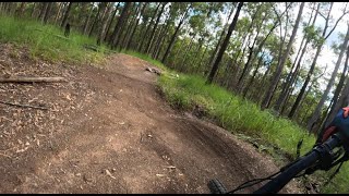
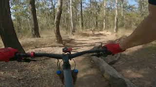
Short but fast sub 2 minute rocky decent with a few jumps, water bars over loose rock and gravel followed by some windy single track.

Aka: Ballbuster

Access Info

trailhead off access trail

Adaptive Bike Info
aMTB Blue Rating: Intermediate features and steeper terrain.

A bit narrow between the grass up the top. A couple of small drops in the middle but have B lines around them.

Tags
DropsJumpsLooseRock gardens

Local Trail Association

Traditionally Indigenous Territory

Recent Activity on Trail

Past Week
  • 2 rides
  • 8.9 km average
6 Months
  • 203 rides
  • 20.2 km avg distance
All
  • 1,751 rides
  • Last: Oct 24, 2026
c1c2c3c4
January
February
March
April
May
June
July
August
September
October
November
December
update trails status or condition

Lorikeet (4) Trail Reports

statusdatedescription
Sep 27, 2025 @ 6:32am (Australia/Brisbane)
Sep 26, 2025
Aug 2, 2025 @ 2:10pm
Aug 2, 2025
New jumps are well worn in now.
Jun 26, 2025 @ 11:21am
Jun 26, 2025
Mar 16, 2025 @ 6:34am
Mar 16, 2025
reporter Fast, new jumps are bedding in nice
Jan 31, 2025 @ 8:15am
Jan 31, 2025
Trail has seems like it has some partially finished trail maintenance on the lower section
more »
Status:
on Dec 6, 2025
Dry
Avg: 3.96 (18 votes)
Your vote: 0

view (16,791)
close
      Directions to lorikeet-4 trailhead (-27.385970, 152.920050)

      Photos

      4 more »
      mtb
      72 |
      Jan 20, 2025 @ 1:24pm
      Jan 20, 2025
      mtb
      60 |
      Jan 20, 2025 @ 1:24pm
      Jan 20, 2025
      mtb
      265 |
      Jun 5, 2018 @ 7:24pm
      Jun 5, 2018

      Videos

      6 more »
      youtuber Lorikeet | Samford/Ironbark | RAW WEDNESDAYS
      mtb
      2:16 | 585 | Sep 29, 2021 , Brisbane
      Updated Lorikeet Trail At Samford Conservation...
      mtb
      2:23 | 63 | Jan 20, 2025 , Brisbane
      Samford Conservation Park MTB trails - Lorikeet
      mtb
      2:38 | 161 | Aug 6, 2024 , Brisbane
      Lorikeet - Samford - Adaptive Mountain bike
      mtb
      3:41 | 360 | Feb 21, 2021 , Brisbane
      4.0 ★★★★★
      18 Ratings
      5 ★ 44%
      4 ★ 28%
      3 ★ 11%
      2 ★ 11%
      1 ★ 6%

      13 Reviews & Comments

      bhaackmtb
      Trail crew have made some further changes. Keep an eye out for signs when riding.
      cha-589
      Whilst not signposted as a one way trail (down), you’d have to be naïve or stupid to climb Ballbuster! For everyone’s safety, don’t climb up this trail. You’ll get hit by someone coming down at 60+ kmph.
      JudeDSWZOn
      The jumps are so good and the bottom of the big descent and will the incredible speed you come down with you will have no trouble clearing them, but then it gets better, a fast technical descent to the bottom with some tight switchbacks. Love this trail, also you can take the extension of trail 3 to get to the top. Unfortunately due to the rain no one has ridden hear for a while but should be good when we’re all back on our bikes

      We hope you've been enjoying Trailforks!

      Create a FREE account to view all trail reviews and much more.

      • By Nutcracker & contributors
      • #27204 - 4,609 views

      Frequently Asked Questions

      ▼ Where is Lorikeet (4) located?
      Lorikeet (4) is located in Samford Conservation Park, Brisbane, Australia. It is part of the Samford Conservation Park trail network. The trailhead is located at coordinates -27.38597, 152.92005.
      ▼ How hard is Lorikeet (4)?
      Lorikeet (4) is rated as Blue difficulty. The physical rating is Moderate. The average grade is 6.9%.
      ▼ What is the elevation gain for Lorikeet (4)?
      The trail has 206 ft of elevation descent. The elevation ranges from 312 ft to 517 ft.
      ▼ Is Lorikeet (4) a point to point trail?
      Yes, Lorikeet (4) is a point to point trail. The direction is Downhill Only. The trail type is singletrack.
      ▼ How long is Lorikeet (4)?
      Lorikeet (4) is 2,972 ft long. The trail type is singletrack.
      ▼ Are dogs allowed on Lorikeet (4)?
      There is no information about dogs being allowed on Lorikeet (4). Check with local trail managers or the trail page for the latest access rules.
      ▼ When is the best time of year to ride Lorikeet (4)?
      Lorikeet (4) is best visited during: All year.
      ▼ How do I access Lorikeet (4)? Where is the closest parking trailhead?
      The closest parking and trailhead locations to Lorikeet (4) are: View all parking locations in the area.
      ▼ How long does it take to ride Lorikeet (4)?
      Based on recorded activities, it takes an average of 5 minutes to ride Lorikeet (4). The trail is 2,972 ft long. Actual times will vary based on fitness level, conditions, and pace. View recent activity logs for more details.
      ▼ How busy is Lorikeet (4)?
      Lorikeet (4) is a very popular trail. There have been 15,461 recorded activities on this trail. The trail has received 16,791 check-ins. View recent activity on this trail.

      Hit the Trail

      Open in App

      Get this trail on your phone instantly.

      open trail in app

      Download Trail

      Save to wishlist, Garmin & download.
      save the trail

      Find Related Routes

      Find routes and users activities that include this trail.
      find routes for this trail

      You must enter a description before submitting.