
more stats
3,179 ft
Distance
-494 ft
Descent
00:08:05
Avg time
-494 ft
Altitude change
720 ft
Altitude min
1,214 ft
Altitude max
1,214 ft
Altitude start
722 ft
Altitude end
-15.5%
Grade
-41.9%
Grade max
2,943 ft
Distance down
236 ft
Distance flat
00:08:05
Avg time

Lost Horizon Details

  • Activities
    • Mountain Bike
    • E-Bike
  • Riding Area
  • Difficulty Rating
  • Local Popularity
    75 in Mountain Biking heatmap [+]
    • 85 in E-Biking
  • Global Ranking
    #6440 in Mountain Biking [+]
    • #17870 in E-Biking
  • National Ranking
    #186 in Mountain Biking · United Kingdom [+]
    • #937 in E-Biking
  • Trail Type
    Singletrack
  • Bike Type
    AM
  • Direction
    Downhill Only
    Popular Direction Shown
  • Climb Difficulty
    Green
  • Physical Rating
    Hard
  • Trail Visibility
    Always easy to follow
  • eBike Allowed
    Yes up to Class 1
  • Year Opened
    2021

Trail cuts easily across the heather to access the tree line (Middle Finger). This upper section is covered by thick pine needles, which makes it slippy. Nothing technical but twisty in the tree's, there are a couple of sharp right hand turns (taped). The dense tree's give way to a more open technical section with some rocky roll overs and leads to the dead wood. This is steep, twisty and very tight through the tree's (no rocks) A left turn give rise to open forest, which leads down to the exit track on the left (taped). Follow the trail to Slug Road. The end of the track is well back from the road.

Access Info

Start at the small cairn to the west of Cairn-Mon-Earn. Take the small trail that heads north with difficulty to access the trail across the heather.

This trail is unsanctioned.

Tags
Tight and twisty

Recent Activity on Trail

Past Week
  • 0 rides
  •  
6 Months
  • 4 rides
  • 13 miles avg distance
All
  • 67 rides
  • Last: Oct 17, 2026
c1c2c3c4
January
February
March
April
May
June
July
August
September
October
November
December
update trails status or condition

Lost Horizon Trail Reports

statusdatedescription
Nov 2, 2026 @ 5:19pm (Europe/London)
Nov 2, 2026
Nov 2, 2026 @ 2:45pm (Europe/London)
Nov 2, 2026
Storm Boelo has brought down about 10 trees over the trail. lots of branches too, making navigation difficult.
Apr 27, 2026 @ 6:00pm (Europe/London)
Apr 27, 2026
Tree removed 27/4/26
Apr 6, 2026 @ 12:23pm (Europe/London)
Apr 6, 2026
The low tree just before you finish on the road is now even lower, need to get off and carry around
Dec 16, 2025 @ 4:19pm (Europe/London)
Dec 16, 2025
more »
Status:
on Nov 2, 2026
Ideal
Avg: 4.24 (2 votes)
Your vote: 0

view (605)
close
      Directions to lost-horizon trailhead (57.017990, -2.360510)

      Photos

      12 more »
      mtb
      116 |
      Mar 20, 2021 @ 11:26am
      Mar 20, 2021
      mtb
      141 |
      Mar 20, 2021 @ 11:23am
      Mar 20, 2021
      mtb
      123 |
      Mar 20, 2021 @ 11:22am
      Mar 20, 2021
      mtb
      109 |
      Mar 20, 2021 @ 11:21am
      Mar 20, 2021

      Videos

      1 more »
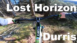
      youtuber Lost Horizon - Durris
      mtb
      4:04 | 627 | May 13, 2021 , Durris
      5.0 ★★★★★
      2 Ratings
      5 ★ 100%
      4 ★
      3 ★
      2 ★
      1 ★

      4 Reviews & Comments

      enmac
      Many trees down following Storm Boelo. Will need serious work to reinstate.
      Rt2112
      Brilliant Trail. Very dry when I rode it, imagine it gets pretty wet though
      felasmor
      Bone dry, cleared all debris. Stick to the original line.

      We hope you've been enjoying Trailforks!

      Create a FREE account to view all trail reviews and much more.

      • #417575 - 1,276 views

      Frequently Asked Questions

      ▼ Where is Lost Horizon located?
      Lost Horizon is located in Durris, United Kingdom. It is part of the Durris trail network. The trailhead is located at coordinates 57.01799, -2.36051.
      ▼ How hard is Lost Horizon?
      Lost Horizon is rated as Red difficulty. The physical rating is Hard. The average grade is 15.5%. The climb difficulty is rated Green.
      ▼ What is the elevation gain for Lost Horizon?
      The trail has 494 ft of elevation descent. The elevation ranges from 720 ft to 1,214 ft.
      ▼ Is Lost Horizon a point to point trail?
      Yes, Lost Horizon is a point to point trail. The direction is Downhill Only. The trail type is singletrack.
      ▼ How long is Lost Horizon?
      Lost Horizon is 3,179 ft long. The trail type is singletrack.
      ▼ Are dogs allowed on Lost Horizon?
      There is no information about dogs being allowed on Lost Horizon. Check with local trail managers or the trail page for the latest access rules.
      ▼ When is the best time of year to ride Lost Horizon?
      Based on activity log data, the most popular months to ride Lost Horizon are:
      • June (6 activities)
      • May (4 activities)
      • September (3 activities)
      Check the reports page for current trail conditions.
      ▼ How do I access Lost Horizon? Where is the closest parking trailhead?
      The closest parking and trailhead locations to Lost Horizon are: View all parking locations in the area.
      ▼ How long does it take to ride Lost Horizon?
      Based on recorded activities, it takes an average of 8 minutes to ride Lost Horizon. The trail is 3,179 ft long. Actual times will vary based on fitness level, conditions, and pace. View recent activity logs for more details.
      ▼ How busy is Lost Horizon?
      Lost Horizon is a very popular trail. There have been 553 recorded activities on this trail. The trail has received 605 check-ins. View recent activity on this trail.

      Hit the Trail

      Open in App

      Get this trail on your phone instantly.

      open trail in app

      Download Trail

      Save to wishlist, Garmin & download.
      save the trail

      Find Related Routes

      Find routes and users activities that include this trail.
      find routes for this trail

      You must enter a description before submitting.

