

more stats
1,319 ft
Distance
-243 ft
Descent
00:01:17
Avg time
-243 ft
Altitude change
1,104 ft
Altitude min
1,347 ft
Altitude max
1,347 ft
Altitude start
1,106 ft
Altitude end
-18.4%
Grade
-34.5%
Grade max
4.6%
Grade min
33 ft
Distance climb
1,158 ft
Distance down
128 ft
Distance flat
00:01:17
Avg time

Low Down Part 2 Details

  • Activities
    • Mountain Bike
    • E-Bike
    • Hike
    • Trail Running
  • Riding Area
    Diamond Head
    Squamish, British Columbia
  • Difficulty Rating
  • Voted Difficulty
    Blue (2 votes)
  • Local Popularity
    100 in Mountain Biking [+]
    • 100 in E-Biking
    • 35 in Trail Running
    • 50 in Hiking
  • Global Ranking
    #32089 in Mountain Biking [+]
    • #14919 in E-Biking
    • #116345 in Trail Running
    • #117260 in Hiking
  • Trail Type
    Singletrack
  • Bike Type
    DH, AM, XC
  • Direction
    Downhill Only[+]
    Popular Direction Shown
    • Downhill Only for E-Biking
    • Downhill Primary for Trail Running
    • Downhill Primary for Hiking
  • Dogs Allowed
    Yes
  • eBike Allowed
    Yes up to Class 1
  • Year Opened
    2007

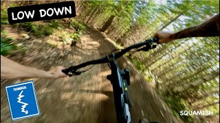
Lowdown is a fast downhill trail which at one time featured large radius, round off camber turns. Some smaller berms and rollers have been added recently. Foot out, flat out.

Trail Supporters
Traditionally Indigenous Territory

Recent Activity on Trail

Past Week
  • 30 rides
  • 9 miles average
6 Months
  • 620 rides
  • 11 miles avg distance
All
  • 1,905 rides
  • Last: Sep 17, 2026
update trails status or condition

Low Down Part 2 Trail Reports

statusdatedescription
Sep 11, 2026 @ 12:13pm (America/Vancouver)
Sep 11, 2026
reporter
Aug 27, 2026 @ 10:48am (America/Vancouver)
Aug 27, 2026
reporter
Aug 8, 2026 @ 10:36am (America/Vancouver)
Aug 8, 2026
Jul 29, 2026 @ 7:33pm (America/Vancouver)
Jul 29, 2026
Filled in some of the bad holes in the top berms, carved out and extended the one bad right hander after jump, will improve that more in the fall....
Jul 27, 2026 @ 6:32pm (America/Vancouver)
Jul 27, 2026
Doing some touch ups while there’s moisture in the soil. Closed for a couple days please stay off and let the fresh dirt soak up some rain!
more »
Status:
on Sep 11, 2026
Ideal
Avg: 3.93 (25 votes)
Your vote: 0

view (11,918)
close
      Directions to low-down-part-2 trailhead (49.743940, -123.078990)

      Photos

      40 more »
      mtb
      621 |
      Nov 25, 2012 @ 10:21pm
      Nov 25, 2012
      mtb
      350 |
      Feb 13, 2012 @ 5:14pm
      Feb 13, 2012
      mtb
      95 |
      Nov 11, 2022 @ 12:52pm
      Nov 11, 2022
      mtb
      65 |
      Aug 19, 2022 @ 10:32pm
      Aug 19, 2022

      Videos

      3 more »
      youtuber Low Down is back! Better than ever | Blue...
      mtb
      0:21 | 91 | Apr 9, 2026 , Squamish
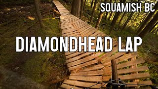
      Diamondhead Lap - Squamish Mountain Biking
      mtb
      7:46 | 320 | Apr 30, 2023 , Squamish
      Low Down 4k
      mtb
      4:05 | 892 | Jun 9, 2018 , Squamish

      Routes with this trail

      2.0 37 miles 6,933 ft 35 Loop
      There is a shuttle from Half Nelson lot to Garibaldi chain-up lot, courtesy of Shred Shuttle. As a result,...
      3.7 10 miles 1,804 ft 10 Race
      Loam Hustler Blue Course 2026
      7 miles 1,949 ft 7
      Legacy Climb > > Climb Trail > Lower One Man's Garbage > Garibaldi Park Road > Ring Creek...
      3.9
      25 Ratings
      5 28%
      4 48%
      3 12%
      2 12%
      1

      2 Reviews & Comments

      whyapinkbike
      The new exit has compacted into a better shape than before. I still think that covering the water channel would have been a better design. Then again, I'm wimpy cautious! :-)
      whyapinkbike
      The new exit-point (Thu 9 July 2020) is a berm+bridge. It looks great, & demands more caution than the glide-out that was the previous version.

      We hope you've been enjoying Trailforks!

      Create a FREE account to view all trail reviews and much more.

      • By BCpovTF Pro & contributors
      • #1639 - 5,412 views

      Frequently Asked Questions

      Where is Low Down Part 2 located?
      Low Down Part 2 is located in Diamond Head, Squamish, British Columbia, Canada. It is part of the Diamond Head trail network. The trailhead is located at coordinates 49.74394, -123.07899.
      How hard is Low Down Part 2?
      Low Down Part 2 is rated as Blue difficulty. The average grade is 18.4%.
      What is the elevation gain for Low Down Part 2?
      The trail has 243 ft of elevation descent. The elevation ranges from 1,104 ft to 1,347 ft.
      Is Low Down Part 2 a point to point trail?
      Yes, Low Down Part 2 is a point to point trail. The direction is Downhill Only. The trail type is singletrack.
      How long is Low Down Part 2?
      Low Down Part 2 is 1,319 ft long. The trail type is singletrack.
      Are dogs allowed on Low Down Part 2?
      Yes, dogs are allowed on Low Down Part 2. Please keep dogs on a leash where required and clean up after them.
      How do I access Low Down Part 2? Where is the closest parking trailhead?
      The closest parking and trailhead locations to Low Down Part 2 are: View all parking locations in the area.
      How long does it take to ride Low Down Part 2?
      Based on recorded activities, it takes an average of 1 minute to ride Low Down Part 2. The trail is 1,319 ft long. Actual times will vary based on fitness level, conditions, and pace. View recent activity logs for more details.
      How busy is Low Down Part 2?
      Low Down Part 2 is a very popular trail. There have been 12,142 recorded activities on this trail. The trail has received 11,918 check-ins. View recent activity on this trail.

      Hit the Trail

      Open in App

      Get this trail on your phone instantly.

      open trail in app

      Download Trail

      Save to wishlist, Garmin & download.
      save the trail

      Find Related Routes

      Find routes and users activities that include this trail.
      find routes for this trail

      You must enter a description before submitting.



