


Open in App
Get this trail on your phone instantly.

No community description for Lower Picnic trail has been added yet!
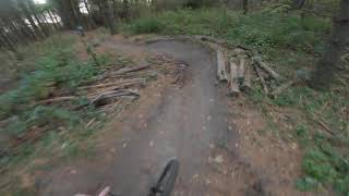
Lower Picnic is a 105 m less popular blue difficulty closed singletrack trail located near Guelph Ontario. Nearby: a picnic spot. This mountain bike primary trail can be used both directions. It features jump and pump track. Trail visibility is always easy to follow. On average it takes minutes to complete this trail.
This trail is in process of closure as it does not comply with the City of Guelph Official Plan and Natural Heritage System policy. This trail is located within flood plain and significant natural area. The trail will be restored to improve habitat quality.
This trail is unsanctioned.
| c1 | c2 | c3 | c4 |
|---|---|---|---|
January | February | March | April |
May | June | July | August |
September | October | November | December |

Service Road Atlas is a free to use, community-driven service for viewing and creating reports on the numerous back-country service roads around B.C. and Alberta.
Save the current map location and zoom level as your default home location whenever this page is loaded.
Save
No reviews yet, be the first to write a review or ask a question.
Use trail reports to comment on trail conditions.
We hope you've been enjoying Trailforks!
Create a FREE account to view all trail reviews and much more.
You must enter a description before submitting.

