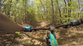

more stats
1.3 miles
Distance
-289 ft
Descent
00:10:09
Avg time
-291 ft
Altitude change
2,265 ft
Altitude min
2,557 ft
Altitude max
2,556 ft
Altitude start
2,267 ft
Altitude end
-4.2%
Grade
-33.6%
Grade max
1.5%
Grade min
282 ft
Distance climb
1 mile
Distance down
1,020 ft
Distance flat
00:10:09
Avg time

Trail Details

  • Activities
    • Mountain Bike
    • Horse
    • Hike
    • Trail Running
  • Riding Area
    North Mills River
    Mills River, North Carolina
  • Difficulty Rating
  • Local Popularity
    85 in Mountain Biking [+]
    • 70 in Trail Running
    • 60 in Hiking
    • 5 in Horseback
  • Global Ranking
    #69298 in Mountain Biking [+]
    • #122575 in Trail Running
    • #143765 in Hiking
    • #23071 in Horseback
  • State Ranking
    #492 in Mountain Biking · North Carolina [+]
    • #1,253 in Trail Running
    • #1,696 in Hiking
    • #137 in Horseback
  • Trail Type
    Singletrack
  • Bike Type
    AM, XC
  • Direction
    Downhill Primary
    Popular Direction Shown
  • Dogs Allowed
    Yes
  • eBike Allowed
  • Land Owner
    U.S. Forest Service

The section from Wash Creek Trail to where Trace Ridge Trail intersects with North Mills River Trail was rerouted in 2015 to aid in the erosion prevention and make more sustainable trails.

Tags
Ridgeline

Trail Supporters

Local Trail Association

Recent Activity on Trail

Past Week
  • 4 rides
  • 13 miles average
6 Months
  • 127 rides
  • 15 miles avg distance
All
  • 689 rides
  • Last: Nov 8, 2026
c1c2c3c4
January
February
March
April
May
June
July
August
September
October
November
December
update trails status or condition

Trace Ridge... Trail Reports

statusdatedescription
Aug 23, 2026 @ 10:09am (America/Kentucky/Monticello)
Aug 23, 2026
Previously reported tree was cleared
Aug 16, 2026 @ 9:11am (America/Kentucky/Monticello)
Aug 16, 2026
Aug 13, 2026 @ 1:34pm (America/New_York)
Aug 13, 2026
reporter
Aug 10, 2026 @ 6:12pm (America/New_York)
Aug 10, 2026
A large oak tha had partially fallen a month ago yet was mostly easy to get around has finally collapsed and requires dismounting for an easy...
Jun 20, 2026 @ 10:56am (America/Kentucky/Monticello)
Jun 20, 2026
more »
Status:
on Aug 23, 2026
Variable
Avg: 4 (14 votes)
Your vote: 0

view (4,371)
close
      Directions to trace-ridge-trail-lower trailhead (35.420340, -82.656860)

      Photos

      3 more »
      mtb
      90 |
      Jun 27, 2025 @ 11:17am
      Jun 27, 2025
      report
      mtb
      85 |
      Oct 12, 2021 @ 3:50pm
      Oct 12, 2021
      report
      hike
      40 |
      Aug 13, 2026 @ 10:34am
      Aug 13, 2026

      Videos

      3 more »
      Shredding the Pisgah GNAR featuring Trace...
      mtb
      18:01 | 285 | Jul 29, 2023 , Mills River
      youtuber A Crazy Adventure on Trace Ridge • The Duke...
      mtb
      14:51 | 788 | Apr 8, 2020 , Mills River
      Pisgah 2019 - Trace Ridge
      mtb
      12:57 | 433 | Sep 17, 2019 , Mills River

      Routes with this trail

      more »
      ★ 4.7 • 8 miles • 1,148 ft • 8 • Loop •
      If you like steep techy downhills this is the route for you. Climb up wash creek road to Spencer Gap....
      ★ 4.0 • 11 miles • 1,364 ft • 16 •
      Pisgah Lite. Climb up wash creek from Horse camp until Spencer Gap. Tough climbing on Spencer gap and...
      ★ 5.0 • 12 miles • 1,530 ft • 6 • Loop •
      Typical North River Mills Blue loop. - Spencer Gap (Upper) - Spencer Branch (Upper) - Spencer Gap (Lower)...
      4.0 ★★★★★
      14 Ratings
      5 ★ 21%
      4 ★ 57%
      3 ★ 21%
      2 ★
      1 ★

      2 Reviews & Comments

      EllenWpNvaN
      Sick trail at the top with speed and a jump or two and then a fun techy little cross country trail once you pass wash creek trail
      906Yooper906 906Yooper906
      Descending from the Trace Ridge Trail Head to North Mills River Trail can be fun if its not wet. There are some minor rock drops/jumps. Ascending this trail from North Mills River Trail to Wash Creek Trail is not that difficult and provides for some moderately technical features to climb over vs going up the gravel roads. I would not second guess in my future rides to use this as an up hill connection.

      We hope you've been enjoying Trailforks!

      Create a FREE account to view all trail reviews and much more.

      • By blowmyfuseTF Pro & contributors
      • #35524 - 3,723 views

      Frequently Asked Questions

      ▼ Where is Trace Ridge Trail (Lower) located?
      Trace Ridge Trail (Lower) is located in North Mills River, Mills River, North Carolina, United States. It is part of the North Mills River trail network. The trailhead is located at coordinates 35.42034, -82.65686.
      ▼ How hard is Trace Ridge Trail (Lower)?
      Trace Ridge Trail (Lower) is rated as Blue difficulty. The average grade is 4.2%.
      ▼ What is the elevation gain for Trace Ridge Trail (Lower)?
      The trail has 289 ft of elevation descent. The elevation ranges from 2,265 ft to 2,557 ft.
      ▼ Is Trace Ridge Trail (Lower) a point to point trail?
      Trace Ridge Trail (Lower) is not a point to point trail. The direction is Downhill Primary. The trail type is singletrack.
      ▼ How long is Trace Ridge Trail (Lower)?
      Trace Ridge Trail (Lower) is 1.3 miles long. The trail type is singletrack.
      ▼ Are dogs allowed on Trace Ridge Trail (Lower)?
      Yes, dogs are allowed on Trace Ridge Trail (Lower). Please keep dogs on a leash where required and clean up after them.
      ▼ When is the best time of year to ride Trace Ridge Trail (Lower)?
      Based on activity log data, the most popular months to ride Trace Ridge Trail (Lower) are:
      • April (61 activities)
      • May (54 activities)
      • June (47 activities)
      Check the reports page for current trail conditions.
      ▼ How do I access Trace Ridge Trail (Lower)? Where is the closest parking trailhead?
      The closest parking and trailhead locations to Trace Ridge Trail (Lower) are: View all parking locations in the area.
      ▼ How long does it take to ride Trace Ridge Trail (Lower)?
      Based on recorded activities, it takes an average of 10 minutes to ride Trace Ridge Trail (Lower). The trail is 1.3 miles long. Actual times will vary based on fitness level, conditions, and pace. View recent activity logs for more details.
      ▼ How busy is Trace Ridge Trail (Lower)?
      Trace Ridge Trail (Lower) is a very popular trail. There have been 3,738 recorded activities on this trail. The trail has received 4,371 check-ins. View recent activity on this trail.

      Hit the Trail

      Open in App

      Get this trail on your phone instantly.

      open trail in app

      Download Trail

      Save to wishlist, Garmin & download.
      save the trail

      Find Related Routes

      Find routes and users activities that include this trail.
      find routes for this trail

      You must enter a description before submitting.