



Open in App
Get this trail on your phone instantly.

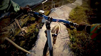
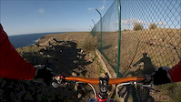
Trail goes around the airport perimeter. The north to south version ( follow the red and white signs of the GR01SMA walking trail) has a bit more climbing to it but gravity works with you in some of the technical sections. The other way around there are some sections that may require you to walk or carry your bike, depending on your trials riding skills. You will have have a creek to cross, and 3 gates. With the exception of one gate which requires you to pass the bike over it first, all the others are easy to go around and have a pedestrian access next to them. As for the terrain, it`s very dry in the summer months, but with constant rain, it can become very difficult to ride, swamp like at times.
You can start the ride at sports center parking lot, the trail works in both directions.


Service Road Atlas is a free to use, community-driven service for viewing and creating reports on the numerous back-country service roads around B.C. and Alberta.
Save the current map location and zoom level as your default home location whenever this page is loaded.
Save
No reviews yet, be the first to write a review or ask a question.
Use trail reports to comment on trail conditions.
We hope you've been enjoying Trailforks!
Create a FREE account to view all trail reviews and much more.
You must enter a description before submitting.

