more stats
1.5 miles
Distance
283 ft
Climb
-281 ft
Descent
00:17:12
Avg time
2 ft
Altitude change
3,990 ft
Altitude min
4,215 ft
Altitude max
3,990 ft
Altitude start
3,993 ft
Altitude end
-30.6%
Grade max
29.8%
Grade min
3,186 ft
Distance climb
3,671 ft
Distance down
843 ft
Distance flat
00:17:12
Avg time

Lunch Loop Details

  • Activities
    • Mountain Bike
    • Winter Fat Bike
    • Hike
    • Trail Running
    • Snowshoe
  • Riding Area
    Sparwood Ridge
    Sparwood, British Columbia
  • Difficulty Rating
  • Local Popularity
    100 in Mountain Biking [+]
    • 95 in Trail Running
    • 90 in Hiking
    • 95 in Snowshoeing
    • 100 in Winter Fat Biking
  • Global Ranking
    #61469 in Mountain Biking [+]
    • #90545 in Trail Running
    • #107068 in Hiking
    • #1739 in Snowshoeing
    • #2093 in Winter Fat Biking
  • Provincial Ranking
    #3,013 in Mountain Biking · British Columbia [+]
    • #5,239 in Trail Running
    • #5,698 in Hiking
    • #275 in Snowshoeing
    • #191 in Winter Fat Biking
  • Trail Type
    Singletrack
  • Snow Grooming
    Backcountry
  • Bike Type
    AM, XC, Fat
  • Direction
    Both Directions[+]
    • Both Directions for Winter Fat Biking
  • Climb Difficulty
    Green
  • Physical Rating
    Moderate
  • Trail Visibility
    Always easy to follow
  • Season
    April- Nov
  • TTFs on Trail
    Berm, Jump
  • Year Opened
    2020

It is best to ride Lunch Loop counter clockwise, although it is rideable in both directions.

Tags
BermsJumps

Trail Supporters

Local Trail Association

Traditionally Indigenous Territory

Recent Activity on Trail

Past Week
  • 2 rides
  • 7 miles average
6 Months
  • 98 rides
  • 8 miles avg distance
All
  • 475 rides
  • Last: Nov 3, 2026
c1c2c3c4
January
February
March
April
May
June
July
August
September
October
November
December
update trails status or condition

Lunch Loop Trail Reports

statusdatedescription
May 12, 2026 @ 8:18am (America/Creston)
May 12, 2026
Great shape
Apr 8, 2026 @ 5:58pm (America/Edmonton)
Apr 8, 2026
reporter
Apr 1, 2026 @ 5:39am (America/Edmonton)
Apr 1, 2026
reporter The trail is currently in a freeze–thaw cycle with soft sections developing, please use caution when riding or walking to avoid rutting surface.
Apr 11, 2025 @ 6:59pm
Apr 11, 2025
one tiny tiny patch of snow at the very top, and one 5 meter section of snow on the connector. lunch loop good to go!!!!!
Apr 15, 2024 @ 12:31pm
Apr 15, 2024
Hero dirt! Small wet patches at the top before descent
more »
Status:
on May 12, 2026
Ideal
Avg: 4.06 (8 votes)
Your vote: 0

view (3,113)
close
      Directions to lunch-loop trailhead (49.724840, -114.880430)

      Photos

      6 more »
      mtb
      168 |
      May 11, 2022 @ 5:48pm
      May 11, 2022
      report
      mtb
      46 |
      Apr 11, 2025 @ 6:59pm
      Apr 11, 2025
      report
      mtb
      56 |
      Apr 11, 2025 @ 6:59pm
      Apr 11, 2025
      report
      mtb
      64 |
      Aug 20, 2023 @ 6:22am
      Aug 20, 2023

      Videos

      1 more »
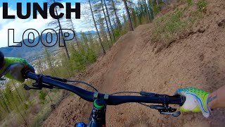
      The Best Descent in Sparwood
      mtb
      7:15 | 593 | May 12, 2022 , Sparwood

      Routes with this trail

      28 miles • 4,289 ft • 8 • Race •
      4.2 ★★★★★
      8 Ratings
      5 ★ 50%
      4 ★ 25%
      3 ★ 13%
      2 ★ 13%
      1 ★

      5 Reviews & Comments

      rusty-reebs rusty-reebs
      Awesome trail network, we had a great time riding a bunch of these trails north and south of the golf course. Thanks to the builders and maintainers!
      ipass9
      Nice work Sparwood Trial builders. Worth a stop and a ride if your passing through. Ride lunch loop up ( counter clock) then half way down link lunch money and Sloppy and for fun flowy down. Good bang for your buck.
      dh-king34
      A trail that Sparwood needed! Great ride

      We hope you've been enjoying Trailforks!

      Create a FREE account to view all trail reviews and much more.

      • By RM78TF Pro STA & contributors
      • #313513 - 3,577 views

      Frequently Asked Questions

      ▼ Where is Lunch Loop located?
      Lunch Loop is located in Sparwood Ridge, Sparwood, British Columbia, Canada. It is part of the Sparwood Ridge trail network. The trailhead is located at coordinates 49.72484, -114.88043.
      ▼ How hard is Lunch Loop?
      Lunch Loop is rated as Blue difficulty. The physical rating is Moderate. The climb difficulty is rated Green.
      ▼ What is the elevation gain for Lunch Loop?
      Lunch Loop has 283 ft of elevation gain. The trail has 281 ft of elevation descent. The elevation ranges from 3,990 ft to 4,215 ft.
      ▼ Is Lunch Loop a point to point trail?
      Lunch Loop is not a point to point trail. The direction is Both Directions. The trail type is singletrack.
      ▼ How long is Lunch Loop?
      Lunch Loop is 1.5 miles long. The trail type is singletrack.
      ▼ Are dogs allowed on Lunch Loop?
      There is no information about dogs being allowed on Lunch Loop. Check with local trail managers or the trail page for the latest access rules.
      ▼ When is the best time of year to ride Lunch Loop?
      Based on activity log data, the most popular months to ride Lunch Loop are:
      • May (45 activities)
      • June (38 activities)
      • July (38 activities)
      Check the reports page for current trail conditions.
      ▼ How do I access Lunch Loop? Where is the closest parking trailhead?
      The closest parking and trailhead locations to Lunch Loop are: View all parking locations in the area.
      ▼ How long does it take to ride Lunch Loop?
      Based on recorded activities, it takes an average of 17 minutes to ride Lunch Loop. The trail is 1.5 miles long. Actual times will vary based on fitness level, conditions, and pace. View recent activity logs for more details.
      ▼ How busy is Lunch Loop?
      Lunch Loop is a very popular trail. There have been 2,460 recorded activities on this trail. The trail has received 3,113 check-ins. View recent activity on this trail.

      Hit the Trail

      Open in App

      Get this trail on your phone instantly.

      open trail in app

      Download Trail

      Save to wishlist, Garmin & download.
      save the trail

      Find Related Routes

      Find routes and users activities that include this trail.
      find routes for this trail

      You must enter a description before submitting.