
more stats
2,677 ft
Distance
-595 ft
Descent
00:08:03
Avg time
-595 ft
Altitude change
2,388 ft
Altitude min
2,983 ft
Altitude max
2,983 ft
Altitude start
2,388 ft
Altitude end
-22.2%
Grade
-61.6%
Grade max
-3.2%
Grade min
2,677 ft
Distance down
00:08:03
Avg time

Madroños Details

  • Activities
    • Mountain Bike
    • E-Bike
    • Hike
    • Trail Running
  • Riding Area
  • Difficulty Rating
  • Local Popularity
    95 in Mountain Biking heatmap [+]
    • 75 in E-Biking
    • 5 in Trail Running
    • 5 in Hiking
  • Global Ranking
    #23242 in Mountain Biking [+]
    • #1815 in E-Biking
    • #372811 in Trail Running
    • #318183 in Hiking
  • National Ranking
    #1,119 in Mountain Biking · Spain [+]
    • #813 in E-Biking
    • #40,663 in Trail Running
    • #31,951 in Hiking
  • Hiking SAC Scale
    T2 Mountain Hiking
  • Trail Type
    Singletrack
  • Bike Type
    AM, XC
  • Direction
    Downhill Primary
    Popular Direction Shown
  • Trail Visibility
    Always easy to follow
  • Dogs Allowed
    Yes
  • eBike Allowed
    Yes up to Class 1

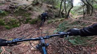
Una bajada roja en toda regla con algún tramo negro, muy guapa, en un entorno muy peculiar. Un barranco seco, pero relativamente sencillo, tiene varios drops pequeños, estrechamientos, arboles caidos, piedras grandes... un sendero único para no aburrirse.

Tags

Recent Activity on Trail

Past Week
  • 0 rides
  •  
6 Months
  • 3 rides
  • 19 miles avg distance
All
  • 8 rides
  • Last: Nov 14, 2026
c1c2c3c4
January
February
March
April
May
June
July
August
September
October
November
December
update trails status or condition

Madroños Trail Reports

statusdatedescription
Sep 6, 2026 @ 9:07am (Europe/Madrid)
Sep 6, 2026
reporter Sigue el árbol, hemos pasado por debajo. Muy seco, ojo con la rueda delantera que se va
Mar 8, 2026 @ 4:50pm (Europe/Madrid)
Mar 8, 2026
Árbol caído al entrar en la vaguada pero se puede pasar por un lado
Mar 1, 2026 @ 9:37am (Europe/Madrid)
Mar 1, 2026
Árbol caído al entrar al barranco. Se puede pasar por un lateral. Resto perfecto.
Dec 27, 2025 @ 4:38pm (Europe/Madrid)
Dec 27, 2025
Recién limpia,falta el comienzo y ya se vuelve a pasar todo otra vez como antes
Dec 26, 2025 @ 10:11am (Europe/Madrid)
Dec 26, 2025
reporter El inicio con vegetación un poco crecida, pero en cuanto entras en el barranco, está perfecta
more »
Status:
on Sep 6, 2026
Very Dry
Avg: 4.24 (2 votes)
Your vote: 0

view (67)
close
      Directions to madronos-483229 trailhead (42.741750, -3.098930)

      Photos

      2 more »
      mtb
      66 |
      Nov 5, 2023 @ 8:22am
      Nov 5, 2023
      mtb
      52 |
      Nov 5, 2023 @ 8:22am
      Nov 5, 2023

      Videos

      2 more »
      PiNaR JUMPS+ CRASH
      mtb
      6:47 | 133 | Jan 3, 2023 , Sobron
      ⚠️E N D H U R O
      mtb
      5:29 | 188 | Nov 19, 2021 , Sobron

      Trail Lists

      5.0 ★★★★★
      2 Ratings
      5 ★ 100%
      4 ★
      3 ★
      2 ★
      1 ★

      1 Review & Comments

      correcamimos
      Una bajada roja en toda regla con algún tramo negro, muy guapa, en un entorno muy peculiar. Un barranco seco, pero relativamente sencillo, tiene varios drops pequeños, estrechamientos, arboles caidos, piedras grandes... un sendero único para no aburrirse.

      We hope you've been enjoying Trailforks!

      Create a FREE account to view all trail reviews and much more.

      • By davidgome8TF Pro BASAMTB & contributors
      • #483229 - 505 views

      Frequently Asked Questions

      ▼ Where is Madroños located?
      Madroños is located in Sobrón Obarenes Burgales, Sobron, Spain. It is part of the Sobrón Obarenes Burgales trail network. The trailhead is located at coordinates 42.74175, -3.09893.
      ▼ How hard is Madroños?
      Madroños is rated as Red difficulty. The average grade is 22.2%.
      ▼ What is the elevation gain for Madroños?
      The trail has 595 ft of elevation descent. The elevation ranges from 2,388 ft to 2,983 ft.
      ▼ Is Madroños a point to point trail?
      Madroños is not a point to point trail. The direction is Downhill Primary. The trail type is singletrack.
      ▼ How long is Madroños?
      Madroños is 2,677 ft long. The trail type is singletrack.
      ▼ Are dogs allowed on Madroños?
      Yes, dogs are allowed on Madroños. Please keep dogs on a leash where required and clean up after them.
      ▼ How do I access Madroños? Where is the closest parking trailhead?
      The closest parking and trailhead locations to Madroños are: View all parking locations in the area.
      ▼ How long does it take to ride Madroños?
      Based on recorded activities, it takes an average of 8 minutes to ride Madroños. The trail is 2,677 ft long. Actual times will vary based on fitness level, conditions, and pace. View recent activity logs for more details.
      ▼ How busy is Madroños?
      Madroños is a very popular trail. There have been 66 recorded activities on this trail. The trail has received 67 check-ins. View recent activity on this trail.

      Hit the Trail

      Open in App

      Get this trail on your phone instantly.

      open trail in app

      Download Trail

      Save to wishlist, Garmin & download.
      save the trail

      Find Related Routes

      Find routes and users activities that include this trail.
      find routes for this trail

      You must enter a description before submitting.

