

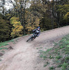
more stats
1.9 miles
Distance
2 ft
Climb
-1,066 ft
Descent
00:13:08
Avg time
-1,064 ft
Altitude change
724 ft
Altitude min
1,792 ft
Altitude max
1,788 ft
Altitude start
725 ft
Altitude end
-10.4%
Grade
-42.7%
Grade max
3.3%
Grade min
509 ft
Distance climb
2 miles
Distance down
387 ft
Distance flat
00:13:08
Avg time

Maják Details

  • Activities
    • Mountain Bike
  • Riding Area
  • Difficulty Rating
  • Voted Difficulty
    Black Diamond (1 vote)
  • Local Popularity
    40 in Mountain Biking
  • Global Ranking
    #31356 in Mountain Biking
  • Trail Type
    Singletrack
  • Bike Type
    DH, AM
  • Direction
    Downhill Primary
    Popular Direction Shown
  • Physical Rating
    Hard
  • Dogs Allowed
    Yes
  • TTFs on Trail
    Berm, Drop, Jump, Gap Jump, Ladder Bridge, Rock Face

Lot of jumps. Super fun. Maintained by local riders

Access Info

For the access please use access road.

Disclaimer

Please don`t walk uphill on the Trail. Danger of fast riders.

Recent Activity on Trail

Past Week
  • 0 rides
  •  
6 Months
  • 0 rides
  •  
All
  • 70 rides
  • Last: May 23, 2026
c1c2c3c4
January
February
March
April
May
June
July
August
September
October
November
December
update trails status or condition

Maják Trail Reports

statusdatedescription
Jun 16, 2026 @ 12:12pm (Europe/Bratislava)
Jun 16, 2026
Bol som maják pozrieť a vrch je stále zbúraný pohazxane stromy všade plus zničené skoky ale vznikajú nejaké obchádzky ale je to o ničom
May 5, 2026 @ 3:23pm (Europe/Bratislava)
May 5, 2026
Zbúrané skoky spadnuté stromy lesníci zničili trail dá sa to prejsť ale nič moc
Apr 18, 2026 @ 2:17pm (Europe/Bratislava)
Apr 18, 2026
Nejazditelne. Všade popadané stromy vo vrchnej časti až po hrad.
Nov 5, 2025 @ 7:58pm (Europe/Bratislava)
Nov 5, 2025
Veľa lístia
Oct 18, 2025 @ 5:57pm (Europe/Bratislava)
Oct 18, 2025
Veľa listov napadalo ale dá sa to jazdiť len pomalšie, stále sú spadnute 2 stromy za sebou hneď v strede za strmou skalnataou častou
more »
Status:
on Jun 16, 2026
Variable
Avg: 4.59 (21 votes)
Your vote: 0

view (1,304)
close
      Directions to majak trailhead (48.272840, 17.095970)

      Photos

      107 more »
      mtb
      108 |
      Aug 4, 2023 @ 3:05am
      Aug 4, 2023
      mtb
      94 |
      Aug 4, 2023 @ 3:05am
      Aug 4, 2023
      mtb
      93 |
      Jul 31, 2023 @ 1:12pm
      Jul 31, 2023
      mtb
      97 |
      Jul 31, 2023 @ 1:12pm
      Jul 31, 2023

      Videos

      4 more »
      MTB Bratislava - Trail Maják (Pajštún)
      mtb
      8:28 | 90 | Mar 14, 2025 , Malacky
      Pajštúnske single Maják a Salamandra /...
      mtb
      7:36 | 629 | Aug 13, 2021 , Malacky
      mtb
      0:06 | | Jan 14, 2020 , Malacky
      pajstun
      mtb
      6:12 | 644 | Nov 11, 2018 , Malacky
      4.8
      21 Ratings
      5 86%
      4 10%
      3
      2 5%
      1

      4 Reviews & Comments

      IgorLacik
      Bolo by dobre spraviť nejakú organizovanú brigádu, oproti minulému roku je to v dosť zlom stave.

      Rad sa zapojím
      rikifriki
      Das beste Trail in die Nahe von Marchfeld
      original-name original-name
      The best trail by far in this part of the Small Carapthian mountains

      We hope you've been enjoying Trailforks!

      Create a FREE account to view all trail reviews and much more.

      • By vladolTF Pro & contributors
      • #54488 - 12,194 views

      Frequently Asked Questions

      Where is Maják located?
      Maják is located in Malacky, Slovakia. It is part of the Malacky trail network. The trailhead is located at coordinates 48.27284, 17.09597.
      How hard is Maják?
      Maják is rated as Black Diamond difficulty. The physical rating is Hard. The average grade is 10.4%.
      What is the elevation gain for Maják?
      Maják has 2 ft of elevation gain. The trail has 1,066 ft of elevation descent. The elevation ranges from 724 ft to 1,792 ft.
      Is Maják a point to point trail?
      Maják is not a point to point trail. The direction is Downhill Primary. The trail type is singletrack.
      How long is Maják?
      Maják is 1.9 miles long. The trail type is singletrack.
      Are dogs allowed on Maják?
      Yes, dogs are allowed on Maják. Please keep dogs on a leash where required and clean up after them.
      How do I access Maják? Where is the closest parking trailhead?
      The closest parking and trailhead locations to Maják are: View all parking locations in the area.
      How long does it take to ride Maják?
      Based on recorded activities, it takes an average of 20 minutes to ride Maják. The trail is 1.9 miles long. Actual times will vary based on fitness level, conditions, and pace. View recent activity logs for more details.
      How busy is Maják?
      Maják is a moderately popular trail. There have been 1,280 recorded activities on this trail. The trail has received 1,304 check-ins. View recent activity on this trail.

      Hit the Trail

      Open in App

      Get this trail on your phone instantly.

      open trail in app

      Download Trail

      Save to wishlist, Garmin & download.
      save the trail

      Find Related Routes

      Find routes and users activities that include this trail.
      find routes for this trail

      You must enter a description before submitting.



