

more stats
2.2 miles
Distance
-1,563 ft
Descent
00:23:07
Avg time
-1,563 ft
Altitude change
4,970 ft
Altitude min
6,533 ft
Altitude max
6,533 ft
Altitude start
4,970 ft
Altitude end
-13.4%
Grade
-39.9%
Grade max
2 miles
Distance down
82 ft
Distance flat
00:23:07
Avg time

Maxi Trail Details

  • Activities
    • Hike
    • Mountain Bike
    • E-Bike
    • Trail Running
  • Riding Area
  • Difficulty Rating
  • Voted Difficulty
    Red (1 vote)
  • Local Popularity
    95 in Mountain Biking [+]
    • 75 in E-Biking
    • 60 in Trail Running
    • 70 in Hiking
  • Global Ranking
    #112187 in Mountain Biking [+]
    • #84833 in E-Biking
    • #31319 in Trail Running
    • #35571 in Hiking
  • National Ranking
    #4,753 in Mountain Biking · France [+]
    • #6,470 in E-Biking
    • #1,128 in Trail Running
    • #1,062 in Hiking
  • Hiking SAC Scale
    T1 Hiking
  • Trail Type
    Singletrack
  • Bike Type
    AM
  • Trail Visibility
    Always easy to follow
  • Alpine Trail
    Yes
  • Dogs Allowed
    Yes
  • eBike Allowed
    Yes up to Class 1

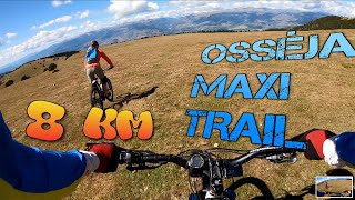
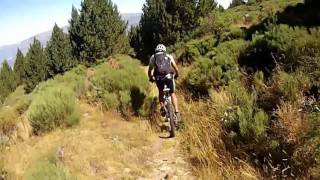
EN: Long singletrack down to the village of Osseja. Follows the ridge line. Starts over open fields, then enters in a beautiful pine forest and then gets dryer and dryer as you gets closer to the valley floor.

Disclaimer

Ce Trail est un PR, c'est donc un chemin de randonnée pedestre. (VTT accepté)

Tags
AlpineRidgeline

Recent Activity on Trail

Past Week
  • 0 rides
  •  
6 Months
  • 4 rides
  • 17 miles avg distance
All
  • 20 rides
  • Last: Sep 11, 2026
c1c2c3c4
January
February
March
April
May
June
July
August
September
October
November
December
update trails status or condition

Maxi Trail Trail Reports

statusdatedescription
Jul 18, 2026 @ 7:51am (Europe/Andorra)
Jul 17, 2026
Sep 13, 2025 @ 9:51am (Europe/Andorra)
Sep 13, 2025
Moltes pedres soltes, però es pot fer tot perfectament
Jul 6, 2025 @ 9:10am
Jul 6, 2025
Aug 3, 2024 @ 11:04am
Aug 3, 2024
Està molt bé, sec com a tot arreu, però es fa perfecte
Sep 30, 2023 @ 8:53am
Sep 30, 2023
more »
Status:
on Jul 18, 2026
Dry
Avg: 3.81 (5 votes)
Your vote: 0

view (111)
close
      Directions to maxi-trail trailhead (42.373330, 2.016560)

      Photos

      2 more »
      mtb
      219 |
      Sep 17, 2020 @ 12:29am
      Sep 17, 2020
      mtb
      147 |
      Sep 11, 2020 @ 9:23am
      Sep 11, 2020

      Videos

      5 more »
      Osséja Maxi Trail
      mtb
      3:06 | 703 | Oct 15, 2020 , Osséja
      vtt Osseja Borne 501
      mtb
      7:36 | 267 | Sep 9, 2020 , Osséja
      vtt Osseja Borne 504 frontière espagnole 21...
      mtb
      7:09 | 331 | Sep 9, 2020 , Osséja
      Osséja forest
      mtb
      0:08 | 92 | Sep 17, 2020 , Osséja
      3.6 ★★★★★
      5 Ratings
      5 ★ 20%
      4 ★ 60%
      3 ★
      2 ★
      1 ★ 20%

      3 Reviews & Comments

      FrdricFGb7Gl
      Je suis moniteur de VTT, de nombreux passage technique avec des marches et cailloux , rocher…. C’est bleu minimum voir rouge…. Ce n’est pas vert du tout, je n’emmène pas ma fille de 9 ans la dedans…. Certains commentaires sont inadmissibles !
      polete22
      Muy fácil , sucio y nada de flow , para mí es verde , no azul

      We hope you've been enjoying Trailforks!

      Create a FREE account to view all trail reviews and much more.

      • By snaker4TF Pro TFSPAIN & contributors
      • #213528 - 2,484 views

      Frequently Asked Questions

      ▼ Where is Maxi Trail located?
      Maxi Trail is located in Osséja, France. It is part of the Osséja trail network. The trailhead is located at coordinates 42.37333, 2.01656.
      ▼ How hard is Maxi Trail?
      Maxi Trail is rated as Red difficulty. The average grade is 13.4%.
      ▼ What is the elevation gain for Maxi Trail?
      The trail has 1,563 ft of elevation descent. The elevation ranges from 4,970 ft to 6,533 ft.
      ▼ How long is Maxi Trail?
      Maxi Trail is 2.2 miles long. The trail type is singletrack.
      ▼ Are dogs allowed on Maxi Trail?
      Yes, dogs are allowed on Maxi Trail. Please keep dogs on a leash where required and clean up after them.
      ▼ How do I access Maxi Trail? Where is the closest parking trailhead?
      The closest parking and trailhead locations to Maxi Trail are: View all parking locations in the area.
      ▼ How long does it take to ride Maxi Trail?
      Based on recorded activities, it takes an average of 23 minutes to ride Maxi Trail. The trail is 2.2 miles long. Actual times will vary based on fitness level, conditions, and pace. View recent activity logs for more details.
      ▼ How busy is Maxi Trail?
      Maxi Trail is a very popular trail. There have been 112 recorded activities on this trail. The trail has received 111 check-ins. View recent activity on this trail.

      Hit the Trail

      Open in App

      Get this trail on your phone instantly.

      open trail in app

      Download Trail

      Save to wishlist, Garmin & download.
      save the trail

      Find Related Routes

      Find routes and users activities that include this trail.
      find routes for this trail

      You must enter a description before submitting.

