more stats
1,903 ft
Distance
-686 ft
Descent
3,629 ft
High Point
-686 ft
Altitude change
2,943 ft
Altitude min
3,629 ft
Altitude start
2,943 ft
Altitude end
-36%
Grade
-75.6%
Grade max
1,663 ft
Distance down
243 ft
Distance flat

MDL Details

  • Activities
    • Mountain Bike
    • E-Bike
    • Hike
    • Trail Running
  • Riding Area
    Basaburua
    Lekunberri
  • Difficulty Rating
  • Local Popularity
    80 in Mountain Biking [+]
    • 85 in E-Biking
    • 5 in Trail Running
    • 5 in Hiking
  • Global Ranking
    #12100 in Mountain Biking [+]
    • #34526 in E-Biking
    • #156173 in Trail Running
    • #25959 in Hiking
  • Trail Type
    Singletrack
  • Bike Type
    DH, AM
  • Direction
    Downhill Primary
    Popular Direction Shown
  • Trail Visibility
    Sometimes hard to follow
  • Dogs Allowed
    Yes
  • eBike Allowed
    Yes up to Class 1

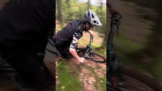
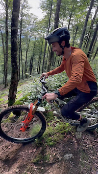
MDL es un sendero empinado y contraperaltado al más puro estilo francés. Muy buen agarre gracias a la turba, pero hay que controlar bien la frenada y la bici.

El sendero comienza en la cima del monte Beigañe, con una sucesión de curvas y tramos contraperaltados. A lo largo del sendero nos encontraremos con algunos tramos muy empinados, compresiones fuertes al cruzar las diferentes pistas forestales y un pequeño drop, que debido a la inclinación de la recepción iremos cogiendo cada vez más y más velocidad hasta llegar al apoyo.

Trail Supporters
Local Trail Association

Recent Activity on Trail

Past Week
  • 0 rides
  •  
6 Months
  • 2 rides
  • 11 miles avg distance
All
  • 23 rides
  • Last: Jun 13, 2026
c1c2c3c4
January
February
March
April
May
June
July
August
September
October
November
December
update trails status or condition

MDL Trail Reports

statusdatedescription
Jun 3, 2026 @ 8:08am (Europe/Madrid)
Jun 2, 2026
reporter Cerrada. Hay un haya caído que bloquea el paso del barranco
May 23, 2026 @ 8:50pm (Europe/Madrid)
May 23, 2026
efectivamente el tubo está impracticable
May 22, 2026 @ 1:26pm (Europe/Madrid)
May 22, 2026
el tubo está cerrado, ojo al tirarte que paras contra el árbol.... lo demás difícil de seguir por ojas pero practicable. una pena pues es un...
Feb 27, 2026 @ 1:43pm (Europe/Madrid)
Feb 27, 2026
reporter Sucia de hojas y ramas. Cuesta seguir el sendero
Nov 24, 2025 @ 9:35pm (Europe/Madrid)
Nov 24, 2025
reporter Sendero cerrado lleno de ramas y hojas caídas. Se hará mantenimiento en las próximas semanas.
more »
Status:
on Jun 3, 2026
Variable
Avg: 3.99 (4 votes)
Your vote: 0

view (77)
close
3D
Trail Conditions
  • Unknown
  • Snow Groomed
  • Snow Packed
  • Snow Covered
  • Snow Cover Partial
  • Freeze/thaw Cycle
  • Icy
  • Prevalent Mud
  • Wet
  • Variable
  • Ideal
  • Dry
  • Very Dry
Trail Flow (Ridden Direction)
Trailforks scans users ridelogs to determine the most popular direction each trail is ridden. A good flowing trail network will have most trails flowing in a single direction according to their intension.
The colour categories are based on what percentage of riders are riding a trail in its intended direction.
  • > 96%
  • > 90%
  • > 80%
  • > 70%
  • > 50%
  • < 50%
  • bi-directional trail
  • no data
Trail Last Ridden
Trailforks scans ridelogs to determine the last time a trail was ridden.
  • < 2 days
  • < 1 week
  • < 2 weeks
  • < 1 month
  • < 6 months
  • > 6 months
Trail Ridden Direction
The intended direction a trail should be ridden.
  • Downhill Only
  • Downhill Primary
  • Both Directions
  • Uphill Primary
  • Uphill Only
  • One Direction
Contribute Details
Colors indicate trail is missing specified detail.
  • Description
  • Photos
  • Description & Photos
  • Videos
Trail Popularity ?
Trailforks scans ridelogs to determine which trails are ridden the most in the last 9 months. Trails are compared with nearby trails in the same city region with a possible 25 colour shades. Think of this as a heatmap, more rides = more kinetic energy = warmer colors.
  • most popular
  • popular
  • less popular
  • not popular
ATV/ORV/OHV Filter
Max Vehicle Width
inches
US Cell Coverage
Legend
cell carrier legend

Radar Time
Activity Recordings
Trailforks uses anonymized public activity data. ?
Activity Recordings
Trailforks uses anonymized public activity data. ?
Personal Heatmap
Activity Types
all / none
Options
2
Date range month
Winter Trails
Warning A routing network for winter maps does not exist. Selecting trails using the winter trails layer has been disabled.
Missing Trails
Most Popular
Least Popular
Trails are colored based on popularity. The more popular a trail is, the more red. Less popular trails trend towards green.
Jump Magnitude Heatmap
Heatmap of where riders jump on trails. Zoom in to see individual jumps, click circles to view jump details.
BC Backroad Status

Service Road Atlas is a free to use, community-driven service for viewing and creating reports on the numerous back-country service roads around B.C. and Alberta.

map legend
Slope Aspect
Direction the slope faces
Flat N NE E SE S SW W NW
Trails Deemphasized
Trails are shown in grey.
disable
Only show trails with no bike usage.
Enable
Suggested Layers
Based on selected activity type

    Save the current map location and zoom level as your default home location whenever this page is loaded.

    Save
        Directions to mdl trailhead (43.047820, -1.802360)

        Photos

        14 more »
        39 |
        Apr 8, 2025 @ 1:23pm
        Apr 8, 2025
        34 |
        Mar 31, 2025 @ 1:42pm
        Mar 31, 2025
        37 |
        Mar 31, 2025 @ 1:42pm
        Mar 31, 2025
        43 |
        Mar 31, 2025 @ 1:42pm
        Mar 31, 2025

        Videos

        2 more »
        MDL-BasaburuaMTB
        0:46 | 161 | Sep 18, 2024 , Lekunberri
        0:12 | 106 | Apr 8, 2025 , Lekunberri

        2 Reviews & Comments


        We hope you've been enjoying Trailforks!

        Create a FREE account to view trail comments and much more.

        Frequently Asked Questions About MDL

        Where is MDL located?
        MDL is located in Basaburua, Lekunberri, Spain. It is part of the Basaburua trail network. The trailhead is located at coordinates 43.04782, -1.80236.
        How hard is MDL?
        MDL is rated as Black difficulty. The average grade is 36%.
        What is the elevation gain for MDL?
        The trail has 209 m of elevation descent. The elevation ranges from 897 m to 1,106 m.
        Is MDL a point to point trail?
        MDL is not a point to point trail. The direction is Downhill Primary. The trail type is singletrack.

        Hit the Trail

        Open in App

        Get this trail on your phone instantly.
        open trail in app

        Download Trail

        Save to wishlist, Garmin & download.
        save the trail

        Find Related Routes

        Find routes and users activities that include this trail.
        find routes for this trail

        You must enter a description before submitting.