
more stats
3,071 ft
Distance
-229 ft
Descent
00:03:40
Avg time
-229 ft
Altitude change
243 ft
Altitude min
472 ft
Altitude max
472 ft
Altitude start
243 ft
Altitude end
-7.5%
Grade
-27.1%
Grade max
2.9%
Grade min
82 ft
Distance climb
2,989 ft
Distance down
00:03:40
Avg time

Meet Cutter Details

  • Activities
    • Mountain Bike
    • Hike
    • Trail Running
  • Riding Area
    Lord Hill Regional Park
    Snohomish, Washington
  • Difficulty Rating
  • Voted Difficulty
    Green (1 vote)
  • Local Popularity
    80 in Mountain Biking heatmap [+]
    • 85 in Trail Running
    • 50 in Hiking
  • Global Ranking
    #41996 in Mountain Biking [+]
    • #88626 in Trail Running
    • #138470 in Hiking
  • State Ranking
    #698 in Mountain Biking · Washington [+]
    • #3,006 in Trail Running
    • #4,646 in Hiking
  • Trail Type
    Singletrack
  • Bike Type
    AM, XC
  • Climb Difficulty
    Blue
  • Physical Rating
    Moderate
  • Dogs Allowed
    Yes
  • eBike Allowed
  • Land Owner

Fast and chattery tech trail with some smaller rooty and rocky sections but nothing too consequential. When combined with Lower Springboard, this makes for one of the longest descents in the park, but keep in mind, unlike Lower Springboard, Meet Cutter is a two-way trail that is also open to hikers.

Tags
RockyRooty

Local Trail Association

Traditionally Indigenous Territory

Recent Activity on Trail

Past Week
  • 4 rides
  • 9 miles average
6 Months
  • 295 rides
  • 10 miles avg distance
All
  • 1,276 rides
  • Last: Nov 15, 2026
c1c2c3c4
January
February
March
April
May
June
July
August
September
October
November
December
update trails status or condition

Meet Cutter Trail Reports

statusdatedescription
Nov 4, 2026 @ 7:32pm (America/Los_Angeles)
Nov 4, 2026
Leaf blown(ty Greg & Pete )
Oct 23, 2026 @ 7:05pm (America/Los_Angeles)
Oct 23, 2026
Leaf blown
Oct 22, 2026 @ 9:59am (America/Vancouver)
Oct 22, 2026
[L=https://www.evergreenmtb.org/trails/ride-reports/rr-9787]Evergreen MTB Report[/L]
Sep 17, 2026 @ 10:48am (America/Los_Angeles)
Sep 17, 2026
Armored potholes and patched up edges along second turn
Sep 6, 2026 @ 3:00pm (America/Los_Angeles)
Sep 6, 2026
Recent rains primed the dirt well! [L=https://www.evergreenmtb.org/trails/ride-reports/rr-9724]Evergreen MTB Report[/L]
more »
Status:
on Nov 4, 2026
Variable
Avg: 4.11 (12 votes)
Your vote: 0

view (4,034)
close
      Directions to meet-cutter trailhead (47.851880, -122.052010)

      Photos

      11 more »
      mtb
      96 |
      May 9, 2026 @ 5:21pm
      May 9, 2026
      mtb
      115 |
      May 9, 2026 @ 5:21pm
      May 9, 2026
      mtb
      428 |
      Mar 11, 2021 @ 5:40pm
      Mar 11, 2021
      mtb
      418 |
      Apr 2, 2018 @ 10:21am
      Apr 2, 2018

      Videos

      3 more »
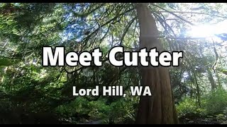
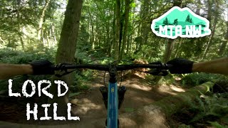
      Meet Cutter | Mountain Bike Lord Hill, WA
      mtb
      3:07 | 445 | Aug 21, 2022 , Snohomish
      Lord Hill Regional Park | Upper Springboard |...
      mtb
      5:09 | 941 | Jul 13, 2020 , Snohomish
      Meetcutter with Lower Trail Reroute
      mtb
      3:06 | 11 | Oct 23, 2026 , Snohomish

      Routes with this trail

      more »
      10 miles • 1,380 ft • 19 •
      This route combines both downhill and XC trails to create the 3 longest downhill runs in the park. Expect...
      8 miles • 1,033 ft • 20 •
      Focusing on downhill trails. Upper and Lower Springboard, Meat Cutter, Golden Eye, Wishbone, Ewe Tube.
      11 miles • 1,641 ft • 17 • Loop •
      A tour of the drier trails at Lord Hill. Includes downhill and XC sections.
      4.3 ★★★★★
      12 Ratings
      5 ★ 42%
      4 ★ 42%
      3 ★ 17%
      2 ★
      1 ★

      7 Reviews & Comments

      Brianjonesphoto
      Rode the revamped trail for the first time today. I appreciate volunteer work the work that went into it this reroute. Sadly this trail has lost half of the old PNW single track feeling and now the second half is another generic groomed flow trail.
      pxj022
      The new reroute is very fun and flowy. It bypasses the old end with the narrow squeeze between the trees and steep chute. Still have to climb to get out of there
      pxj022
      Fun rooty descent but it’s a steep climb to get out back to the main trail

      We hope you've been enjoying Trailforks!

      Create a FREE account to view all trail reviews and much more.

      • By jcowanTF Pro & contributors
      • #25072 - 4,283 views

      Frequently Asked Questions

      ▼ Where is Meet Cutter located?
      Meet Cutter is located in Lord Hill Regional Park, Snohomish, Washington, United States. It is part of the Lord Hill Regional Park trail network. The trailhead is located at coordinates 47.85188, -122.05201.
      ▼ How hard is Meet Cutter?
      Meet Cutter is rated as Blue difficulty. The physical rating is Moderate. The average grade is 7.5%. The climb difficulty is rated Blue.
      ▼ What is the elevation gain for Meet Cutter?
      The trail has 229 ft of elevation descent. The elevation ranges from 243 ft to 472 ft.
      ▼ How long is Meet Cutter?
      Meet Cutter is 3,071 ft long. The trail type is singletrack.
      ▼ Are dogs allowed on Meet Cutter?
      Yes, dogs are allowed on Meet Cutter. Please keep dogs on a leash where required and clean up after them.
      ▼ How do I access Meet Cutter? Where is the closest parking trailhead?
      The closest parking and trailhead locations to Meet Cutter are: View all parking locations in the area.
      ▼ How long does it take to ride Meet Cutter?
      Based on recorded activities, it takes an average of 4 minutes to ride Meet Cutter. The trail is 3,071 ft long. Actual times will vary based on fitness level, conditions, and pace. View recent activity logs for more details.
      ▼ How busy is Meet Cutter?
      Meet Cutter is a very popular trail. There have been 3,605 recorded activities on this trail. The trail has received 4,034 check-ins. View recent activity on this trail.

      Hit the Trail

      Open in App

      Get this trail on your phone instantly.

      open trail in app

      Download Trail

      Save to wishlist, Garmin & download.
      save the trail

      Find Related Routes

      Find routes and users activities that include this trail.
      find routes for this trail

      You must enter a description before submitting.

