9.6 miles
Distance
1,380 ft
Climb
-1,380 ft
Descent
695 ft
High Point
220 ft
Altitude min
499 ft
Altitude start
499 ft
Altitude end
-31.1%
Grade max
38.1%
Grade min
5 miles
Distance climb
4 miles
Distance down
1 mile
Distance flat

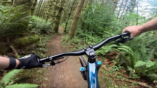
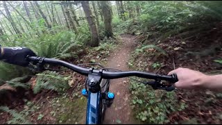
This route combines both downhill and XC trails to create the 3 longest downhill runs in the park. Expect to do pedaling between trails and on the XC portions and keep in mind the runs end on XC trails which are shared with hikers.

Upper Springboard --> Lower Springboard --> Meetcutter
Goldeneye --> Third eye --> Liquid Bread
Wishbone --> Redline

Detailed Description
Crossduro is a 10 mile popular intermediate route located near Snohomish Washington. This mountain bike only route. This route includes 19 trails. This route climbs 1,380 ft with a max elevation of 695 ft then descends -1,380 ft.
Local Trail Association
South Sound Evergreen
Please consider joining or donating to the local riding association to support trail development & maintenance.
Donate to earn trail karma!

Stats

  • Distance
    10 miles
  • Altitude min
    220 ft
  • Altitude start
    499 ft
  • Altitude end
    499 ft
  • Climb
    1,380 ft
  • Descent
    -1,380 ft
  • Grade max
    -31.1%
  • Grade min
    38.1%
  • Distance climb
    5 miles
  • Distance down
    4 miles
  • Distance flat
    1 mile

33 Reviews & Comments


We hope you've been enjoying Trailforks!

Create a FREE account to view route comments and much more.

Details

Directions

  1. Walk south on Upper Lot Entrance Trail.
  2. Continue for 600 meters.
  3. Walk southwest on Main Trail.
  4. Continue for 80 meters.
  5. Walk southwest on Main Trail.
  6. Continue for 500 meters.
  7. Walk southwest on West View Trail.
  8. Continue for 200 meters.
  9. Keep right to stay on West View Trail.
  10. Continue for 30 meters.
  11. Keep straight to stay on West View Trail.
  12. Continue for 40 meters.
  13. Keep right to stay on West View Trail.
  14. Continue for 70 meters.
  15. Keep left to stay on West View Trail.
  16. Continue for 40 meters.
  17. Keep straight to stay on West View Trail.
  18. Continue for 40 meters.
  19. Keep left to stay on West View Trail.
  20. Continue for 20 meters.
  21. Keep straight to stay on West View Trail.
  22. Continue for 20 meters.
  23. Keep straight to stay on West View Trail.
  24. Continue for 30 meters.
  25. Keep straight to stay on West View Trail.
  26. Continue for 50 meters.
  27. Keep straight to stay on West View Trail.
  28. Continue for 20 meters.
  29. Keep straight to stay on West View Trail.
  30. Continue for less than 10 meters.
  31. Keep left to stay on West View Trail.
  32. Continue for 20 meters.
  33. Keep straight to stay on West View Trail.
  34. Continue for 20 meters.
  35. Keep left to stay on West View Trail.
  36. Continue for 20 meters.
  37. Keep straight to stay on West View Trail.
  38. Continue for 30 meters.
  39. Keep left to stay on West View Trail.
  40. Continue for 10 meters.
  41. Keep left to stay on West View Trail.
  42. Continue for 30 meters.
  43. Keep left to stay on West View Trail.
  44. Continue for 10 meters.
  45. Keep straight to stay on West View Trail.
  46. Continue for 20 meters.
  47. Keep straight to stay on West View Trail.
  48. Continue for 20 meters.
  49. Keep right to stay on West View Trail.
  50. Continue for 20 meters.
  51. Keep straight to stay on West View Trail.
  52. Continue for 30 meters.
  53. Walk west on West View Trail.
  54. Continue for 20 meters.
  55. Walk northwest on West View Trail.
  56. Continue for 40 meters.
  57. Walk northeast on West View Trail.
  58. Continue for less than 10 meters.
  59. Walk north on West View Trail.
  60. Continue for 10 meters.
  61. Walk east on Erratic.
  62. Continue for 20 meters.
  63. Walk east on Erratic.
  64. Continue for 30 meters.
  65. Walk east on Erratic.
  66. Continue for 900 meters.
  67. Walk north on Erratic.
  68. Continue for 10 meters.
  69. Turn right onto The Sink.
  70. Continue for 200 meters.
  71. Walk north on Private Road.
  72. Continue for 30 meters.
  73. Walk east on Upper Springboard.
  74. Continue for 40 meters.
  75. Walk southeast on Upper Springboard.
  76. Continue for 500 meters.
  77. Walk south on Upper Springboard.
  78. Continue for 100 meters.
  79. Walk southwest on West View Trail.
  80. Continue for 100 meters.
  81. Walk northeast on Lower Springboard.
  82. Continue for 500 meters.
  83. Walk southwest on Meet Cutter.
  84. Continue for 700 meters.
  85. Keep left to stay on Meet Cutter.
  86. Continue for 10 meters.
  87. Turn right to stay on Meet Cutter.
  88. Continue for 100 meters.
  89. Walk east on Upper River Trail.
  90. Continue for 200 meters.
  91. Turn left to stay on Upper River Trail.
  92. Continue for 600 meters.
  93. Walk northeast on Upper River Trail.
  94. Continue for 10 meters.
  95. Turn left onto Main Trail.
  96. Continue for 600 meters.
  97. Walk southeast on Rock Candy Bypass.
  98. Continue for 300 meters.
  99. Walk southeast on Rock Candy Bypass.
  100. Continue for 300 meters.
  101. Walk north on Pipeline Trail.
  102. Continue for 300 meters.
  103. Walk southwest on Goldeneye.
  104. Continue for 80 meters.
  105. Walk southwest on Goldeneye.
  106. Continue for 40 meters.
  107. Walk northwest on Goldeneye.
  108. Continue for 40 meters.
  109. Walk southwest on Goldeneye.
  110. Continue for 90 meters.
  111. Walk west on Goldeneye.
  112. Continue for 40 meters.
  113. Walk west on Goldeneye.
  114. Continue for 40 meters.
  115. Walk south on Goldeneye.
  116. Continue for 70 meters.
  117. Walk northwest on Goldeneye.
  118. Continue for less than 10 meters.
  119. Walk south on Third Eye.
  120. Continue for 30 meters.
  121. Walk west on Third Eye.
  122. Continue for 200 meters.
  123. Walk south on Rock Candy Bypass.
  124. Continue for 200 meters.
  125. Walk east on Rock Candy Bypass.
  126. Continue for 30 meters.
  127. Walk southwest on Liquid Bread.
  128. Continue for 800 meters.
  129. Walk north on Main Trail.
  130. Continue for 20 meters.
  131. Walk north on Main Trail.
  132. Continue for 20 meters.
  133. Walk north on Main Trail.
  134. Continue for 600 meters.
  135. Walk north on Rock Candy Bypass.
  136. Continue for less than 10 meters.
  137. Walk north on Rock Candy Bypass.
  138. Continue for 40 meters.
  139. Walk south on Rock Candy Bypass.
  140. Continue for 80 meters.
  141. Walk south on Rock Candy Bypass.
  142. Continue for 200 meters.
  143. Walk east on Rock Candy Bypass.
  144. Continue for 30 meters.
  145. Walk east on Rock Candy Bypass.
  146. Continue for 70 meters.
  147. Walk northeast on Rock Candy Bypass.
  148. Continue for 100 meters.
  149. Walk east on Rock Candy Bypass.
  150. Continue for 50 meters.
  151. Walk north on Pipeline Trail.
  152. Continue for 300 meters.
  153. Walk southwest on Goldeneye.
  154. Continue for 80 meters.
  155. Walk north on Wishbone.
  156. Continue for 300 meters.
  157. Walk southwest on Wishbone.
  158. Continue for 100 meters.
  159. Walk west on Redline.
  160. Continue for 400 meters.
  161. Walk south on Redline.
  162. Continue for 300 meters.
  163. Walk southeast on Upper River Trail.
  164. Continue for 100 meters.
  165. Walk east on Upper River Trail.
  166. Continue for 40 meters.
  167. Walk north on Main Trail.
  168. Continue for 600 meters.
  169. Walk northeast on Main Trail.
  170. Continue for 80 meters.
  171. Walk southeast on Rock Candy Bypass.
  172. Continue for 100 meters.
  173. Walk south on Rock Candy Bypass.
  174. Continue for 200 meters.
  175. Walk east on Rock Candy Bypass.
  176. Continue for 200 meters.
  177. Walk northeast on Rock Candy Bypass.
  178. Continue for 100 meters.
  179. Walk north on Pipeline Trail.
  180. Continue for 300 meters.
  181. Walk north on Pipeline Trail.
  182. Continue for 100 meters.
  183. Walk northwest on Red Hill Trail.
  184. Continue for 50 meters.
  185. Walk north on Ewe Tube.
  186. Continue for 200 meters.
  187. Walk west on Ewe Tube.
  188. Continue for 70 meters.
  189. Walk north on Main Trail.
  190. Continue for 60 meters.
  191. Walk northwest on Main Trail.
  192. Continue for 600 meters.
  193. Walk north on Main Trail.
  194. Continue for 100 meters.
  195. Walk northeast on Main Trail.
  196. Continue for 10 meters.
  197. Turn left onto Upper Lot Entrance Trail.
  198. Continue for 200 meters.
  199. Walk north on Upper Lot Entrance Trail.
  200. Continue for 400 meters.
no votes yet
close
3D
Trail Conditions
  • Unknown
  • Snow Groomed
  • Snow Packed
  • Snow Covered
  • Snow Cover Partial
  • Freeze/thaw Cycle
  • Icy
  • Prevalent Mud
  • Wet
  • Variable
  • Ideal
  • Dry
  • Very Dry
Trail Flow (Ridden Direction)
Trailforks scans users ridelogs to determine the most popular direction each trail is ridden. A good flowing trail network will have most trails flowing in a single direction according to their intension.
The colour categories are based on what percentage of riders are riding a trail in its intended direction.
  • > 96%
  • > 90%
  • > 80%
  • > 70%
  • > 50%
  • < 50%
  • bi-directional trail
  • no data
Trail Last Ridden
Trailforks scans ridelogs to determine the last time a trail was ridden.
  • < 2 days
  • < 1 week
  • < 2 weeks
  • < 1 month
  • < 6 months
  • > 6 months
Trail Ridden Direction
The intended direction a trail should be ridden.
  • Downhill Only
  • Downhill Primary
  • Both Directions
  • Uphill Primary
  • Uphill Only
  • One Direction
Contribute Details
Colors indicate trail is missing specified detail.
  • Description
  • Photos
  • Description & Photos
  • Videos
Trail Popularity ?
Trailforks scans ridelogs to determine which trails are ridden the most in the last 9 months. Trails are compared with nearby trails in the same city region with a possible 25 colour shades. Think of this as a heatmap, more rides = more kinetic energy = warmer colors.
  • most popular
  • popular
  • less popular
  • not popular
ATV/ORV/OHV Filter
Max Vehicle Width
inches
US Cell Coverage
Legend
cell carrier legend

Radar Time
Activity Recordings
Trailforks uses anonymized public activity data. ?
Activity Recordings
Trailforks uses anonymized public activity data. ?
Personal Heatmap
Activity Types
all / none
Options
2
Date range month
Winter Trails
Warning A routing network for winter maps does not exist. Selecting trails using the winter trails layer has been disabled.
Missing Trails
Most Popular
Least Popular
Trails are colored based on popularity. The more popular a trail is, the more red. Less popular trails trend towards green.
Jump Magnitude Heatmap
Heatmap of where riders jump on trails. Zoom in to see individual jumps, click circles to view jump details.
BC Backroad Status

Service Road Atlas is a free to use, community-driven service for viewing and creating reports on the numerous back-country service roads around B.C. and Alberta.

map legend
Slope Aspect
Direction the slope faces
Flat N NE E SE S SW W NW
Trails Deemphasized
Trails are shown in grey.
disable
Only show trails with no bike usage.
Enable
Suggested Layers
Based on selected activity type

    Save the current map location and zoom level as your default home location whenever this page is loaded.

    Save
    Trail transparency
    • Singletrack
    • Unpaved
    39
    41
    65
    52
    Ewe Tube - Lord Hill - Snohomish - Washington
    Ewe Tube - Lord Hill - Snohomish - Washington
    trail: Ewe Tube
    0:19 | 75 | comments: 0 | favs:
    Aug 21, 2025
    Lower Springboard - Lord Hill - Snohomish -...
    Lower Springboard - Lord Hill - Snohomish - Washington
    2:08 | 68 | comments: 0 | favs:
    Aug 17, 2025

    Recent Trail Reports Along Route

    statustraildateconditiondescription
    Lower Springboard
    Jun 21, 2026 @ 8:05am (America/Vancouver)
    Jun 21, 2026
    [L=https://www.evergreenmtb.org/trails/ride-reports/rr-9656]Evergreen MTB Report[/L]
    Upper Springboard
    Jun 21, 2026 @ 8:05am (America/Vancouver)
    Jun 21, 2026
    [L=https://www.evergreenmtb.org/trails/ride-reports/rr-9656]Evergreen MTB Report[/L]
    Meet Cutter
    Jun 21, 2026 @ 8:05am (America/Vancouver)
    Jun 21, 2026
    [L=https://www.evergreenmtb.org/trails/ride-reports/rr-9656]Evergreen MTB Report[/L]
    Upper Lot Entrance Trail
    Jun 21, 2026 @ 8:05am (America/Vancouver)
    Jun 21, 2026
    [L=https://www.evergreenmtb.org/trails/ride-reports/rr-9656]Evergreen MTB Report[/L]
    Rock Candy Bypass
    Jun 21, 2026 @ 8:05am (America/Vancouver)
    Jun 21, 2026
    [L=https://www.evergreenmtb.org/trails/ride-reports/rr-9656]Evergreen MTB Report[/L]
    more reports »
    • By jordanlacroixTF Pro SVS & contributors
    • #62671 - 353 views

    Hit the Trail

    Open in App

    Get this route on your phone instantly.

    Download Route

    Save to wishlist, Garmin & download.