
more stats
3,123 ft
Distance
11 ft
Climb
-180 ft
Descent
00:02:30
Avg time
-171 ft
Altitude change
1,061 ft
Altitude min
1,242 ft
Altitude max
1,231 ft
Altitude start
1,060 ft
Altitude end
-5.5%
Grade
-22.9%
Grade max
6.3%
Grade min
351 ft
Distance climb
2,507 ft
Distance down
269 ft
Distance flat
00:02:30
Avg time

Melindwr Loop Details

  • Activities
    • Mountain Bike
    • E-Bike
  • Riding Area
    Bwlch Nant yr Arian
    Aberystwyth
  • Difficulty Rating
  • Local Popularity
    100 in Mountain Biking [+]
    • 100 in E-Biking
  • Global Ranking
    #36206 in Mountain Biking [+]
    • #13574 in E-Biking
  • National Ranking
    #936 in Mountain Biking · United Kingdom [+]
    • #650 in E-Biking
  • Trail Type
    Singletrack
  • Bike Type
    AM, XC, DJ
  • Direction
    One Direction
    Popular Direction Shown
  • Dogs Allowed
    Yes
  • eBike Allowed
    Yes up to Class 1
  • TTFs on Trail
    Berm

The Melindwr trail is in two loops. The first loop is under 2km with one forest road climb, a fine view with a bench and one super fun flowy descent with lots of berms back to the visitor centre. Riding both loops is 5km. This takes you up the beginning of ‘Italian Job’ before descending the ‘Half Pipe’. Take care on the next two-way shared use section before climbing round the ‘Nose’ for a distant view to the sea. Recover on the bench before a long, flowing descent with fun rollers and berms. The return forest road climb has one section of 12% gradient, but you’ll be well rewarded by the exciting final descent.

This trail is designed as ‘progressive’; allowing riders who are competent riding blue grade trails to improve their skills before progressing
to the next grade up.

The Bwlch Nant yr Arian mountain bike trails are managed and maintained by Natural Resources Wales. Follow MTB Ranger on Facebook, Twitter or Instagram for trail updates and drop our rangers a message if you come across any issues on the trail.

http://www.mbwales.com/listings/melindwr/

Tags
BermsFlowyRollers

Recent Activity on Trail

Past Week
  • 0 rides
  •  
6 Months
  • 22 rides
  • 12 miles avg distance
All
  • 252 rides
  • Last: Oct 24, 2026
c1c2c3c4
January
February
March
April
May
June
July
August
September
October
November
December
update trails status or condition

Melindwr Loop Trail Reports

Status:
on Apr 10, 2026
Wet
Avg: 4.21 (3 votes)
Your vote: 0

view (3,509)
close
      Directions to melindwr-loop trailhead (52.420960, -3.881450)

      Photos

      No photos have been added for Melindwr Loop yet, add a photo.

      Videos

      1 more »
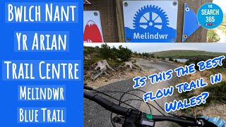
      Bwlch Nant Yr Arian Melindwr Blue Trail
      mtb
      9:14 | 598 | Mar 2, 2021 , Aberystwyth
      4.7 ★★★★★
      3 Ratings
      5 ★ 67%
      4 ★ 33%
      3 ★
      2 ★
      1 ★

      1 Review & Comments

      james-goddard
      This "progressive" trail has the biggest official features on the mountain and offers up the most speed. 1 or 2 of the berms are quite washy due to the cheap surfacing and if you stay off the brakes you will just take off on many of the rollers some of which are pretty big doubles plus its wide enough to race your mates.

      Lots to think about for a blue

      We hope you've been enjoying Trailforks!

      Create a FREE account to view all trail reviews and much more.

      • By gav-sTF Pro & contributors
      • #231488 - 1,267 views

      Frequently Asked Questions

      ▼ Where is Melindwr Loop located?
      Melindwr Loop is located in Bwlch Nant yr Arian, Aberystwyth, United Kingdom. It is part of the Bwlch Nant yr Arian trail network. The trailhead is located at coordinates 52.42096, -3.88145.
      ▼ How hard is Melindwr Loop?
      Melindwr Loop is rated as Blue difficulty. The average grade is 5.5%.
      ▼ What is the elevation gain for Melindwr Loop?
      Melindwr Loop has 11 ft of elevation gain. The trail has 180 ft of elevation descent. The elevation ranges from 1,061 ft to 1,242 ft.
      ▼ Is Melindwr Loop a point to point trail?
      Yes, Melindwr Loop is a point to point trail. The direction is One Direction. The trail type is singletrack.
      ▼ How long is Melindwr Loop?
      Melindwr Loop is 3,123 ft long. The trail type is singletrack.
      ▼ Are dogs allowed on Melindwr Loop?
      Yes, dogs are allowed on Melindwr Loop. Please keep dogs on a leash where required and clean up after them.
      ▼ When is the best time of year to ride Melindwr Loop?
      Based on activity log data, the most popular months to ride Melindwr Loop are:
      • September (14 activities)
      • May (13 activities)
      • June (13 activities)
      Check the reports page for current trail conditions.
      ▼ How do I access Melindwr Loop? Where is the closest parking trailhead?
      The closest parking and trailhead locations to Melindwr Loop are: View all parking locations in the area.
      ▼ How long does it take to ride Melindwr Loop?
      Based on recorded activities, it takes an average of 3 minutes to ride Melindwr Loop. The trail is 3,123 ft long. Actual times will vary based on fitness level, conditions, and pace. View recent activity logs for more details.
      ▼ How busy is Melindwr Loop?
      Melindwr Loop is a very popular trail. There have been 2,652 recorded activities on this trail. The trail has received 3,509 check-ins. View recent activity on this trail.

      Hit the Trail

      Open in App

      Get this trail on your phone instantly.

      open trail in app

      Download Trail

      Save to wishlist, Garmin & download.
      save the trail

      Find Related Routes

      Find routes and users activities that include this trail.
      find routes for this trail

      You must enter a description before submitting.

