more stats
2,133 ft
Distance
3 ft
Climb
-177 ft
Descent
00:04:17
Avg time
-174 ft
Altitude change
344 ft
Altitude min
521 ft
Altitude max
518 ft
Altitude start
344 ft
Altitude end
-8.2%
Grade
-27.4%
Grade max
3%
Grade min
118 ft
Distance climb
1,575 ft
Distance down
440 ft
Distance flat
00:04:17
Avg time

Melt Down Details

  • Activities
    • Mountain Bike
    • E-Bike
  • Riding Area
    Wilderness Tours Bike Park
    Beachburg, Ontario
  • Ref Number
    #22
  • Difficulty Rating
  • Local Popularity
    65 in Mountain Biking [+]
    • 70 in E-Biking
  • Global Ranking
    #199766 in Mountain Biking
  • Trail Type
    Singletrack
  • Bike Type
    DH, AM, XC
  • Trail Visibility
    Always easy to follow
  • eBike Allowed
    Yes up to Class 1
  • TTFs on Trail
    Berm, Drop, Jump, Rock Face
  • Year Opened
    2024
  • Land Owner

Melt Down starts of with a raw rocky tech section with a combo of natural rock into fun berms and small chutes with 4 extra spicy options branched off the main line. Continuing on to the second half of the trail as the terrain changes getting closer to the Ottawa River, things get flowy and fun. Ending with an optional 3 ft drop into some massive berms.

Access Info

Wilderness Tours Bike Park pass required to ride as well as signed waiver. One waiver per year.

Trail Supporters

Bike Park

Recent Activity on Trail

Past Week
  • 2 rides
  • 16 miles average
6 Months
  • 68 rides
  • 12 miles avg distance
All
  • 108 rides
  • Last: Sep 20, 2026
c1c2c3c4
January
February
March
April
May
June
July
August
September
October
November
December
update trails status or condition

Melt Down Trail Reports

statusdatedescription
Aug 21, 2026 @ 1:27pm (America/Toronto)
Aug 21, 2026
reporter
Blown and cleaned
Jul 22, 2026 @ 8:45pm (America/Toronto)
Jul 22, 2026
reporter New feature added to lower meltdown as you cross the road. Thanks to Lucas for coming up with this crazy creation and Travis for the help...
Jun 15, 2026 @ 1:57am (America/Toronto)
Jun 14, 2026
reporter
Blown
Nov 4, 2025 @ 11:13am (America/Toronto)
Nov 4, 2025
reporter HERO DIRT the whole way through. Minimal leaves on the upper section, Lower section is rippin fasssst
Oct 20, 2025 @ 7:41am (America/Toronto)
Oct 20, 2025
reporter
Blown and cleaned
more »
Status:
on Aug 21, 2026
no votes yet
Your vote: 0

view (345)
close
      Directions to melt-down trailhead (45.716320, -76.735590)

      Photos

      22 more »
      mtb
      80 |
      Aug 21, 2025 @ 2:26pm
      Aug 21, 2025
      mtb
      73 |
      Aug 21, 2025 @ 2:26pm
      Aug 21, 2025
      mtb
      71 |
      Aug 21, 2025 @ 2:26pm
      Aug 21, 2025
      mtb
      68 |
      Aug 21, 2025 @ 2:26pm
      Aug 21, 2025

      Videos

      1 more »
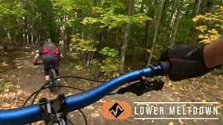
      Melt Down | Wilderness Tours Bike Park
      mtb
      2:15 | 62 | Jun 8, 2026 , Beachburg

      Routes with this trail

      8 miles 1,164 ft 29
      The route for the 2025 Ottawa River Enduro. 6 stages with 7th mystery stage :-)

      Reviews / Comments

      No reviews yet, be the first to write a review or ask a question.
      Use trail reports to comment on trail conditions.


      We hope you've been enjoying Trailforks!

      Create a FREE account to view all trail reviews and much more.

      • By Sharkyh2oTF Pro WT & contributors
      • #584847 - 598 views

      Frequently Asked Questions

      Where is Melt Down located?
      Melt Down is located in Wilderness Tours Bike Park, Beachburg, Ontario, Canada. It is part of the Wilderness Tours Bike Park trail network. The trailhead is located at coordinates 45.71632, -76.73559.
      How hard is Melt Down?
      Melt Down is rated as Black Diamond difficulty. The average grade is 8.2%.
      What is the elevation gain for Melt Down?
      Melt Down has 3 ft of elevation gain. The trail has 177 ft of elevation descent. The elevation ranges from 344 ft to 521 ft.
      How long is Melt Down?
      Melt Down is 2,133 ft long. The trail type is singletrack.
      Are dogs allowed on Melt Down?
      There is no information about dogs being allowed on Melt Down. Check with local trail managers or the trail page for the latest access rules.
      When is the best time of year to ride Melt Down?
      Based on activity log data, the most popular months to ride Melt Down are:
      • August (28 activities)
      • September (24 activities)
      • July (23 activities)
      Check the reports page for current trail conditions.
      How do I access Melt Down? Where is the closest parking trailhead?
      The closest parking and trailhead locations to Melt Down are: View all parking locations in the area.
      How long does it take to ride Melt Down?
      The estimated time to ride Melt Down is approximately 4 minutes. The trail is 2,133 ft long. Actual times will vary based on fitness level, conditions, and pace.
      How busy is Melt Down?
      Melt Down is a moderately popular trail. There have been 258 recorded activities on this trail. The trail has received 345 check-ins. View recent activity on this trail.

      Hit the Trail

      Open in App

      Get this trail on your phone instantly.

      open trail in app

      Download Trail

      Save to wishlist, Garmin & download.
      save the trail

      Find Related Routes

      Find routes and users activities that include this trail.
      find routes for this trail

      You must enter a description before submitting.