

more stats
3,750 ft
Distance
55 ft
Climb
-115 ft
Descent
00:06:56
Avg time
-61 ft
Altitude change
487 ft
Altitude min
557 ft
Altitude max
547 ft
Altitude start
486 ft
Altitude end
-1.6%
Grade
-15.2%
Grade max
18.3%
Grade min
804 ft
Distance climb
1,588 ft
Distance down
1,302 ft
Distance flat
00:06:56
Avg time

Mercury Details

  • Activities
    • Mountain Bike
    • E-Bike
    • Horse
    • Hike
    • Trail Running
    • Snowshoe
  • Riding Area
    Taconic Hereford Multiple Use Area (909)
    Pleasant Valley, New York
  • Difficulty Rating
  • Local Popularity
    100 in Mountain Biking heatmap [+]
    • 100 in E-Biking
    • 5 in Trail Running
    • 5 in Hiking
    • 5 in Horseback
    • 5 in Snowshoeing
  • Global Ranking
    #35570 in Mountain Biking [+]
    • #6815 in E-Biking
    • #348641 in Trail Running
    • #330770 in Hiking
    • #22454 in Horseback
    • #19365 in Snowshoeing
  • State Ranking
    #495 in Mountain Biking · New York State [+]
    • #7 in E-Biking
    • #6,152 in Trail Running
    • #6,768 in Hiking
    • #293 in Horseback
    • #674 in Snowshoeing
  • Trail Exposure
    Normal
  • Trail Type
    Singletrack
  • Bike Type
    AM, XC
  • Climb Difficulty
    Blue
  • Physical Rating
    Moderate
  • Dogs Allowed
    Yes
  • eBike Allowed
    Yes up to Class 1
  • TTFs on Trail
    Rock Face
  • Land Owner
    NYSDEC Region 3

No community description for Mercury trail has been added yet!

AI Generated Description

Mercury is a highly rated 3,750 ft popular blue difficulty singletrack trail located near Pleasant Valley New York. It has rock slabs. This mountain bike primary trail and has a moderate overall physical rating with a 55 ft blue climb. It features rock face. Exposure: Normal Injury Risk. On average it takes 6 minutes to complete this trail.

Disclaimer

Use the trails at your own risk. Hidden hazards may exist. You are responsible for your own safety.

Tags
Rock slabs

Local Trail Association

Traditionally Indigenous Territory

Recent Activity on Trail

Past Week
  • 2 rides
  • 10 miles average
6 Months
  • 116 rides
  • 8 miles avg distance
All
  • 1,491 rides
  • Last: Nov 10, 2026
c1c2c3c4
January
February
March
April
May
June
July
August
September
October
November
December
update trails status or condition

Mercury Trail Reports

Status:
on Jul 30, 2026
Variable
Avg: 4.15 (7 votes)
Your vote: 0

view (6,113)
close
      Directions to mercury trailhead (41.745470, -73.767400)

      Photos

      2 more »
      report
      mtb
      64 |
      May 16, 2026 @ 4:22am
      May 16, 2026

      Videos

      3 more »
      Mercury Trail | Taconic Hereford | 2020
      mtb
      4:36 | 1142 | Jul 26, 2020 , Pleasant Valley
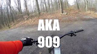
      youtuber Pleasant Valley  - AKA  909 Taconic Hereford
      mtb
      729 | Dec 4, 2017 , Pleasant Valley
      Mercury + Green Acres - 909
      mtb
      4:57 | 250 | Jul 5, 2017 , Pleasant Valley

      Routes with this trail

      more »
      9 miles • 1,123 ft • 19 •
      Route without the Gut that ends with Timbuk2
      13 miles • 1,494 ft • 11 •
      909 flow loop stays out of the gut
      4.3 ★★★★★
      7 Ratings
      5 ★ 43%
      4 ★ 43%
      3 ★ 14%
      2 ★
      1 ★

      1 Review & Comments

      JohnTZpPlA
      This is a sweet little trail. Nice layout with some fun tight turns. Has one technical rock drop option.

      We hope you've been enjoying Trailforks!

      Create a FREE account to view all trail reviews and much more.

      • By Hvmtb & contributors
      • #53931 - 2,090 views

      Frequently Asked Questions

      ▼ Where is Mercury located?
      Mercury is located in Taconic Hereford Multiple Use Area (909), Pleasant Valley, New York, United States. It is part of the Taconic Hereford Multiple Use Area (909) trail network. The trailhead is located at coordinates 41.74547, -73.7674.
      ▼ How hard is Mercury?
      Mercury is rated as Blue difficulty. The physical rating is Moderate. The average grade is 1.6%. The climb difficulty is rated Blue.
      ▼ What is the elevation gain for Mercury?
      Mercury has 55 ft of elevation gain. The trail has 115 ft of elevation descent. The elevation ranges from 487 ft to 557 ft.
      ▼ How long is Mercury?
      Mercury is 3,750 ft long. The trail type is singletrack.
      ▼ Are dogs allowed on Mercury?
      Yes, dogs are allowed on Mercury. Please keep dogs on a leash where required and clean up after them.
      ▼ When is the best time of year to ride Mercury?
      Based on activity log data, the most popular months to ride Mercury are:
      • June (61 activities)
      • April (53 activities)
      • September (50 activities)
      Check the reports page for current trail conditions.
      ▼ How do I access Mercury? Where is the closest parking trailhead?
      The closest parking and trailhead locations to Mercury are: View all parking locations in the area.
      ▼ How long does it take to ride Mercury?
      Based on recorded activities, it takes an average of 7 minutes to ride Mercury. The trail is 3,750 ft long. Actual times will vary based on fitness level, conditions, and pace. View recent activity logs for more details.
      ▼ How busy is Mercury?
      Mercury is a very popular trail. There have been 5,522 recorded activities on this trail. The trail has received 6,113 check-ins. View recent activity on this trail.

      Hit the Trail

      Open in App

      Get this trail on your phone instantly.

      open trail in app

      Download Trail

      Save to wishlist, Garmin & download.
      save the trail

      Find Related Routes

      Find routes and users activities that include this trail.
      find routes for this trail

      You must enter a description before submitting.