Mesa Trail Details
-
Activities
- Mountain Bike
- Hike
- Trail Running
-
Riding AreaCowles Mountain
San Diego, California -
Difficulty Rating
-
Voted DifficultyBlue (1 vote)
-
Trail TypeSingletrack
-
Bike TypeDH, AM
-
Trail UsageBiking Primary
-
DirectionBoth Directions
-
Climb DifficultyBlue
-
Physical RatingModerate
-
SeasonIt's San Diego, you'll be fine.
-
Dogs AllowedYes
-
TTFs on TrailBerm
-
Ride in RainYes
-
Global Ranking#13762 in Mountain Biking
-
Local Popularity55 in Mountain Biking [+]
- 70 in Trail Running
- 85 in Hiking
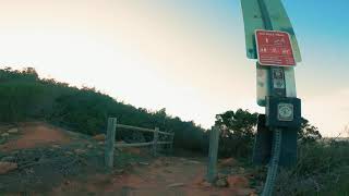
I parked on Mesa Road (right near Grossmont College) down at the end of the street where you will find the main gate. The trails have clearly marked signs telling you where to go for what trail. This is useful because some of the trail heads look like small clearings off the path. Lots of hikers on these trails so bring a bell if you can. There are a decent amount of bikers here so people are very kind and let you pass.
The climb up Mesa Trail can be challenging especially on a hot summer day. There is some shady parts but it is pretty dusty the whole way up. From the top of Mesa trail you can connect up to Cowles Mountain from the Fire Road, ride a technical chunky downhill (very fun but rough) to Big Rock Park, or you can go right back down Mesa Trail to enjoy all the features you saw on the way up and thought "man if i was only going the other way".
Mesa Trail down (or mesa trail DH as its known on strava) is a flowy. more mellow version of the ride down to Big Rock Park (sorry the name of the trail escapes me). There will be people on the way down like i mentioned earlier but this track isn't particularly fast so it is easy to spot people and vice versa.
About a 20 min walk up (not ride) and about a 5 min downhill for just Mesa Trail Up and Down. Connect with Cowles Mountain for a goodwork out, you can also link up to Mission Trails.
Access Info
Mesa Road Near Grossmont College. Park near the end of the street just past the apartments.
Local Trail Association
-
Please consider joining or donating to the local trail association to supportdonate to earn trail karma!
trail development & maintenance.
Traditionally Indigenous Territory
More Stats for Mesa Trail mountain bike trail trail
-
Altitude change-383 ft
-
Altitude min497 ft
-
Altitude max882 ft
-
Altitude start881 ft
-
Altitude end497 ft
-
Grade-9.442%
-
Grade max-25.467%
-
Grade min15.804%
-
Distance climb497 ft
-
Distance down3,379 ft
-
Distance flat182 ft
-
Avg time00:06:46
-
Avg reverse time00:19:48
- view trail stats
- Unknown
- Snow Groomed
- Snow Packed
- Snow Covered
- Freeze/thaw Cycle
- Icy
- Prevalent Mud
- Wet
- Variable
- Ideal
- Dry
- Very Dry
The colour categories are based on what percentage of riders are riding a trail in its intended direction.
- > 96%
- > 90%
- > 80%
- > 70%
- > 50%
- < 50%
- < 2 days
- < 1 week
- < 2 weeks
- < 1 month
- < 6 months
- > 6 months
- Downhill Only
- Downhill Primary
- Both Directions
- Uphill Primary
- Uphill Only
- One Direction
- Description
- Photos
- Description & Photos
- Videos
- most popular
- popular
- less popular
- not popular
- Access Road/Trail
- White
- Green
- Blue
- Black
- Double Black Diamond
Trail Report Status
- Clear / Green
- Minor Issue / Yellow
- Significant Issue / Amber
- Closed
- Land Owner Overlay
- Wilderness (typically no bikes in USA)
- BLM (public)
- USFS (Wildlife sanctuaries darker than usfs)
- State land
- Indigenous
- Military
- Unknown
- Snow Groomed
- Snow Packed
- Snow Covered
- Freeze/thaw Cycle
- Icy
- Prevalent Mud
- Wet
- Variable
- Ideal
- Dry
- Very Dry
- Map Markers
Trail Head
Photo
Directory Listing
Riding Area
TTF
Parking
Viewpoint
Information
Warning
Directions
Sight
Restrooms
eBike Charging Point
Water Fountain/Source
Gate
Trail Sign
Table or Bench
Ladder
Stairs
Bridge
Boardwalk
Camping
Cabin
Lodge
Bear Cache
Dock
Ranger Station
Summit
Other
Mesa Trail Trail Reports
Recent Ridelog Activity on Trail
Past Week
- 3 rides
- 4 miles avg distance
6 Months
- 52 rides
- 6 miles avg distance
All
- 335 rides
-
+ 0


Nearby Trails
- Cowles Mountain Backside (big Rock Dh) 0 ft
- Big Rock Trail 2,589 ft
- Cowles Backside Alt 3,071 ft
- Shortcut 4,616 ft
- Cowles Peak Fire Road 1 mile
- embed Mesa Trail trail on your website
- By The-dirt-farmer & contributors
- #42802 - 1,120 views
- subscribe
- login to download gpx or kml files.