more stats
1.3 miles
Distance
294 ft
Climb
-352 ft
Descent
00:13:04
Avg time
-58 ft
Altitude change
2,214 ft
Altitude min
2,463 ft
Altitude max
2,458 ft
Altitude start
2,400 ft
Altitude end
-0.841%
Grade
-37.495%
Grade max
33.669%
Grade min
2,581 ft
Distance climb
2,667 ft
Distance down
1,668 ft
Distance flat
00:13:04
Avg time

Mesa Details

  • Activities
    • Mountain Bike
    • E-Bike
    • Hike
    • Trail Running
    • Snowshoe
  • Riding Area
    Kenna Cartwright Park
    Kamloops, British Columbia
  • Difficulty Rating
  • Local Popularity
    85 in Mountain Biking [+]
    • 75 in E-Biking
    • 95 in Trail Running
    • 90 in Hiking
    • 5 in Snowshoeing
  • Global Ranking
    #60072 in Mountain Biking [+]
    • #35017 in E-Biking
    • #3449 in Trail Running
    • #41526 in Hiking
    • #2831 in Snowshoeing
  • Trail Type
    Singletrack
  • Bike Type
    XC
  • Direction
    Downhill Primary
    Popular Direction Shown
  • Climb Difficulty
    Blue
  • Physical Rating
    Moderate
  • Dogs Allowed
    Yes
  • eBike Allowed
    Yes up to Class 1
  • Land Owner
    City of Kamloops Nature Park

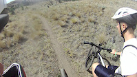
A classic "must do" trail that is typically ridden north to south east. (Start downhill off the Sunset Trail and finish climbing out to the Spadefoot Pond and outhouse intersection.)

Recent Activity on Trail

Past Week
  • 2 rides
  • 8 miles average
6 Months
  • 36 rides
  • 11 miles avg distance
All
  • 429 rides
  • Last: Jun 5, 2026
c1c2c3c4
January
February
March
April
May
June
July
August
September
October
November
December
update trails status or condition

Mesa Trail Reports

statusdatedescription
May 23, 2026 @ 3:57pm (America/Vancouver)
May 23, 2026
May 17, 2026 @ 4:59pm (America/Vancouver)
May 17, 2026
Perfect conditions with the recent precip.
May 9, 2026 @ 12:51pm (America/Vancouver)
May 9, 2026
The tight steps corner on Mesa is very dry and slippery. I didn't make it.
Mar 25, 2026 @ 10:09am (America/Vancouver)
Mar 25, 2026
reporter there are a bunch of really slimy sections throughout the whole north facing outer portions. Recommend staying off the trail for at least several...
Sep 24, 2025 @ 12:36pm (America/Vancouver)
Sep 24, 2025
more »
Status:
on May 23, 2026
Ideal
Avg: 3.99 (10 votes)
Your vote: 0

view (2,557)
close
3D
Trail Conditions
  • Unknown
  • Snow Groomed
  • Snow Packed
  • Snow Covered
  • Snow Cover Partial
  • Freeze/thaw Cycle
  • Icy
  • Prevalent Mud
  • Wet
  • Variable
  • Ideal
  • Dry
  • Very Dry
Trail Flow (Ridden Direction)
Trailforks scans users ridelogs to determine the most popular direction each trail is ridden. A good flowing trail network will have most trails flowing in a single direction according to their intension.
The colour categories are based on what percentage of riders are riding a trail in its intended direction.
  • > 96%
  • > 90%
  • > 80%
  • > 70%
  • > 50%
  • < 50%
  • bi-directional trail
  • no data
Trail Last Ridden
Trailforks scans ridelogs to determine the last time a trail was ridden.
  • < 2 days
  • < 1 week
  • < 2 weeks
  • < 1 month
  • < 6 months
  • > 6 months
Trail Ridden Direction
The intended direction a trail should be ridden.
  • Downhill Only
  • Downhill Primary
  • Both Directions
  • Uphill Primary
  • Uphill Only
  • One Direction
Contribute Details
Colors indicate trail is missing specified detail.
  • Description
  • Photos
  • Description & Photos
  • Videos
Trail Popularity ?
Trailforks scans ridelogs to determine which trails are ridden the most in the last 9 months. Trails are compared with nearby trails in the same city region with a possible 25 colour shades. Think of this as a heatmap, more rides = more kinetic energy = warmer colors.
  • most popular
  • popular
  • less popular
  • not popular
ATV/ORV/OHV Filter
Max Vehicle Width
inches
US Cell Coverage
Legend
cell carrier legend

Radar Time
Activity Recordings
Trailforks uses anonymized public activity data. ?
Activity Recordings
Trailforks uses anonymized public activity data. ?
Personal Heatmap
Activity Types
all / none
Options
2
Date range month
Winter Trails
Warning A routing network for winter maps does not exist. Selecting trails using the winter trails layer has been disabled.
Missing Trails
Most Popular
Least Popular
Trails are colored based on popularity. The more popular a trail is, the more red. Less popular trails trend towards green.
Jump Magnitude Heatmap
Heatmap of where riders jump on trails. Zoom in to see individual jumps, click circles to view jump details.
BC Backroad Status

Service Road Atlas is a free to use, community-driven service for viewing and creating reports on the numerous back-country service roads around B.C. and Alberta.

map legend
Slope Aspect
Direction the slope faces
Flat N NE E SE S SW W NW
Trails Deemphasized
Trails are shown in grey.
disable
Only show trails with no bike usage.
Enable
Suggested Layers
Based on selected activity type

    Save the current map location and zoom level as your default home location whenever this page is loaded.

    Save
        Directions to mesa trailhead (50.673130, -120.421380)

        Photos

        10 more »
        69 |
        Sep 19, 2025 @ 12:44pm
        Sep 19, 2025
        69 |
        May 13, 2023 @ 10:17pm
        May 13, 2023
        88 |
        May 13, 2023 @ 10:16pm
        May 13, 2023
        78 |
        May 30, 2020 @ 1:31pm
        May 30, 2020

        Videos

        1 more »
        mesa trail
        5:54 | 459 | Oct 19, 2013 , Kamloops

        Routes with this trail

        1.0 7 miles 950 ft 16
        Date: Saturday Sept 9th Staging Address: Kenna Cartwright Park - Click here for link Registration begins...
        10 miles 1,385 ft 6 Loop
        A loop designed by the DirtyFeet people. This is for training and for people that would rather do the...
        18 miles 2,370 ft 21
        This is the course for the past 2 years used in the Dirty Feet 6 hour endure race in June. It's a super...

        Reviews / Comments

        No reviews yet, be the first to write a review or ask a question.
        Use trail reports to comment on trail conditions.


        We hope you've been enjoying Trailforks!

        Create a FREE account to view trail comments and much more.

        • By Lennard & contributors
        • #3707 - 3,147 views

        Frequently Asked Questions About Mesa

        Where is Mesa located?
        Mesa is located in Kenna Cartwright Park, Kamloops, British Columbia, Canada. It is part of the Kenna Cartwright Park trail network. The trailhead is located at coordinates 50.67313, -120.42138.
        How hard is Mesa?
        Mesa is rated as Blue difficulty. The physical rating is Moderate. The average grade is 0.841%. The climb difficulty is rated Blue.
        What is the elevation gain for Mesa?
        Mesa has 90 m of elevation gain. The trail has 107 m of elevation descent. The elevation ranges from 675 m to 751 m.
        Is Mesa a point to point trail?
        Mesa is not a point to point trail. The direction is Downhill Primary. The trail type is singletrack.

        Hit the Trail

        Open in App

        Get this trail on your phone instantly.
        open trail in app

        Download Trail

        Save to wishlist, Garmin & download.
        save the trail

        Find Related Routes

        Find routes and users activities that include this trail.
        find routes for this trail

        You must enter a description before submitting.