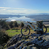
more stats
3,012 ft
Distance
-566 ft
Descent
00:04:22
Avg time
-566 ft
Altitude change
1,044 ft
Altitude min
1,610 ft
Altitude max
1,610 ft
Altitude start
1,043 ft
Altitude end
-18.8%
Grade
-59%
Grade max
-1.4%
Grade min
33 ft
Distance climb
2,946 ft
Distance down
36 ft
Distance flat
00:04:22
Avg time

Mikeltxo Details

  • Activities
    • Mountain Bike
    • E-Bike
  • Riding Area
  • Difficulty Rating
  • Voted Difficulty
    Blue (2 votes)
  • Local Popularity
    100 in Mountain Biking heatmap [+]
    • 100 in E-Biking
  • Global Ranking
    #174 in Mountain Biking [+]
    • #2562 in E-Biking
  • National Ranking
    #6 in Mountain Biking · Spain [+]
    • #1,116 in E-Biking
  • Trail Type
    Singletrack
  • Bike Type
    DH, AM
  • Climb Difficulty
    Blue
  • Trail Visibility
    Always easy to follow
  • Dogs Allowed
    Yes
  • eBike Allowed
  • Year Opened
    2024

(cast. abajo)
Mikel Gorri izeneko parajean dagoen zirkuitua, Askati eta Pipiflow artean. Jeitsiera honetan sartzeko Askatirekin hasi eta bigarren pista gurutzatzean irtetea gomendatzen da. Pasabide bat igaro behar da eta 200 metro pista batetik egin. Jeitsierari dagokionez, maila guztietarako zirkuitua da, eta bakoitzak bere mailara egokitu ahal izango du abiadura.

Maila altua baduzu, bidean aurkituko dituzun hainbat bihurgune lotu ahal izango dituzu, jaitsiera zorrotzagoa bihurtuz eta gozatuz. Aldiz, maila handirik ez duten horietakoa bazara, zailtasunik gabe egin ahal izango dituzu ere. Erritmo altuko zirkuitua da eta denbora guztian bihurguneak izango dituzu. Jeitsiera oso gomendagarria da haurrentzat, hasi berrientzat edo Askati zail samarra aurkitzen dutenentzat.

---------------

Circuito situado en el paraje Mikel Gorri, entre Askati y Pipiflow. Para acceder a esta bajada se recomienda empezar con Askati y salirse al cruzar la segunda pista. Hay que pasar un paso canadiense y enlazar 200m por pista. Respecto a la bajada, es un circuito para todos los niveles, donde cada uno podrá adaptar la velocidad a su nivel de pilotaje.

Si tienes un nivel alto podrás llegar a empalmar varias ondulaciones que te encontrarás por el camino, haciendo que la bajada sea más exigente y disfrutona para tu nivel. En cambio si eres de los que no tienen mucho nivel podrás rodarlos sin dificultad. Es un circuito poco revirado, con buen ritmo, y donde todo el rato tendrás ondulaciones y curvas con las que jugar. Es una bajada muy recomendable para niños, iniciación o aquellos a los que Askati se les quede un poco grande.

Tags

Local Trail Association

Recent Activity on Trail

Past Week
  • 1 rides
  • 21 miles average
6 Months
  • 39 rides
  • 17 miles avg distance
All
  • 171 rides
  • Last: Nov 16, 2026
c1c2c3c4
January
February
March
April
May
June
July
August
September
October
November
December
Status:
on Oct 30, 2026
Ideal
Avg: 4.4 (15 votes)
Your vote: 0

view (850)
close
      Directions to mikeltxo trailhead (43.245820, -1.753340)

      Photos

      37 more »
      mtb
      84 |
      Feb 14, 2024 @ 10:57pm
      Feb 14, 2024
      mtb
      81 |
      Feb 14, 2024 @ 10:56pm
      Feb 14, 2024
      mtb
      66 |
      Jan 4, 2025 @ 11:37am
      Jan 4, 2025
      mtb
      66 |
      Jan 4, 2025 @ 11:36am
      Jan 4, 2025

      Videos

      1 more »
      MIKELTXO Enduro Lesaka
      mtb
      2:33 | 180 | May 8, 2025 , Lesaka

      Routes with this trail

      more »
      14 miles • 4,430 ft • 10 • Loop •
      Track basado en la carrera del Open Sustrails 2024, celebrada en el mes de mayo de 2024. Aparcamos en las...
      12 miles • 2,713 ft • 8 • Loop •
      (cast. abajo) Seinaleztapenik gabeko Bizibideko ibilbide ofiziala. Irasmendi, Askati-Mikeltxo eta Pipiflow...

      Links

      4.6 ★★★★★
      15 Ratings
      5 ★ 73%
      4 ★ 13%
      3 ★ 13%
      2 ★
      1 ★

      6 Reviews & Comments

      EnekoO3Ig4F
      Bajada muy chula apta para cualquier nivel!
      Jotadosis Jotadosis
      Una gozada.
      Muy divertida.
      Eso sí, con muscular los últimos 500 metros de acceso por la pista me han parecido durísimos por desnivel y piedra suelta.
      Mokigor Mokigor
      Simplemente brutal. Antes de hacerla y si no se tiene el nivel suficiente para hacer Askati al completo, recomiendo hacer los 2 primeros tramos y empalmar por pista Mikeltxo

      We hope you've been enjoying Trailforks!

      Create a FREE account to view all trail reviews and much more.

      • By soupbay & contributors
      • #728371 - 1,368 views

      Frequently Asked Questions

      ▼ Where is Mikeltxo located?
      Mikeltxo is located in Lesaka, Spain. It is part of the Lesaka trail network. The trailhead is located at coordinates 43.24582, -1.75334.
      ▼ How hard is Mikeltxo?
      Mikeltxo is rated as Blue difficulty. The average grade is 18.8%. The climb difficulty is rated Blue.
      ▼ What is the elevation gain for Mikeltxo?
      The trail has 566 ft of elevation descent. The elevation ranges from 1,044 ft to 1,610 ft.
      ▼ How long is Mikeltxo?
      Mikeltxo is 3,012 ft long. The trail type is singletrack.
      ▼ Are dogs allowed on Mikeltxo?
      Yes, dogs are allowed on Mikeltxo. Please keep dogs on a leash where required and clean up after them.
      ▼ When is the best time of year to ride Mikeltxo?
      Based on activity log data, the most popular months to ride Mikeltxo are:
      • May (37 activities)
      • March (23 activities)
      • April (17 activities)
      Check the reports page for current trail conditions.
      ▼ How do I access Mikeltxo? Where is the closest parking trailhead?
      The closest parking and trailhead locations to Mikeltxo are: View all parking locations in the area.
      ▼ How long does it take to ride Mikeltxo?
      Based on recorded activities, it takes an average of 4 minutes to ride Mikeltxo. The trail is 3,012 ft long. Actual times will vary based on fitness level, conditions, and pace. View recent activity logs for more details.
      ▼ How busy is Mikeltxo?
      Mikeltxo is a very popular trail. There have been 730 recorded activities on this trail. The trail has received 850 check-ins. View recent activity on this trail.

      Hit the Trail

      Open in App

      Get this trail on your phone instantly.

      open trail in app

      Download Trail

      Save to wishlist, Garmin & download.
      save the trail

      Find Related Routes

      Find routes and users activities that include this trail.
      find routes for this trail

      You must enter a description before submitting.