
more stats
2,532 ft
Distance
52 ft
Climb
-52 ft
Descent
353 ft
High Point
319 ft
Altitude min
345 ft
Altitude start
345 ft
Altitude end
-16.348%
Grade max
18.642%
Grade min
951 ft
Distance climb
1,175 ft
Distance down
406 ft
Distance flat

Mile 76 Loop Details

  • Activities
    • Mountain Bike
    • Winter Fat Bike
    • Hike
    • Trail Running
  • Riding Area
    Frye MTB & BMX Trails
    Wilbraham, Massachusetts
  • Difficulty Rating
  • Local Popularity
    5 in Mountain Biking [+]
    • 5 in Trail Running
    • 5 in Hiking
  • Global Ranking
    #333842 in Mountain Biking [+]
    • #218860 in Trail Running
    • #209976 in Hiking
  • State Ranking
    #11,516 in Mountain Biking · Massachusetts [+]
    • #7,100 in Trail Running
    • #8,203 in Hiking
  • Trail Type
    Mixed
  • Bike Type
    AM, XC, Fat, CX
  • Direction
    Both Directions
  • Climb Difficulty
    Blue
  • Physical Rating
    Moderate
  • Trail Visibility
    Always easy to follow
  • Family Friendly
    Yes
  • eBike Allowed
  • TTFs on Trail
    Berm, Bridge, Jump
  • Year Opened
    2019
  • Land Owner
    Darik Frye

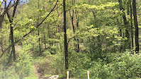
This .50 mile loop has alil bit of everything mud/water crossing, rocks, uphill, downhill, berms, jumps! everything you could want. More trails intersect with this loop for Dirt jumping, rock garden, balancing.

Bring a shovel, rake and help make it your own as well!

Disclaimer

This is Private Property, please ask permission before coming!

Traditionally Indigenous Territory

Recent Activity on Trail

Past Week
  • 0 rides
  •  
6 Months
  • 0 rides
  •  
All
  • 0 rides
  •  
update trails status or condition

Mile 76 Loop Trail Reports

statusdatedescription
May 13, 2019 @ 4:57am
May 13, 2019
Minor Water drainage issue, standing water on trail surface in some areas.
May 6, 2019 @ 5:08pm
May 6, 2019
more »
Status:
on May 13, 2019
Wet
no votes yet
Your vote: 0

view (0)
close
      Directions to mile-76-loop trailhead (42.152380, -72.384370)

      Photos

      No photos have been added for Mile 76 Loop yet, add a photo.

      Videos

      1 more »
      Testing New Drop
      mtb
      0:08 | 221 | May 13, 2019 , Wilbraham

      Reviews / Comments

      No reviews yet, be the first to write a review or ask a question.
      Use trail reports to comment on trail conditions.


      We hope you've been enjoying Trailforks!

      Create a FREE account to view all trail reviews and much more.

      • By darikfrye91 & contributors
      • #181495 - 1,162 views

      Frequently Asked Questions

      ▼ Where is Mile 76 Loop located?
      Mile 76 Loop is located in Frye MTB & BMX Trails, Wilbraham, Massachusetts, United States. It is part of the Frye MTB & BMX Trails trail network. The trailhead is located at coordinates 42.15238, -72.38437.
      ▼ How hard is Mile 76 Loop?
      Mile 76 Loop is rated as Green difficulty. The physical rating is Moderate. The climb difficulty is rated Blue.
      ▼ What is the elevation gain for Mile 76 Loop?
      Mile 76 Loop has 52 ft of elevation gain. The trail has 52 ft of elevation descent. The elevation ranges from 319 ft to 353 ft.
      ▼ Is Mile 76 Loop a point to point trail?
      Mile 76 Loop is not a point to point trail. The direction is Both Directions. The trail type is mixed.
      ▼ How long is Mile 76 Loop?
      Mile 76 Loop is 2,532 ft long. The trail type is mixed.
      ▼ Are dogs allowed on Mile 76 Loop?
      There is no information about dogs being allowed on Mile 76 Loop. Check with local trail managers or the trail page for the latest access rules.
      ▼ How do I access Mile 76 Loop? Where is the closest parking trailhead?
      The closest parking and trailhead locations to Mile 76 Loop are: View all parking locations in the area.
      ▼ How busy is Mile 76 Loop?
      Mile 76 Loop is a less popular trail with lighter traffic. View recent activity on this trail.

      Hit the Trail

      Open in App

      Get this trail on your phone instantly.

      open trail in app

      Download Trail

      Save to wishlist, Garmin & download.
      save the trail

      Find Related Routes

      Find routes and users activities that include this trail.
      find routes for this trail

      You must enter a description before submitting.

