Trail Supporters, Builders & Maintainers of Mojoe Trail
Singletrack TrailsBuilder
Dave GrossmanBuilder
BLMLand Manager
Mojoe Details
-
Activities
- Mountain Bike
- Hike
- Trail Running
-
Riding AreaFruita
, Colorado -
Difficulty Rating
-
Voted DifficultyBlue (3 votes)
-
Trail TypeSingletrack
-
Bike TypeAM
-
Trail UsageBiking Primary
-
DirectionDownhill OnlyPopular direction shown
-
Climb DifficultyBlue
-
Physical RatingModerate
-
Dogs AllowedYes
-
eBike Allowed
-
TTFs on TrailBerm, Drop, Jump, Gap Jump, Rock Garden, Roller Coaster
-
Global Ranking#314 in Mountain Biking
-
Local Popularity100 in Mountain Biking [+]
- 5 in Trail Running
- 80 in Hiking
-
Year Opened2015
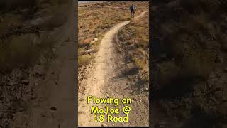
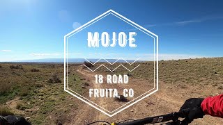
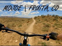
Designed by Dave Grossman and built by Singletrack Trails, Mojoe is one of the favorites among the more advanced locals; it’s got it’s fair share of jumps, gaps, and a large rock garden that typically requires quite a bit of momentum to to clear it. It’s downhill only, but it’s best to start up top on Joe’s Ridge and carry your speed over (it’s way easier to find your flow coming from Joe’s across the road). Expect mostly hardpack with the occasional sand sluff and loose rocks in the few small dried up creek beds. Also expect rollers (able to air out), gaps, large berms, roller coaster terrain, a drop or two, and a pretty technical rock garden. The best freestyle trail at 18 Road. Enjoy
Access Info
At the bottom of Upper Joe’s Ridge, cross the road and drop in.
Local Trail Association
-
Please consider joining or donating to the local trail association to supportdonate to earn trail karma!
trail development & maintenance.
Traditionally Indigenous Territory
More Stats for Mojoe mountain bike trail trail
-
Altitude change-206 ft
-
Altitude min5,043 ft
-
Altitude max5,249 ft
-
Altitude start5,249 ft
-
Altitude end5,043 ft
-
Grade-3.707%
-
Grade max-58.422%
-
Grade min11.606%
-
Distance climb423 ft
-
Distance down4,213 ft
-
Distance flat919 ft
-
Avg time00:06:27
-
Avg reverse time00:11:19
- view trail stats
- Unknown
- Snow Groomed
- Snow Packed
- Snow Covered
- Freeze/thaw Cycle
- Icy
- Prevalent Mud
- Wet
- Variable
- Ideal
- Dry
- Very Dry
The colour categories are based on what percentage of riders are riding a trail in its intended direction.
- > 96%
- > 90%
- > 80%
- > 70%
- > 50%
- < 50%
- < 2 days
- < 1 week
- < 2 weeks
- < 1 month
- < 6 months
- > 6 months
- Downhill Only
- Downhill Primary
- Both Directions
- Uphill Primary
- Uphill Only
- One Direction
- Description
- Photos
- Description & Photos
- Videos
- most popular
- popular
- less popular
- not popular
- Access Road/Trail
- White
- Green
- Blue
- Black
- Double Black Diamond
Trail Report Status
- Clear / Green
- Minor Issue / Yellow
- Significant Issue / Amber
- Closed
- Land Owner Overlay
- Wilderness (typically no bikes in USA)
- BLM (public)
- USFS (Wildlife sanctuaries darker than usfs)
- State land
- Indigenous
- Military
- Unknown
- Snow Groomed
- Snow Packed
- Snow Covered
- Freeze/thaw Cycle
- Icy
- Prevalent Mud
- Wet
- Variable
- Ideal
- Dry
- Very Dry
- Map Markers
Trail Head
Photo
Directory Listing
Riding Area
TTF
Parking
Viewpoint
Information
Warning
Directions
Sight
Restrooms
eBike Charging Point
Water Fountain/Source
Gate
Trail Sign
Table or Bench
Ladder
Stairs
Bridge
Boardwalk
Camping
Cabin
Lodge
Bear Cache
Dock
Ranger Station
Summit
Other
Mojoe Trail Reports
Recent Ridelog Activity on Trail
Past Week
- 13 rides
- 13 miles avg distance
6 Months
- 507 rides
- 11 miles avg distance
All
- 3,111 rides
Photos
Routes with this trail


Videos

Nearby Trails
- Straight English 1,585 ft
- Kessel Cutoff 2,799 ft
- Frontside 1 mile
- Zippity Do Dah 1 mile
- Kessel Run 1 mile
- embed Mojoe trail on your website
- By todd
Trailforks Plus & contributors
- #12273 - 3,328 views
- subscribe
- login to download gpx or kml files.
Fun at some points, but again the rock garden is way to short and easy to blast through without even thinking.
The jumps are very small and easy to roll, so like with most 18 trails this is built for families.