
more stats
3,169 ft
Distance
-178 ft
Descent
00:01:57
Avg time
-178 ft
Altitude change
495 ft
Altitude min
674 ft
Altitude max
674 ft
Altitude start
495 ft
Altitude end
-5.6%
Grade
-46.9%
Grade max
1.5%
Grade min
62 ft
Distance climb
3,107 ft
Distance down
00:01:57
Avg time

Mountain Exit Details

  • Activities
    • Mountain Bike
    • E-Bike
    • Gravel Bike
    • Adaptive Bike
    • Winter Fat Bike
    • Hike
    • Trail Running
  • Riding Area
  • AKA
    Big Boys
  • Difficulty Rating
  • Local Popularity
    5 in Mountain Biking heatmap [+]
    • 5 in E-Biking
    • 5 in Trail Running
    • 5 in Hiking
    • 5 in Winter Fat Biking
    • 5 in Adaptive Biking
    • 5 in Gravel Biking
  • Hiking SAC Scale
    T2 Mountain Hiking
  • Trail Type
    Asphalt/Tarmac Road
  • Bike Type
    DH, AM, XC, RD, Fat, Adaptive MTB, Gravel
  • Direction
    Both Directions[+]
    • Both Directions for E-Biking
    • Both Directions for Trail Running
    • Both Directions for Hiking
  • Climb Difficulty
    Blue
  • Physical Rating
    Hard
  • Trail Visibility
    Always easy to follow
  • Season
    Spring
  • Family Friendly
    Yes
  • eBike Allowed
    Yes up to Class 1
  • TTFs on Trail
    Rock Face
  • Year Opened
    2019
  • Land Owner

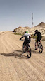
Pre-2022 : A relatively long climb through the gravel and rocks leading up to King Abdullah Adventure Park right behind the the television communication tower.

Post-2022 : Reopened as part of SB Access Road II

Access Info Restricted Access

This road is yet to be built for King Abdullah Adventure Park project.

This trail is unsanctioned.

Disclaimer

Avoid trespassing near the TV Tower.

Tags
Family friendlyRock slabs

Trail Supporters

Recent Activity on Trail

Past Week
  • 0 rides
  •  
6 Months
  • 0 rides
  •  
All
  • 2 rides
  • Last: Jul 6, 2023
update trails status or condition

Mountain Exit Trail Reports

statusdatedescription
Aug 8, 2020 @ 7:29pm
Aug 8, 2020
reporter Closed. Currently under King Abdullah Park project.
Jun 25, 2019 @ 9:24pm
Jun 25, 2019
reporter Sand accumulations at the start. All clear and dry as always.
more »
Status:
on Aug 8, 2020
Avg: 4.13 (1 votes)
Your vote: 0

view (102)
close
      Directions to mountain-exit trailhead (25.469510, 49.641550)

      Photos

      1 more »
      mtb
      74 |
      Jun 25, 2019 @ 9:45pm
      Jun 25, 2019

      Videos

      1 more »
      Big Boys Climbing
      mtb
      0:02 | 66 | Jun 28, 2019 , Hofuf
      5.0 ★★★★★
      1 Ratings
      5 ★ 100%
      4 ★
      3 ★
      2 ★
      1 ★

      Reviews / Comments

      No reviews yet, be the first to write a review or ask a question.
      Use trail reports to comment on trail conditions.


      We hope you've been enjoying Trailforks!

      Create a FREE account to view all trail reviews and much more.

      • #192597 - 747 views

      Hit the Trail

      Open in App

      Get this trail on your phone instantly.

      open trail in app

      Download Trail

      Save to wishlist, Garmin & download.
      save the trail

      Find Related Routes

      Find routes and users activities that include this trail.
      find routes for this trail

      You must enter a description before submitting.

