more stats
2,972 ft
Distance
-269 ft
Descent
00:07:34
Avg time
-269 ft
Altitude change
1,470 ft
Altitude min
1,740 ft
Altitude max
1,740 ft
Altitude start
1,470 ft
Altitude end
-9.1%
Grade
-25.7%
Grade max
-4.2%
Grade min
2,972 ft
Distance down
00:07:34
Avg time

Mr. Bones (Upper) Details

  • Activities
    • Mountain Bike
    • E-Bike
  • Riding Area
    North Slope Trails
    Olympia, Washington
  • AKA
    Crab Meat
  • Difficulty Rating
  • Voted Difficulty
    Black Diamond (1 vote)
  • Local Popularity
    95 in Mountain Biking [+]
    • 95 in E-Biking
  • Global Ranking
    #4302 in Mountain Biking [+]
    • #6592 in E-Biking
  • Trail Type
    Singletrack
  • Bike Type
    DH, AM, XC
  • Dogs Allowed
    Yes
  • eBike Allowed
  • Year Opened
    2022
  • Land Owner
    WA DNR - Black Hills District

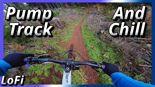
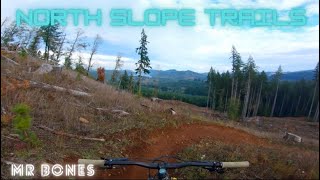
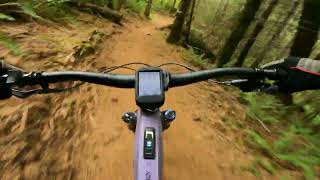
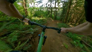
Mr Bones is hand built technical single track that is generally mellow in grade with a few steep switch back turns and rollable drops that will challenge intermediate riders. The top section is less difficult and I would rate this somewhere between blue and black. You access the start of this trail via the entrance to Low key. This section exits onto the moto trail after you walk through a moto gate. Head out to the road and access the lower section for the full descent.

Local Trail Association
Traditionally Indigenous Territory

Recent Activity on Trail

Past Week
  • 0 rides
  •  
6 Months
  • 58 rides
  • 19 miles avg distance
All
  • 277 rides
  • Last: Jun 28, 2026
c1c2c3c4
January
February
March
April
May
June
July
August
September
October
November
December
update trails status or condition

Mr. Bones (Upper) Trail Reports

Status:
on May 4, 2026
Ideal
Avg: 4.11 (4 votes)
Your vote: 0

view (2,316)
close
3D
Trail Conditions
  • Unknown
  • Snow Groomed
  • Snow Packed
  • Snow Covered
  • Snow Cover Partial
  • Freeze/thaw Cycle
  • Icy
  • Prevalent Mud
  • Wet
  • Variable
  • Ideal
  • Dry
  • Very Dry
Trail Flow (Ridden Direction)
Trailforks scans users ridelogs to determine the most popular direction each trail is ridden. A good flowing trail network will have most trails flowing in a single direction according to their intension.
The colour categories are based on what percentage of riders are riding a trail in its intended direction.
  • > 96%
  • > 90%
  • > 80%
  • > 70%
  • > 50%
  • < 50%
  • bi-directional trail
  • no data
Trail Last Ridden
Trailforks scans ridelogs to determine the last time a trail was ridden.
  • < 2 days
  • < 1 week
  • < 2 weeks
  • < 1 month
  • < 6 months
  • > 6 months
Trail Ridden Direction
The intended direction a trail should be ridden.
  • Downhill Only
  • Downhill Primary
  • Both Directions
  • Uphill Primary
  • Uphill Only
  • One Direction
Contribute Details
Colors indicate trail is missing specified detail.
  • Description
  • Photos
  • Description & Photos
  • Videos
Trail Popularity ?
Trailforks scans ridelogs to determine which trails are ridden the most in the last 9 months. Trails are compared with nearby trails in the same city region with a possible 25 colour shades. Think of this as a heatmap, more rides = more kinetic energy = warmer colors.
  • most popular
  • popular
  • less popular
  • not popular
ATV/ORV/OHV Filter
Max Vehicle Width
inches
US Cell Coverage
Legend
cell carrier legend

Radar Time
Activity Recordings
Trailforks uses anonymized public activity data. ?
Activity Recordings
Trailforks uses anonymized public activity data. ?
Personal Heatmap
Activity Types
all / none
Options
2
Date range month
Winter Trails
Warning A routing network for winter maps does not exist. Selecting trails using the winter trails layer has been disabled.
Missing Trails
Most Popular
Least Popular
Trails are colored based on popularity. The more popular a trail is, the more red. Less popular trails trend towards green.
Jump Magnitude Heatmap
Heatmap of where riders jump on trails. Zoom in to see individual jumps, click circles to view jump details.
BC Backroad Status

Service Road Atlas is a free to use, community-driven service for viewing and creating reports on the numerous back-country service roads around B.C. and Alberta.

map legend
Slope Aspect
Direction the slope faces
Flat N NE E SE S SW W NW
Trails Deemphasized
Trails are shown in grey.
disable
Only show trails with no bike usage.
Enable
Suggested Layers
Based on selected activity type

    Save the current map location and zoom level as your default home location whenever this page is loaded.

    Save
        Directions to mr-bones-upper trailhead (47.036030, -123.164160)

        Photos

        1 more »
        48 |
        Jun 15, 2025 @ 4:41pm
        Jun 15, 2025

        Videos

        9 more »
        youtuber Mountain Biking Can Be Peaceful
        6:45 | 128 | Jan 29, 2024 , Olympia
        youtuber Mr Bones - North Slope Trails - Capitol Forest, WA
        9:49 | 206 | Nov 13, 2022 , Olympia
        North Slope Trails: Mr. Bones (Upper)
        2:42 | 42 | Nov 14, 2025 , Olympia
        youtuber Mr. Bones / Olympia, WA / MTB
        7:30 | 65 | Jul 7, 2025 , Olympia

        Routes with this trail

        5.0 16 miles 4,932 ft 12 Race
        13 miles 3,367 ft 10
        Just a loop I threw together to plan a NS trip. This route is cleaned up from a previous submission where...
        20 miles 5,909 ft 13

        3 Reviews & Comments


        We hope you've been enjoying Trailforks!

        Create a FREE account to view trail comments and much more.

        Nearby Trails

        • By franksterTF Pro FOCF & contributors
        • #570495 - 1,454 views

        Frequently Asked Questions About Mr. Bones (Upper)

        Where is Mr. Bones (Upper) located?
        Mr. Bones (Upper) is located in North Slope Trails, Olympia, Washington, United States. It is part of the North Slope Trails trail network. The trailhead is located at coordinates 47.03603, -123.16416.
        How hard is Mr. Bones (Upper)?
        Mr. Bones (Upper) is rated as Blue difficulty. The average grade is 9.1%.
        What is the elevation gain for Mr. Bones (Upper)?
        The trail has 269 ft of elevation descent. The elevation ranges from 1,470 ft to 1,740 ft.
        How long is Mr. Bones (Upper)?
        Mr. Bones (Upper) is 2,972 ft long. The trail type is singletrack.

        Hit the Trail

        Open in App

        Get this trail on your phone instantly.
        open trail in app

        Download Trail

        Save to wishlist, Garmin & download.
        save the trail

        Find Related Routes

        Find routes and users activities that include this trail.
        find routes for this trail

        You must enter a description before submitting.