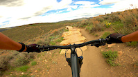
more stats
2,474 ft
Distance
51 ft
Climb
-113 ft
Descent
00:03:12
Avg time
-61 ft
Altitude change
6,608 ft
Altitude min
6,721 ft
Altitude max
6,721 ft
Altitude start
6,660 ft
Altitude end
-2.5%
Grade
-18.8%
Grade max
19.6%
Grade min
673 ft
Distance climb
1,565 ft
Distance down
89 ft
Distance flat
00:03:12
Avg time

Mr Muchrocks Details

  • Activities
    • Mountain Bike
    • Adaptive Bike
  • Riding Area
    Trailside Park
    Park City, Utah
  • Difficulty Rating
  • Voted Difficulty
    Black Diamond (1 vote)
  • Local Popularity
    70 in Mountain Biking [+]
    • 5 in Adaptive Biking
  • Global Ranking
    #41799 in Mountain Biking
  • State Ranking
    #806 in Mountain Biking · Utah
  • Trail Type
    Singletrack
  • Bike Type
    DH, AM, DJ, Adaptive MTB
  • Dogs Allowed
    Yes
  • TTFs on Trail
    Berm, Bridge, Drop, Jump, Rock Garden, Wallride

Fun flow trail with a few berms and jumps, and lots of wooden bridges mixed with some technical rock features. There are a couple turns that are basically deep embedded rocks. The toughest rock garden has a ride-around. Probably not expert, because of the ride-arounds, maybe in between intermediate and expert.

Adaptive Bike Info
aMTB DBL Black Rating: Expert trail features not suitable for some adaptive equipment

With manditory drops agressive rock gardens, and mutiple manditory 36 inch wide wood bridge features, this trail is not for the faint of heart. Wider bikes beware as this trail has long narrow features you might not fit on with no ride around. there is one wood bridge that turns and gos to an 18" drop that will be espically tight. If you attempt this trail have spotters and be careful! Wider bikes Its probably not worth it.

Bike Park

Traditionally Indigenous Territory

Recent Activity on Trail

Past Week
  • 1 rides
  • 4 miles average
6 Months
  • 90 rides
  • 10 miles avg distance
All
  • 692 rides
  • Last: Nov 9, 2026
c1c2c3c4
January
February
March
April
May
June
July
August
September
October
November
December
Status:
on Oct 19, 2026
Ideal
Avg: 4.48 (21 votes)
Your vote: 0

view (8,534)
close
      Directions to mr-muchrocks trailhead (40.708970, -111.502020)

      Photos

      3 more »
      mtb
      229 |
      Sep 27, 2020 @ 3:45am
      Sep 27, 2020
      mtb
      232 |
      Sep 27, 2020 @ 3:45am
      Sep 27, 2020
      mtb
      523 |
      Jun 3, 2017 @ 5:25pm
      Jun 3, 2017

      Videos

      2 more »
      youtuber Mr Muchrocks with BCpov
      mtb
      8:08 | 1316 | Dec 16, 2018 , Park City
      Wood features don't move
      mtb
      0:10 | 621 | May 16, 2020 , Park City

      Trail Lists

      Routes with this trail

      ★ 1.0 • 40 miles • 4,200 ft • 36 •
      First park of my project to ride of of the PC trails... We will see how this goes...
      16 miles • 1,613 ft • 36 • Loop •
      Loop de RV, hitting all the big names
      4.6 ★★★★★
      21 Ratings
      5 ★ 67%
      4 ★ 29%
      3 ★ 5%
      2 ★
      1 ★

      8 Reviews & Comments

      Byubell
      This is my favorite trail in northern UT. Northern UT is missing rocky tech features, and this trail is that in rapid succession. It is a northern UT black, but would be blue in most other states. All main trail drops are rollable.
      codekitchen
      It’s possible I’m remembering wrong, but did they add a couple more drops and tech since last year? Tons of fun either way.
      VsnDK
      I would consider this a blue not a black, but still super fun! A lot more rocks on this trail vs the others.

      We hope you've been enjoying Trailforks!

      Create a FREE account to view all trail reviews and much more.

      • By toddTF Pro Trailforks & contributors
      • #11700 - 4,100 views

      Frequently Asked Questions

      ▼ Where is Mr Muchrocks located?
      Mr Muchrocks is located in Trailside Park, Park City, Utah, United States. It is part of the Trailside Park trail network. The trailhead is located at coordinates 40.70897, -111.50202.
      ▼ How hard is Mr Muchrocks?
      Mr Muchrocks is rated as Black Diamond difficulty. The average grade is 2.5%.
      ▼ What is the elevation gain for Mr Muchrocks?
      Mr Muchrocks has 51 ft of elevation gain. The trail has 113 ft of elevation descent. The elevation ranges from 6,608 ft to 6,721 ft.
      ▼ How long is Mr Muchrocks?
      Mr Muchrocks is 2,474 ft long. The trail type is singletrack.
      ▼ Are dogs allowed on Mr Muchrocks?
      Yes, dogs are allowed on Mr Muchrocks. Please keep dogs on a leash where required and clean up after them.
      ▼ How do I access Mr Muchrocks? Where is the closest parking trailhead?
      The closest parking and trailhead locations to Mr Muchrocks are: View all parking locations in the area.
      ▼ How long does it take to ride Mr Muchrocks?
      Based on recorded activities, it takes an average of 3 minutes to ride Mr Muchrocks. The trail is 2,474 ft long. Actual times will vary based on fitness level, conditions, and pace. View recent activity logs for more details.
      ▼ How busy is Mr Muchrocks?
      Mr Muchrocks is a very popular trail. There have been 4,826 recorded activities on this trail. The trail has received 8,534 check-ins. View recent activity on this trail.

      Hit the Trail

      Open in App

      Get this trail on your phone instantly.

      open trail in app

      Download Trail

      Save to wishlist, Garmin & download.
      save the trail

      Find Related Routes

      Find routes and users activities that include this trail.
      find routes for this trail

      You must enter a description before submitting.