more stats
2,329 ft
Distance
-240 ft
Descent
00:04:52
Avg time
-240 ft
Altitude change
241 ft
Altitude min
481 ft
Altitude max
481 ft
Altitude start
243 ft
Altitude end
-10.3%
Grade
-39.5%
Grade max
-0.2%
Grade min
2,188 ft
Distance down
00:04:52
Avg time

MV Details

  • Activities
    • Mountain Bike
    • E-Bike
    • Hike
    • Trail Running
    • Dirtbike/Moto
    • Observed Trials
  • Riding Area
  • Difficulty Rating
  • Local Popularity
    70 in Mountain Biking [+]
    • 70 in E-Biking
    • 5 in Trail Running
    • 5 in Hiking
    • 5 in Dirtbiking
    • 5 in Observed Trials
  • Global Ranking
    #81183 in Mountain Biking [+]
    • #56128 in E-Biking
    • #123425 in Trail Running
    • #135196 in Hiking
    • #3802 in Dirtbiking
    • #281 in Observed Trials
  • Trail Type
    Singletrack
  • Direction
    Downhill Primary
    Popular Direction Shown
  • Dogs Allowed
    Yes
  • eBike Allowed
    Yes up to Class 1

Motorbikes can only ride in Riverhead Forest at a sanctioned Waitemata Motorcycle ride. No riding at any other time.
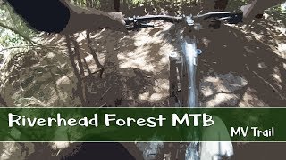
Starts off zig zagging down semi steep hill and then straightens up a bit with a few wheel size holes that you can hop over if you are carrying lots of speed. Halfway down keep to the right at a junction. One of the better trails in the Pines.

Trail Supporters
Local Trail Association

Recent Activity on Trail

Past Week
  • 0 rides
  •  
6 Months
  • 9 rides
  • 9 miles avg distance
All
  • 224 rides
  • Last: Mar 17, 2026
c1c2c3c4
January
February
March
April
May
June
July
August
September
October
November
December
update trails status or condition

MV Trail Reports

statusdatedescription
Jan 18, 2024 @ 11:40am
Jan 18, 2024
Forgot how fun this trail is. Fast and flowy, by RH standards. A few patches could use a trim, but running well
Nov 12, 2023 @ 4:56am
Nov 12, 2023
Jul 16, 2023 @ 6:49am
Jul 16, 2023
Great but the trail at the bottom ending on western side of Campbell's was a stagnant swamp in places
Mar 25, 2023 @ 7:48pm
Mar 25, 2023
Might be a bit destroyed following the race
Jan 24, 2023 @ 3:20pm
Jan 24, 2023
more »
Status:
on Jan 18, 2024
Variable
Avg: 3.9 (5 votes)
Your vote: 0

view (964)
close
3D
Trail Conditions
  • Unknown
  • Snow Groomed
  • Snow Packed
  • Snow Covered
  • Snow Cover Partial
  • Freeze/thaw Cycle
  • Icy
  • Prevalent Mud
  • Wet
  • Variable
  • Ideal
  • Dry
  • Very Dry
Trail Flow (Ridden Direction)
Trailforks scans users ridelogs to determine the most popular direction each trail is ridden. A good flowing trail network will have most trails flowing in a single direction according to their intension.
The colour categories are based on what percentage of riders are riding a trail in its intended direction.
  • > 96%
  • > 90%
  • > 80%
  • > 70%
  • > 50%
  • < 50%
  • bi-directional trail
  • no data
Trail Last Ridden
Trailforks scans ridelogs to determine the last time a trail was ridden.
  • < 2 days
  • < 1 week
  • < 2 weeks
  • < 1 month
  • < 6 months
  • > 6 months
Trail Ridden Direction
The intended direction a trail should be ridden.
  • Downhill Only
  • Downhill Primary
  • Both Directions
  • Uphill Primary
  • Uphill Only
  • One Direction
Contribute Details
Colors indicate trail is missing specified detail.
  • Description
  • Photos
  • Description & Photos
  • Videos
Trail Popularity ?
Trailforks scans ridelogs to determine which trails are ridden the most in the last 9 months. Trails are compared with nearby trails in the same city region with a possible 25 colour shades. Think of this as a heatmap, more rides = more kinetic energy = warmer colors.
  • most popular
  • popular
  • less popular
  • not popular
ATV/ORV/OHV Filter
Max Vehicle Width
inches
US Cell Coverage
Legend
cell carrier legend

Radar Time
Activity Recordings
Trailforks uses anonymized public activity data. ?
Activity Recordings
Trailforks uses anonymized public activity data. ?
Personal Heatmap
Activity Types
all / none
Options
2
Date range month
Winter Trails
Warning A routing network for winter maps does not exist. Selecting trails using the winter trails layer has been disabled.
Missing Trails
Most Popular
Least Popular
Trails are colored based on popularity. The more popular a trail is, the more red. Less popular trails trend towards green.
Jump Magnitude Heatmap
Heatmap of where riders jump on trails. Zoom in to see individual jumps, click circles to view jump details.
BC Backroad Status

Service Road Atlas is a free to use, community-driven service for viewing and creating reports on the numerous back-country service roads around B.C. and Alberta.

map legend
Slope Aspect
Direction the slope faces
Flat N NE E SE S SW W NW
Trails Deemphasized
Trails are shown in grey.
disable
Only show trails with no bike usage.
Enable
Suggested Layers
Based on selected activity type

    Save the current map location and zoom level as your default home location whenever this page is loaded.

    Save
        Directions to mv trailhead (-36.703770, 174.565130)

        Photos

        4 more »
        61 |
        Nov 26, 2020 @ 4:43pm
        Nov 26, 2020
        43 |
        Apr 18, 2020 @ 1:15pm
        Apr 18, 2020
        65 |
        Jan 18, 2020 @ 3:10pm
        Jan 18, 2020
        49 |
        Jan 18, 2020 @ 3:09pm
        Jan 18, 2020

        Videos

        1 more »
        Riverhead Forest MTB - MV Trail
        3:06 | 128 | Apr 7, 2022 , Riverhead

        Routes with this trail

        5.0 11 miles 2,266 ft 21
        2019 Riverhead Enduro Course Some of the best trails to ride for Intermediate and advanced riders in this...
        20 miles 3,226 ft 18
        Loop of Riverhead encompassing most of the decent descents!!

        1 Review & Comments


        We hope you've been enjoying Trailforks!

        Create a FREE account to view trail comments and much more.

        • By mrmrelder & contributors
        • #171103 - 1,365 views

        Frequently Asked Questions About MV

        Where is MV located?
        MV is located in Riverhead Forest Multi Use Trail Network, Riverhead, New Zealand. It is part of the Riverhead Forest Multi Use Trail Network trail network. The trailhead is located at coordinates -36.70377, 174.56513.
        How hard is MV?
        MV is rated as Blue difficulty. The average grade is 10.3%.
        What is the elevation gain for MV?
        The trail has 240 ft of elevation descent. The elevation ranges from 241 ft to 481 ft.
        Is MV a point to point trail?
        MV is not a point to point trail. The direction is Downhill Primary. The trail type is singletrack.

        Hit the Trail

        Open in App

        Get this trail on your phone instantly.
        open trail in app

        Download Trail

        Save to wishlist, Garmin & download.
        save the trail

        Find Related Routes

        Find routes and users activities that include this trail.
        find routes for this trail

        You must enter a description before submitting.