

more stats
2,461 ft
Distance
4 ft
Climb
-220 ft
Descent
00:05:47
Avg time
-217 ft
Altitude change
1,839 ft
Altitude min
2,060 ft
Altitude max
2,056 ft
Altitude start
1,841 ft
Altitude end
-8.8%
Grade
-57.4%
Grade max
2.2%
Grade min
404 ft
Distance climb
2,054 ft
Distance down
00:05:47
Avg time

Nagot! (Upper) Details

  • Activities
    • Mountain Bike
    • E-Bike
  • Riding Area
  • Difficulty Rating
  • Voted Difficulty
    Green (1 vote)
  • Local Popularity
    70 in Mountain Biking heatmap [+]
    • 80 in E-Biking
  • Global Ranking
    #48096 in Mountain Biking [+]
    • #28602 in E-Biking
  • National Ranking
    #4,422 in Mountain Biking · Italy [+]
    • #3,299 in E-Biking
  • Trail Type
    Mixed
  • Bike Type
    DH, AM, XC
  • Climb Difficulty
    Blue
  • Physical Rating
    Moderate
  • Trail Visibility
    Sometimes hard to follow
  • Dogs Allowed
    Yes
  • eBike Allowed
    Yes up to Class 1
  • TTFs on Trail
    Bridge, Drop, Jump, Roller Coaster, Other
  • Land Owner
    Lecco

Veloce e super flow
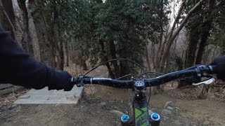
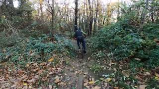
Primo tratto fino al famoso arco di accesso alla città dei balocchi (chiamato Pavesini) senza particolari difficoltà, secondo tratto veloce e prevalentemente flow, presenza di alcune sponde, drop e salti artificiali.
Superata la fontana risalire un 150m lungo asfalto e scendere a destra.
Attenzione:la traccia intercetta più volte la strada asfaltata! Procedere con cautela!

Access Info

Dal cimitero di Consonno

Disclaimer

Ride at your own risk, be careful to pedestrians!

Recent Activity on Trail

Past Week
  • 0 rides
  •  
6 Months
  • 4 rides
  • 26 miles avg distance
All
  • 22 rides
  • Last: Oct 17, 2026
c1c2c3c4
January
February
March
April
May
June
July
August
September
October
November
December
update trails status or condition

Nagot! (Upper) Trail Reports

statusdatedescription
Jul 1, 2026 @ 9:29pm (Europe/Rome)
Jul 1, 2026
reporter
May 30, 2026 @ 12:21pm (Europe/Rome)
May 30, 2026
reporter
Liberato dai rovi
May 18, 2026 @ 5:01pm (Europe/Rome)
May 18, 2026
reporter
Apr 8, 2026 @ 9:02pm (Europe/Rome)
Apr 8, 2026
Tutto ok.
Nov 12, 2025 @ 2:54pm (Europe/Rome)
Nov 12, 2025
Un pochino di fango in un punto, per il resto asciutto, ma tante foglie
more »
Status:
on Jul 1, 2026
Variable
Avg: 4.35 (8 votes)
Your vote: 0

view (504)
close
      Directions to nagot--upper trailhead (45.788490, 9.395390)

      Photos

      9 more »
      mtb
      108 |
      Dec 22, 2024 @ 8:37am
      Dec 22, 2024
      mtb
      264 |
      Sep 20, 2023 @ 7:20am
      Sep 20, 2023
      mtb
      121 |
      Jul 11, 2023 @ 1:09am
      Jul 11, 2023
      mtb
      115 |
      Jul 11, 2023 @ 1:09am
      Jul 11, 2023

      Videos

      6 more »
      Nagot! trail | Consonno | MTB TRAILFORKS
      mtb
      7:15 | 106 | Mar 20, 2025 , Dolzago
      Consonno
      mtb
      0:30 | 229 | Nov 26, 2024 , Dolzago
      CONSONNO Nagot - Hardtail Dh | MTB Lecco
      mtb
      6:19 | 333 | Feb 6, 2024 , Dolzago
      mountain bike a Consonno! | trail e rampe |...
      mtb
      4:32 | 516 | Jun 2, 2023 , Dolzago
      4.7 ★★★★★
      8 Ratings
      5 ★ 63%
      4 ★ 38%
      3 ★
      2 ★
      1 ★

      3 Reviews & Comments

      frusaglia frusaglia
      Complimenti ai ragazzi di NorthNLine, sentiero perfetto!
      hellodominiknoli
      Fantastic, speedy flowtrail with a lot of cool jumps. Thanks to the local trail builder!

      We hope you've been enjoying Trailforks!

      Create a FREE account to view all trail reviews and much more.

      • By Railer83 & contributors
      • #349634 - 2,364 views

      Frequently Asked Questions

      ▼ Where is Nagot! (Upper) located?
      Nagot! (Upper) is located in Monte di Brianza, Dolzago, Italy. It is part of the Monte di Brianza trail network. The trailhead is located at coordinates 45.78849, 9.39539.
      ▼ How hard is Nagot! (Upper)?
      Nagot! (Upper) is rated as Red difficulty. The physical rating is Moderate. The average grade is 8.8%. The climb difficulty is rated Blue.
      ▼ What is the elevation gain for Nagot! (Upper)?
      Nagot! (Upper) has 4 ft of elevation gain. The trail has 220 ft of elevation descent. The elevation ranges from 1,839 ft to 2,060 ft.
      ▼ How long is Nagot! (Upper)?
      Nagot! (Upper) is 2,461 ft long. The trail type is mixed.
      ▼ Are dogs allowed on Nagot! (Upper)?
      Yes, dogs are allowed on Nagot! (Upper). Please keep dogs on a leash where required and clean up after them.
      ▼ When is the best time of year to ride Nagot! (Upper)?
      Based on activity log data, the most popular months to ride Nagot! (Upper) are:
      • April (5 activities)
      • October (5 activities)
      • March (2 activities)
      Check the reports page for current trail conditions.
      ▼ How do I access Nagot! (Upper)? Where is the closest parking trailhead?
      The closest parking and trailhead locations to Nagot! (Upper) are: View all parking locations in the area.
      ▼ How long does it take to ride Nagot! (Upper)?
      Based on recorded activities, it takes an average of 6 minutes to ride Nagot! (Upper). The trail is 2,461 ft long. Actual times will vary based on fitness level, conditions, and pace. View recent activity logs for more details.
      ▼ How busy is Nagot! (Upper)?
      Nagot! (Upper) is a very popular trail. There have been 200 recorded activities on this trail. The trail has received 504 check-ins. View recent activity on this trail.

      Hit the Trail

      Open in App

      Get this trail on your phone instantly.

      open trail in app

      Download Trail

      Save to wishlist, Garmin & download.
      save the trail

      Find Related Routes

      Find routes and users activities that include this trail.
      find routes for this trail

      You must enter a description before submitting.

