
more stats
3.1 miles
Distance
285 ft
Climb
-1,222 ft
Descent
00:52:38
Avg time
-937 ft
Altitude change
3,286 ft
Altitude min
4,373 ft
Altitude max
4,223 ft
Altitude start
3,286 ft
Altitude end
-5.663%
Grade
-28.663%
Grade max
17.131%
Grade min
4,229 ft
Distance climb
2 miles
Distance down
1,561 ft
Distance flat
00:52:38
Avg time

Nares View Details

  • Activities
    • Mountain Bike
    • E-Bike
    • Hike
    • Trail Running
  • Riding Area
    Montana Mountain
    Carcross, Yukon
  • Difficulty Rating
  • Local Popularity
    55 in Mountain Biking [+]
    • 65 in E-Biking
    • 5 in Trail Running
    • 5 in Hiking
  • Global Ranking
    #95117 in Mountain Biking [+]
    • #44135 in E-Biking
    • #350317 in Trail Running
    • #330180 in Hiking
  • Provincial Ranking
    #138 in Mountain Biking · Yukon [+]
    • #173 in E-Biking
    • #581 in Trail Running
    • #525 in Hiking
  • Trail Type
    Singletrack
  • Direction
    Downhill Primary
    Popular Direction Shown
  • Dogs Allowed
    Yes
  • eBike Allowed
  • TTFs on Trail
    Bridge, Rock Garden
  • Land Owner
    Carcross Tagish Management Corporation

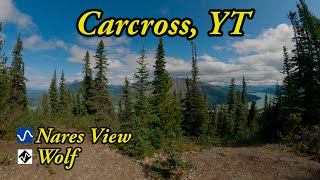
A short singletrack climb then turns into a super fun mixed trail full of fast descents, meadows, viewpoints, rock gardens, climbs, and ridge descents. A great way to start a ride on Montana Mountain is to climb up and do this trail first.

Tags
BridgesMeadowRock gardensViews

Local Trail Association

Recent Activity on Trail

Past Week
  • 0 rides
  •  
6 Months
  • 14 rides
  • 13 miles avg distance
All
  • 127 rides
  • Last: Sep 21, 2026
c1c2c3c4
January
February
March
April
May
June
July
August
September
October
November
December
update trails status or condition

Nares View Trail Reports

statusdatedescription
Aug 28, 2026 @ 6:43pm (America/Whitehorse)
Aug 28, 2026
large freshly killed caribou carcass on the track just uphill of where Nares View splits off - did not see bear around but did not linger
Aug 11, 2026 @ 8:15am (America/Whitehorse)
Aug 11, 2026
Perfect shape. Good dirt no trees down
Jul 4, 2026 @ 4:24pm (America/Whitehorse)
Jul 4, 2026
Jul 4, 2026 @ 4:23pm (America/Whitehorse)
Jul 4, 2026
Jul 14, 2025 @ 2:25pm
Jul 14, 2025
reporter
more »
Status:
on Aug 28, 2026
Variable
Avg: 3.94 (15 votes)
Your vote: 0

view (419)
close
      Directions to nares-view trailhead (60.121420, -134.680510)

      Photos

      30 more »
      mtb
      40 |
      Aug 11, 2026 @ 8:18am
      Aug 11, 2026
      mtb
      83 |
      Sep 12, 2025 @ 7:50pm
      Sep 12, 2025
      mtb
      89 |
      Sep 12, 2025 @ 7:49pm
      Sep 12, 2025
      mtb
      152 |
      Sep 1, 2025 @ 12:47pm
      Sep 1, 2025

      Videos

      1 more »
      youtuber Best MTB trails in Carcross, YT - Nares View...
      mtb
      12:21 | 269 | Jun 28, 2025 , Carcross

      Routes with this trail

      ★ 5.0 • 36 miles • 7,585 ft • 25 • Loop •
      If you're pressed for time or just feel like a challenge this route hits every trail on the lower mountain...
      10 miles • 2,500 ft • 22 • Loop •
      Nares View Loop. Alternatively substitute Grizzly Bear for Wolf on the descent
      4.1 ★★★★★
      15 Ratings
      5 ★ 40%
      4 ★ 40%
      3 ★ 13%
      2 ★
      1 ★ 7%

      3 Reviews & Comments

      alainlampron alainlampron
      It took me about 1 hour and 20 minutes to get to the trailhead from the base parking lot, at a slow steady pace. Once there, I hesitated between Telegraph and Nares View because I honestly did not feel like climbing anymore and the mosquitoes were having a picnic!

      I felt like doing Nares would be a more unique experience so up I went... I am glad I did because the initial climb was easy, the variety of terrain was nice, the view was spectacular and the descent really fun. At the bottom, I turned left on Cariboo, did Goat (my favorite!), then opted to take it easy with Porcupine, Black bear and AK DNR. Epic ride!
      Cmsobin
      Great trail. Nothing too techy but it’s a rooty Rocky workout. I love it.
      sidecut sidecut
      Truly one of the most spectacular trails I've ever ridden. And the descent is a blast too!

      We hope you've been enjoying Trailforks!

      Create a FREE account to view all trail reviews and much more.

      • By tincancharlieTF Pro & contributors
      • #61759 - 3,693 views

      Frequently Asked Questions

      ▼ Where is Nares View located?
      Nares View is located in Montana Mountain, Carcross, Yukon, Canada. It is part of the Montana Mountain trail network. The trailhead is located at coordinates 60.12142, -134.68051.
      ▼ How hard is Nares View?
      Nares View is rated as Blue difficulty. The average grade is 5.663%.
      ▼ What is the elevation gain for Nares View?
      Nares View has 285 ft of elevation gain. The trail has 1,222 ft of elevation descent. The elevation ranges from 3,286 ft to 4,373 ft.
      ▼ Is Nares View a point to point trail?
      Nares View is not a point to point trail. The direction is Downhill Primary. The trail type is singletrack.
      ▼ How long is Nares View?
      Nares View is 3.1 miles long. The trail type is singletrack.
      ▼ Are dogs allowed on Nares View?
      Yes, dogs are allowed on Nares View. Please keep dogs on a leash where required and clean up after them.
      ▼ How do I access Nares View? Where is the closest parking trailhead?
      The closest parking and trailhead locations to Nares View are: View all parking locations in the area.
      ▼ How long does it take to ride Nares View?
      Based on recorded activities, it takes an average of 53 minutes to ride Nares View. The trail is 3.1 miles long. Actual times will vary based on fitness level, conditions, and pace. View recent activity logs for more details.
      ▼ How busy is Nares View?
      Nares View is a moderately popular trail. There have been 426 recorded activities on this trail. The trail has received 419 check-ins. View recent activity on this trail.

      Hit the Trail

      Open in App

      Get this trail on your phone instantly.

      open trail in app

      Download Trail

      Save to wishlist, Garmin & download.
      save the trail

      Find Related Routes

      Find routes and users activities that include this trail.
      find routes for this trail

      You must enter a description before submitting.