more stats
1.4 miles
Distance
194 ft
Climb
-990 ft
Descent
00:18:39
Avg time
-797 ft
Altitude change
94 ft
Altitude min
906 ft
Altitude max
890 ft
Altitude start
95 ft
Altitude end
-10.5%
Grade
-80.4%
Grade max
31.7%
Grade min
1,470 ft
Distance climb
1 mile
Distance down
367 ft
Distance flat
00:18:39
Avg time

Natal Details

  • Activities
    • Mountain Bike
    • E-Bike
    • Hike
    • Trail Running
  • Riding Area
    Machico
    Funchal
  • Difficulty Rating
  • Voted Difficulty
    Black (2 votes)
  • Local Popularity
    65 in Mountain Biking [+]
    • 5 in E-Biking
    • 90 in Trail Running
    • 90 in Hiking
  • Global Ranking
    #53908 in Mountain Biking [+]
    • #103888 in E-Biking
    • #131939 in Trail Running
    • #36932 in Hiking
  • Trail Type
    Singletrack
  • Bike Type
    DH, AM
  • Direction
    Downhill Primary
    Popular Direction Shown
  • Climb Difficulty
    Blue
  • Physical Rating
    Hard
  • Trail Visibility
    Always easy to follow
  • Season
    All year
  • Dogs Allowed
    Yes
  • eBike Allowed
    Yes up to Class 1
  • TTFs on Trail
    Bridge, Rock Face, Rock Garden

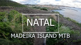
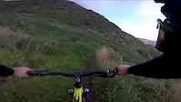
Vereda de terra e muita pedra solta, pequenas pedreiras, perto de 3 curvas muito técnicas. linda vista sobre o Caniçal.

Access Info

No Pico do Facho em Machico, num estradão que tem no lado esquerdo se tiver virado para o mar.

Trail Supporters
Local Trail Association

Recent Activity on Trail

Past Week
  • 0 rides
  •  
6 Months
  • 15 rides
  • 24 miles avg distance
All
  • 87 rides
  • Last: May 18, 2026
c1c2c3c4
January
February
March
April
May
June
July
August
September
October
November
December
update trails status or condition

Natal Trail Reports

statusdatedescription
May 1, 2026 @ 9:47am (Atlantic/Madeira)
May 1, 2026
Apr 7, 2026 @ 1:39pm (Atlantic/Madeira)
Apr 7, 2026
Sep 17, 2025 @ 10:18am (Atlantic/Madeira)
Sep 17, 2025
Challenging. Had to walk some sections but worth riding
Jul 29, 2023 @ 12:18pm
Jul 29, 2023
This trail is extremely challenging, if you are able to ride this trail without ever putting a foot down on the groud, then you are an extremely...
Mar 16, 2022 @ 9:38am
Mar 16, 2022
Partly rocky and try, partly very wet (like a little creek). But totally riadeable.
more »
Status:
on May 1, 2026
Ideal
Avg: 4.49 (11 votes)
Your vote: 0

view (744)
close
3D
Trail Conditions
  • Unknown
  • Snow Groomed
  • Snow Packed
  • Snow Covered
  • Snow Cover Partial
  • Freeze/thaw Cycle
  • Icy
  • Prevalent Mud
  • Wet
  • Variable
  • Ideal
  • Dry
  • Very Dry
Trail Flow (Ridden Direction)
Trailforks scans users ridelogs to determine the most popular direction each trail is ridden. A good flowing trail network will have most trails flowing in a single direction according to their intension.
The colour categories are based on what percentage of riders are riding a trail in its intended direction.
  • > 96%
  • > 90%
  • > 80%
  • > 70%
  • > 50%
  • < 50%
  • bi-directional trail
  • no data
Trail Last Ridden
Trailforks scans ridelogs to determine the last time a trail was ridden.
  • < 2 days
  • < 1 week
  • < 2 weeks
  • < 1 month
  • < 6 months
  • > 6 months
Trail Ridden Direction
The intended direction a trail should be ridden.
  • Downhill Only
  • Downhill Primary
  • Both Directions
  • Uphill Primary
  • Uphill Only
  • One Direction
Contribute Details
Colors indicate trail is missing specified detail.
  • Description
  • Photos
  • Description & Photos
  • Videos
Trail Popularity ?
Trailforks scans ridelogs to determine which trails are ridden the most in the last 9 months. Trails are compared with nearby trails in the same city region with a possible 25 colour shades. Think of this as a heatmap, more rides = more kinetic energy = warmer colors.
  • most popular
  • popular
  • less popular
  • not popular
ATV/ORV/OHV Filter
Max Vehicle Width
inches
US Cell Coverage
Legend
cell carrier legend

Radar Time
Activity Recordings
Trailforks uses anonymized public activity data. ?
Activity Recordings
Trailforks uses anonymized public activity data. ?
Personal Heatmap
Activity Types
all / none
Options
2
Date range month
Winter Trails
Warning A routing network for winter maps does not exist. Selecting trails using the winter trails layer has been disabled.
Missing Trails
Most Popular
Least Popular
Trails are colored based on popularity. The more popular a trail is, the more red. Less popular trails trend towards green.
Jump Magnitude Heatmap
Heatmap of where riders jump on trails. Zoom in to see individual jumps, click circles to view jump details.
BC Backroad Status

Service Road Atlas is a free to use, community-driven service for viewing and creating reports on the numerous back-country service roads around B.C. and Alberta.

map legend
Slope Aspect
Direction the slope faces
Flat N NE E SE S SW W NW
Trails Deemphasized
Trails are shown in grey.
disable
Only show trails with no bike usage.
Enable
Suggested Layers
Based on selected activity type

    Save the current map location and zoom level as your default home location whenever this page is loaded.

    Save
        Directions to natal trailhead (32.725610, -16.759350)

        Photos

        61 more »
        93 |
        Mar 26, 2023 @ 12:56pm
        Mar 26, 2023
        67 |
        Mar 26, 2023 @ 12:56pm
        Mar 26, 2023
        163 |
        Aug 17, 2022 @ 2:20pm
        Aug 17, 2022
        141 |
        Aug 17, 2022 @ 2:20pm
        Aug 17, 2022

        Videos

        3 more »
        youtuber Madeira Island MTB 'NATAL'
        6:09 | 369 | Apr 9, 2023 , Funchal
        Natal trail
        988 | Mar 13, 2016 , Funchal
        Natal Trail Madeira
        0:59 | 363 | Feb 15, 2017 , Funchal

        Routes with this trail

        5.0 20 miles 2,142 ft 11 Point to Point
        Muito puxado fisicamente, muita descida, muito pedal em plano e pouca subida, vários níveis técnicos ao...
        15 miles 4,467 ft 2 Loop Race
        The third round will be heading to the island paradise of Madeira. This tiny island in the Atlantic ocean...
        41 miles 8,603 ft 9 Race
        TransMadeira 2023: day 1

        Reviews / Comments

        No reviews yet, be the first to write a review or ask a question.
        Use trail reports to comment on trail conditions.


        We hope you've been enjoying Trailforks!

        Create a FREE account to view trail comments and much more.

        • By cliogtt & contributors
        • #30637 - 4,109 views

        Frequently Asked Questions About Natal

        Where is Natal located?
        Natal is located in Machico, Funchal, Portugal. It is part of the Machico trail network. The trailhead is located at coordinates 32.72561, -16.75935.
        How hard is Natal?
        Natal is rated as Red difficulty. The physical rating is Hard. The average grade is 10.5%. The climb difficulty is rated Blue.
        What is the elevation gain for Natal?
        Natal has 59 m of elevation gain. The trail has 302 m of elevation descent. The elevation ranges from 29 m to 276 m.
        Is Natal a point to point trail?
        Natal is not a point to point trail. The direction is Downhill Primary. The trail type is singletrack.

        Hit the Trail

        Open in App

        Get this trail on your phone instantly.
        open trail in app

        Download Trail

        Save to wishlist, Garmin & download.
        save the trail

        Find Related Routes

        Find routes and users activities that include this trail.
        find routes for this trail

        You must enter a description before submitting.