

more stats
1.0 mile
Distance
41 ft
Climb
-1,199 ft
Descent
00:52:43
Avg time
-1,158 ft
Altitude change
1,198 ft
Altitude min
2,373 ft
Altitude max
2,373 ft
Altitude start
1,214 ft
Altitude end
-21%
Grade
-98.7%
Grade max
19%
Grade min
512 ft
Distance climb
4,806 ft
Distance down
207 ft
Distance flat
00:52:43
Avg time

Negheredole Details

  • Activities
    • Mountain Bike
    • E-Bike
    • Hike
    • Trail Running
  • Riding Area
  • Difficulty Rating
  • Voted Difficulty
    Double Black Diamond (1 vote)
  • Local Popularity
    5 in Mountain Biking [+]
    • 5 in E-Biking
    • 5 in Trail Running
    • 5 in Hiking
  • Global Ranking
    #139400 in Mountain Biking [+]
    • #143831 in E-Biking
    • #360016 in Trail Running
    • #309552 in Hiking
  • National Ranking
    #10,549 in Mountain Biking · Italy [+]
    • #13,577 in E-Biking
    • #13,943 in Trail Running
    • #11,439 in Hiking
  • Trail Type
    Singletrack
  • Bike Type
    DH, AM, XC
  • Direction
    Downhill Primary
    Popular Direction Shown
  • Physical Rating
    Moderate
  • Trail Visibility
    Always easy to follow
  • Dogs Allowed
    Yes
  • eBike Allowed
    Yes up to Class 1
  • TTFs on Trail
    Skinny

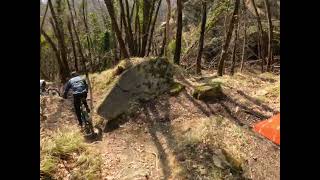
Discesa molto impegnativa, trialistica. Molto ripida con tornanti molto stretti e alcuni tratti esposti. Frequentata dalle moto purtroppo in alcuni punti è molto scavata e bisognerebbe sistemarla. Per il resto discesa molto emozionante per gli amanti del genere ripido e guidato.

Tags
Skinnies

Recent Activity on Trail

Past Week
  • 0 rides
  •  
6 Months
  • 0 rides
  •  
All
  • 2 rides
  • Last: Apr 19, 2025
update trails status or condition

Negheredole Trail Reports

statusdatedescription
Apr 19, 2021 @ 6:54am
Apr 19, 2021
Attenzione che hanno disboscato prima del taglio dalla casetta in salita.. presenza di alberi e rami lungo il sentiero
Oct 26, 2019 @ 12:00am
Oct 26, 2019
Quasi all'inizio si trova un albero in mezzo, non evitabile, molta attenzione. Poi ci sono dei tratti molto scavati da acqua e moto, in due punti...
more »
Status:
on Apr 19, 2021
Very Dry
Avg: 4.13 (1 votes)
Your vote: 0

view (19)
close
      Directions to negheredole trailhead (44.186860, 11.473240)

      Photos

      No photos have been added for Negheredole yet, add a photo.

      Videos

      1 more »
      Freeride mtb Negheredole - Castel Del Rio
      mtb
      5:13 | 356 | Oct 4, 2022 , Imola
      5.0 ★★★★★
      1 Ratings
      5 ★ 100%
      4 ★
      3 ★
      2 ★
      1 ★

      1 Review & Comments

      raffganz raffganz
      All'inizio abbiamo trovato il sentiero chiuso con nastro bianco rosso, abbiamo dovuto seguire una via alternativa contraddistinta da segni gialli fluo sul terreno. Dopo poco si torna in traccia senza problemi: peccato aver perso tempo nel cercare la giusta via.

      We hope you've been enjoying Trailforks!

      Create a FREE account to view all trail reviews and much more.

      • By gpaolocontiTF Pro & contributors
      • #223467 - 1,254 views

      Frequently Asked Questions

      ▼ Where is Negheredole located?
      Negheredole is located in Castel del Rio, Imola, Italy. It is part of the Castel del Rio trail network. The trailhead is located at coordinates 44.18686, 11.47324.
      ▼ How hard is Negheredole?
      Negheredole is rated as Black difficulty. The physical rating is Moderate. The average grade is 21%.
      ▼ What is the elevation gain for Negheredole?
      Negheredole has 41 ft of elevation gain. The trail has 1,199 ft of elevation descent. The elevation ranges from 1,198 ft to 2,373 ft.
      ▼ Is Negheredole a point to point trail?
      Negheredole is not a point to point trail. The direction is Downhill Primary. The trail type is singletrack.
      ▼ How long is Negheredole?
      Negheredole is 1.0 mile long. The trail type is singletrack.
      ▼ Are dogs allowed on Negheredole?
      Yes, dogs are allowed on Negheredole. Please keep dogs on a leash where required and clean up after them.
      ▼ How do I access Negheredole? Where is the closest parking trailhead?
      The closest parking and trailhead locations to Negheredole are: View all parking locations in the area.
      ▼ How long does it take to ride Negheredole?
      Based on recorded activities, it takes an average of 28 minutes to ride Negheredole. The trail is 1.0 mile long. Actual times will vary based on fitness level, conditions, and pace. View recent activity logs for more details.
      ▼ How busy is Negheredole?
      Negheredole is a less popular trail with lighter traffic. There have been 22 recorded activities on this trail. The trail has received 19 check-ins. View recent activity on this trail.

      Hit the Trail

      Open in App

      Get this trail on your phone instantly.

      open trail in app

      Download Trail

      Save to wishlist, Garmin & download.
      save the trail

      Find Related Routes

      Find routes and users activities that include this trail.
      find routes for this trail

      You must enter a description before submitting.

