Supporters, Builders, Maintainers & Land Managers of Nelson Trail
USFSLand Manager
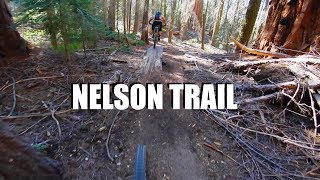
Nelson Trail Details
-
Activities
- Mountain Bike
- Hike
- Trail Running
-
Riding AreaNorthern Sequoia National Forest
Kernville, California -
AKANelson
-
Difficulty Rating
-
Trail TypeSingletrack
-
Bike TypeDH, AM
-
DirectionDownhill PrimaryPopular direction shown
-
SeasonApril-December
-
Dogs AllowedYes
-
TTFs on TrailBridge, Drop, Jump
-
Global Ranking
-
Local Popularity5 in Mountain Biking [+]
- 5 in Trail Running
- 5 in Hiking
-
Land Owner
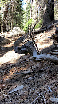
The top of the Camp Nelson trail is located right off highway 190 at the turn-out where the Summit Trail crosses the road. The trailhead is at the meadow/turn-out about 1/2-mile below Quaking Aspen Campground. The trail ends in the McIntyre Tract at the end of Nelson Drive in Camp Nelson. The uppersection of the trail is rocky, steep and there are a lot of roots, making it more difficult and technical than the lower section.
There are a couple small climbs and about a dozen creek crossings along the way. Some are ridable, others you must carry your bike across a fallen tree that spans the creek. Trail speed on Camp Nelson will put a big smile on your face, but be aware that this is the most popular trail in the area for all visitors and it's not unlikely to see a family hiking or a group of equestrians coming up the trail. This it the kind of trail that makes you want to do it again and again.
Traditionally Indigenous Territory
More Stats for Nelson Trail mountain bike trail trail
-
Altitude change-1,809 ft
-
Altitude min5,073 ft
-
Altitude max6,891 ft
-
Altitude start6,883 ft
-
Altitude end5,073 ft
-
Grade max-49.351%
-
Grade min43.138%
-
Distance climb4,862 ft
-
Distance down3 miles
-
Distance flat240 ft
-
Avg time01:01:46
-
Avg reverse time01:40:08
- view trail stats
-
Layers w
- Map Content
- More Layers
- Pro
- Pro
- Pro
- Pro
- Pro
- Pro
- Pro
- Pro
-
Upgrade to

- Unknown
- Snow Groomed
- Snow Packed
- Snow Covered
- Snow Cover Partial
- Freeze/thaw Cycle
- Icy
- Prevalent Mud
- Wet
- Variable
- Ideal
- Dry
- Very Dry
The colour categories are based on what percentage of riders are riding a trail in its intended direction.
- > 96%
- > 90%
- > 80%
- > 70%
- > 50%
- < 50%
- bi-directional trail
- no data
- < 2 days
- < 1 week
- < 2 weeks
- < 1 month
- < 6 months
- > 6 months
- Downhill Only
- Downhill Primary
- Both Directions
- Uphill Primary
- Uphill Only
- One Direction
- Description
- Photos
- Description & Photos
- Videos
- most popular
- popular
- less popular
- not popular

- mountain biking recent
- mountain biking (>6 month)
- hiking (1 year)
- moto (1 year)
- Downhill Ski
- Backcountry Ski
- Nordic Ski
- Snowmobile
Save the current map location and zoom level as your default home location whenever this page is loaded.
SaveNelson Trail Trail Reports
Recent Ridelog Activity on Trail
- 0 rides
- 0 rides
- 137 rides
- Last: Jun 29, 2014


Photos
Routes with this trail
4 Reviews & Comments
We hope you've been enjoying Trailforks!
Create a FREE account to view trail comments and much more.
Videos


Nearby Trails
- Forest Road 21s50 2,503 ft
- Quaking Aspen Trail 4,665 ft
- Freeman Creek Trail 5,151 ft
- Summit Trail (south) 1 mile
- Forest Road 21s05 2 miles
Northern Sequoia National Forest
- By aoneal & contributors
- #28816 - 6,579 views
- follow/subscribe
- login to download gpx or kml files.
You must enter a description before submitting.