more stats
3,999 ft
Distance
5 ft
Climb
-560 ft
Descent
00:15:29
Avg time
-555 ft
Altitude change
1,289 ft
Altitude min
1,844 ft
Altitude max
1,844 ft
Altitude start
1,289 ft
Altitude end
-13.9%
Grade
-45.8%
Grade max
12.2%
Grade min
203 ft
Distance climb
3,596 ft
Distance down
151 ft
Distance flat
00:15:29
Avg time

Nescafe Details

  • Activities
    • Mountain Bike
    • Hike
    • Trail Running
  • Riding Area
    Burke Mountain
    Coquitlam, British Columbia
  • Difficulty Rating
  • Voted Difficulty
    Black Diamond (1 vote)
  • Local Popularity
    55 in Mountain Biking [+]
    • 35 in Trail Running
    • 35 in Hiking
  • Global Ranking
    #81914 in Mountain Biking [+]
    • #117282 in Trail Running
    • #112082 in Hiking
  • Hiking SAC Scale
    T1 Hiking
  • Trail Type
    Singletrack
  • Bike Type
    DH, AM
  • Direction
    Downhill Only
    Popular Direction Shown
  • Climb Difficulty
    Blue
  • Physical Rating
    Moderate
  • Trail Visibility
    Sometimes hard to follow
  • Dogs Allowed
    Yes
  • TTFs on Trail
    Drop, Ladder Bridge, Log Ride, Rock Face, Rock Garden

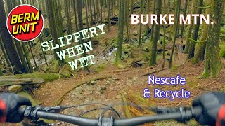
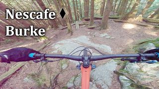
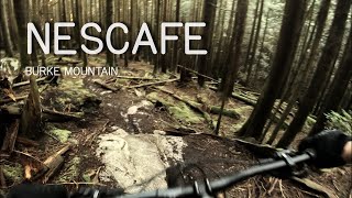
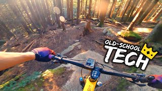
Nescafe is an old school trail. The top half is littered with rock rolls and other slow, technical features. The bottom half is a pedally, loamy, low-angle XC trail. Sometimes the bottom half can be tricky to find/follow, as the forest floor becomes indistinct with pine needles. Riders often choose to ride 'upper' Nescafe to 'lower' The Hammer for ease of pathfinding.

This trail is unsanctioned.

Trail Supporters
Traditionally Indigenous Territory

Recent Activity on Trail

Past Week
  • 0 rides
  •  
6 Months
  • 5 rides
  • 8 miles avg distance
All
  • 165 rides
  • Last: Jun 14, 2026
c1c2c3c4
January
February
March
April
May
June
July
August
September
October
November
December
update trails status or condition

Nescafe Trail Reports

statusdatedescription
Oct 8, 2025 @ 6:53pm (America/Vancouver)
Oct 8, 2025
Aug 31, 2025 @ 2:36pm
Aug 31, 2025
reporter Small tree down towards the end of Nescafé, hand saw should do it.
Aug 29, 2025 @ 10:10am
Aug 29, 2025
Jul 26, 2025 @ 2:47pm
Jul 26, 2025
Apr 3, 2025 @ 8:47pm
Apr 3, 2025
reporter Tree cleared
more »
Status:
on Oct 8, 2025
Variable
Avg: 4 (15 votes)
Your vote: 0

view (808)
close
3D
Trail Conditions
  • Unknown
  • Snow Groomed
  • Snow Packed
  • Snow Covered
  • Snow Cover Partial
  • Freeze/thaw Cycle
  • Icy
  • Prevalent Mud
  • Wet
  • Variable
  • Ideal
  • Dry
  • Very Dry
Trail Flow (Ridden Direction)
Trailforks scans users ridelogs to determine the most popular direction each trail is ridden. A good flowing trail network will have most trails flowing in a single direction according to their intension.
The colour categories are based on what percentage of riders are riding a trail in its intended direction.
  • > 96%
  • > 90%
  • > 80%
  • > 70%
  • > 50%
  • < 50%
  • bi-directional trail
  • no data
Trail Last Ridden
Trailforks scans ridelogs to determine the last time a trail was ridden.
  • < 2 days
  • < 1 week
  • < 2 weeks
  • < 1 month
  • < 6 months
  • > 6 months
Trail Ridden Direction
The intended direction a trail should be ridden.
  • Downhill Only
  • Downhill Primary
  • Both Directions
  • Uphill Primary
  • Uphill Only
  • One Direction
Contribute Details
Colors indicate trail is missing specified detail.
  • Description
  • Photos
  • Description & Photos
  • Videos
Trail Popularity ?
Trailforks scans ridelogs to determine which trails are ridden the most in the last 9 months. Trails are compared with nearby trails in the same city region with a possible 25 colour shades. Think of this as a heatmap, more rides = more kinetic energy = warmer colors.
  • most popular
  • popular
  • less popular
  • not popular
ATV/ORV/OHV Filter
Max Vehicle Width
inches
US Cell Coverage
Legend
cell carrier legend

Radar Time
Activity Recordings
Trailforks uses anonymized public activity data. ?
Activity Recordings
Trailforks uses anonymized public activity data. ?
Personal Heatmap
Activity Types
all / none
Options
2
Date range month
Winter Trails
Warning A routing network for winter maps does not exist. Selecting trails using the winter trails layer has been disabled.
Missing Trails
Most Popular
Least Popular
Trails are colored based on popularity. The more popular a trail is, the more red. Less popular trails trend towards green.
Jump Magnitude Heatmap
Heatmap of where riders jump on trails. Zoom in to see individual jumps, click circles to view jump details.
BC Backroad Status

Service Road Atlas is a free to use, community-driven service for viewing and creating reports on the numerous back-country service roads around B.C. and Alberta.

map legend
Slope Aspect
Direction the slope faces
Flat N NE E SE S SW W NW
Trails Deemphasized
Trails are shown in grey.
disable
Only show trails with no bike usage.
Enable
Suggested Layers
Based on selected activity type

    Save the current map location and zoom level as your default home location whenever this page is loaded.

    Save
        Directions to nescafe trailhead (49.330340, -122.742460)

        Photos

        34 more »
        421 |
        Oct 31, 2010 @ 7:58pm
        Oct 31, 2010
        500 |
        Oct 31, 2010 @ 7:57pm
        Oct 31, 2010
        46 |
        May 6, 2024 @ 8:28am
        May 6, 2024
        204 |
        Apr 6, 2020 @ 9:10pm
        Apr 6, 2020

        Videos

        9 more »
        youtuber SLIPPERY SHOULDER SEASON IS HERE! // BURKE...
        4:39 | 478 | Oct 21, 2020 , Coquitlam
        Nescafe - Burke
        8:11 | 230 | Oct 24, 2023 , Coquitlam
        Riding (and walking) down Nescafe ❱ Burke...
        11:27 | 272 | May 22, 2022 , Coquitlam
        youtuber Taking Old-School KOMs on a Modern Bike
        11:04 | 757 | Jun 16, 2021 , Coquitlam

        Trail Products

        6 Reviews & Comments


        We hope you've been enjoying Trailforks!

        Create a FREE account to view trail comments and much more.

        Nearby Trails

        • #2119 - 4,741 views

        Frequently Asked Questions About Nescafe

        Where is Nescafe located?
        Nescafe is located in Burke Mountain, Coquitlam, British Columbia, Canada. It is part of the Burke Mountain trail network. The trailhead is located at coordinates 49.33034, -122.74246.
        How hard is Nescafe?
        Nescafe is rated as Black Diamond difficulty. The physical rating is Moderate. The average grade is 13.9%. The climb difficulty is rated Blue.
        What is the elevation gain for Nescafe?
        Nescafe has 5 ft of elevation gain. The trail has 560 ft of elevation descent. The elevation ranges from 1,289 ft to 1,844 ft.
        Is Nescafe a point to point trail?
        Yes, Nescafe is a point to point trail. The direction is Downhill Only. The trail type is singletrack.

        Hit the Trail

        Open in App

        Get this trail on your phone instantly.
        open trail in app

        Download Trail

        Save to wishlist, Garmin & download.
        save the trail

        Find Related Routes

        Find routes and users activities that include this trail.
        find routes for this trail

        You must enter a description before submitting.