
more stats
1.4 miles
Distance
14 ft
Climb
-267 ft
Descent
00:09:34
Avg time
-254 ft
Altitude change
1,448 ft
Altitude min
1,704 ft
Altitude max
1,702 ft
Altitude start
1,447 ft
Altitude end
-3.5%
Grade
-17.9%
Grade max
10.7%
Grade min
449 ft
Distance climb
1 mile
Distance down
1,207 ft
Distance flat
00:09:34
Avg time

NIRVANA Details

  • Activities
    • Mountain Bike
    • E-Bike
  • Riding Area
    Mt. Telemark Village
    Cable, Wisconsin
  • Difficulty Rating
  • Voted Difficulty
    Blue (1 vote)
  • Local Popularity
    95 in Mountain Biking [+]
    • 90 in E-Biking
  • Global Ranking
    #4821 in Mountain Biking [+]
    • #12643 in E-Biking
  • State Ranking
    #54 in Mountain Biking · Wisconsin [+]
    • #51 in E-Biking
  • Trail Type
    Singletrack
  • Bike Type
    AM, XC
  • Direction
    Both Directions
  • Climb Difficulty
    Blue
  • Physical Rating
    Moderate
  • Trail Visibility
    Always easy to follow
  • Season
    April - Oct
  • Dogs Allowed
    Yes
  • eBike Allowed
    Yes up to Class 1
  • TTFs on Trail
    Berm, Jump
  • Year Opened
    2023
  • Land Owner

Intermediate XC style connector trail from Evenflow to the top of Telemark Mt.

Access Info

From Mt. Telemark Base, Wisenup - Money - Nirvana. From Birkie Start, Krusen - Once - Evenflow - Nirvana

Tags
BermsJumps

Local Trail Association

Recent Activity on Trail

Past Week
  • 2 rides
  • 11 miles average
6 Months
  • 119 rides
  • 13 miles avg distance
All
  • 375 rides
  • Last: Nov 10, 2026
update trails status or condition

NIRVANA Trail Reports

statusdatedescription
Nov 9, 2026 @ 1:07pm (America/Chicago)
2 days
Trails are riding well after the rain and the soil is tacky! We will begin our (likely) last round of leaf blowing this week across the system for...
Nov 4, 2026 @ 1:55pm (America/Chicago)
Nov 4, 2026
Plenty of rain recently. Deep tread marks left if ridden. Please stay off the trails until it dries out.
Oct 27, 2026 @ 4:19pm (America/Chicago)
Oct 27, 2026
Plenty of rain recently. Deep tread marks left if ridden. Please stay off the trails until it dries out.
Oct 27, 2026 @ 4:10pm (America/Chicago)
Oct 27, 2026
Plenty of rain recently. Deep tread marks left if ridden. Please stay off the trails until it dries out.
Oct 27, 2026 @ 4:06pm (America/Chicago)
Oct 27, 2026
Plenty of rain recently. Deep tread marks left if ridden. Please stay off the trails until it dries out.
more »
Status:
on Nov 9, 2026
Ideal
Avg: 4.07 (7 votes)
Your vote: 0

view (1,922)
close
      Directions to nirvana-694003 trailhead (46.182340, -91.252860)

      Photos

      No photos have been added for NIRVANA yet, add a photo.

      Videos

      1 more »
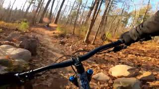
      Nirvana Mountain Bike Trail at Mt. Telemark.
      mtb
      6:40 | 303 | Jul 8, 2024 , Cable

      Routes with this trail

      more »
      10 miles • 872 ft • 7 • Loop •
      Wisconsin NICA Spicy Adventure for Cable
      7 miles • 573 ft • 5 • Loop •
      Wisconsin League Adventure for Cable
      10 miles • 729 ft • 4 • Race •
      This is the 2024 NICA Adventure Ride Route. This is a really fun and challenging route. Mild ride - climb...
      4.2 ★★★★★
      7 Ratings
      5 ★ 43%
      4 ★ 43%
      3 ★
      2 ★ 14%
      1 ★

      3 Reviews & Comments

      Meatloaf5 Meatloaf5
      This trail is great both directions. Its actually a very mellow climb to the top of Mt. Telemark. Halfway up/down there is an option to turn onto "Missing Link" which will connect you to the downward spiral section of Dirt Candy 1. From the top of Mt. Telemark Nirvana is a really fun and long descent with some optional jumps to keep things interesting.
      Kurt8wFjYX
      Road up it yesterday (11/15) for the first time. Trail was in perfect condition. For an all uphill ride it wasn’t as bad as you’d think. Nice design. Great addition to the CAMBA complex. Beautiful back in those hills. You could get a sense of the area with the leaves down.
      Northsupply Northsupply
      Way more mellow than Jumptimus Prime, but still a ton of fun! More of a classic mountain bike trail with lots of flow and some little features here and there to keep you stoked, until you get to the bottom.

      We hope you've been enjoying Trailforks!

      Create a FREE account to view all trail reviews and much more.

      • By jvfish1TF Pro Birkie & contributors
      • #694003 - 1,302 views

      Frequently Asked Questions

      ▼ Where is NIRVANA located?
      NIRVANA is located in Mt. Telemark Village, Cable, Wisconsin, United States. It is part of the Mt. Telemark Village trail network. The trailhead is located at coordinates 46.18234, -91.25286.
      ▼ How hard is NIRVANA?
      NIRVANA is rated as Blue difficulty. The physical rating is Moderate. The average grade is 3.5%. The climb difficulty is rated Blue.
      ▼ What is the elevation gain for NIRVANA?
      NIRVANA has 14 ft of elevation gain. The trail has 267 ft of elevation descent. The elevation ranges from 1,448 ft to 1,704 ft.
      ▼ Is NIRVANA a point to point trail?
      NIRVANA is not a point to point trail. The direction is Both Directions. The trail type is singletrack.
      ▼ How long is NIRVANA?
      NIRVANA is 1.4 miles long. The trail type is singletrack.
      ▼ Are dogs allowed on NIRVANA?
      Yes, dogs are allowed on NIRVANA. Please keep dogs on a leash where required and clean up after them.
      ▼ When is the best time of year to ride NIRVANA?
      NIRVANA is best visited during: April - Oct.
      ▼ How do I access NIRVANA? Where is the closest parking trailhead?
      The closest parking and trailhead locations to NIRVANA are: View all parking locations in the area.
      ▼ How long does it take to ride NIRVANA?
      Based on recorded activities, it takes an average of 10 minutes to ride NIRVANA. The trail is 1.4 miles long. Actual times will vary based on fitness level, conditions, and pace. View recent activity logs for more details.
      ▼ How busy is NIRVANA?
      NIRVANA is a very popular trail. There have been 1,563 recorded activities on this trail. The trail has received 1,922 check-ins. View recent activity on this trail.

      Hit the Trail

      Open in App

      Get this trail on your phone instantly.

      open trail in app

      Download Trail

      Save to wishlist, Garmin & download.
      save the trail

      Find Related Routes

      Find routes and users activities that include this trail.
      find routes for this trail

      You must enter a description before submitting.