
more stats
1,220 ft
Distance
-176 ft
Descent
00:01:30
Avg time
-176 ft
Altitude change
1,095 ft
Altitude min
1,271 ft
Altitude max
1,271 ft
Altitude start
1,096 ft
Altitude end
-14.4%
Grade
-32.1%
Grade max
-2.2%
Grade min
10 ft
Distance climb
1,168 ft
Distance down
46 ft
Distance flat
00:01:30
Avg time

Nocino Details

  • Activities
    • Mountain Bike
    • E-Bike
    • Hike
    • Trail Running
  • Riding Area
    Cà del Vento
    Reggio Emilia
  • Difficulty Rating
  • Voted Difficulty
    Blue (1 vote)
  • Local Popularity
    90 in Mountain Biking heatmap [+]
    • 100 in E-Biking
    • 100 in Trail Running
    • 5 in Hiking
  • Global Ranking
    #9174 in Mountain Biking [+]
    • #6896 in E-Biking
    • #77196 in Trail Running
    • #334651 in Hiking
  • National Ranking
    #917 in Mountain Biking · Italy [+]
    • #768 in E-Biking
    • #1,951 in Trail Running
    • #12,880 in Hiking
  • Trail Type
    Singletrack
  • Bike Type
    DH, AM, XC
  • Trail Visibility
    Always easy to follow
  • eBike Allowed
    Yes up to Class 1
  • TTFs on Trail
    Jump

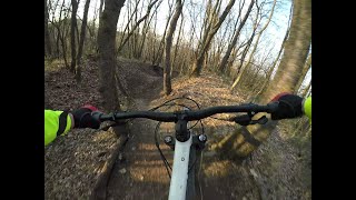
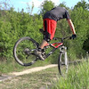
Singletrack con diversi salti di altezza inferiore ad 1mt, sempre evitabili grazie alle vie di fuga. Si prende a sx prima di imboccare il Baccaro e termina sulla stessa carrareccia che, svoltando a dx, riporta su via Franchetti per il Giareto o Borzano.

Tags
Jumps

Recent Activity on Trail

Past Week
  • 0 rides
  •  
6 Months
  • 16 rides
  • 27.8 km avg distance
All
  • 118 rides
  • Last: Nov 2, 2026
c1c2c3c4
January
February
March
April
May
June
July
August
September
October
November
December
Status:
on May 10, 2026
Variable
Avg: 3.98 (1 votes)
Your vote: 0

view (913)
close
      Directions to nocino trailhead (44.588300, 10.613870)

      Photos

      2 more »
      mtb
      80 |
      Apr 9, 2022 @ 9:15am
      Apr 9, 2022
      report
      mtb
      53 |
      Jun 29, 2025 @ 6:55am
      Jun 29, 2025

      Videos

      1 more »
      Esplorazione nuovo trail Nocino - Ca del Vento...
      mtb
      2:06 | 439 | Mar 19, 2022 , Reggio Emilia
      4.0 ★★★★★
      1 Ratings
      5 ★
      4 ★ 100%
      3 ★
      2 ★
      1 ★

      1 Review & Comments

      andreabraglia andreabraglia
      volevo fare un ringraziamento a chi prepara e tiene pulito i sentieri di questa area

      We hope you've been enjoying Trailforks!

      Create a FREE account to view all trail reviews and much more.

      • By LucaGuxx & contributors
      • #517586 - 814 views

      Frequently Asked Questions

      ▼ Where is Nocino located?
      Nocino is located in Cà del Vento, Reggio Emilia, Italy. It is part of the Cà del Vento trail network. The trailhead is located at coordinates 44.5883, 10.61387.
      ▼ How hard is Nocino?
      Nocino is rated as Green difficulty. The average grade is 14.4%.
      ▼ What is the elevation gain for Nocino?
      The trail has 176 ft of elevation descent. The elevation ranges from 1,095 ft to 1,271 ft.
      ▼ How long is Nocino?
      Nocino is 1,220 ft long. The trail type is singletrack.
      ▼ Are dogs allowed on Nocino?
      There is no information about dogs being allowed on Nocino. Check with local trail managers or the trail page for the latest access rules.
      ▼ How do I access Nocino? Where is the closest parking trailhead?
      The closest parking and trailhead locations to Nocino are: View all parking locations in the area.
      ▼ How long does it take to ride Nocino?
      Based on recorded activities, it takes an average of 2 minutes to ride Nocino. The trail is 1,220 ft long. Actual times will vary based on fitness level, conditions, and pace. View recent activity logs for more details.
      ▼ How busy is Nocino?
      Nocino is a very popular trail. There have been 691 recorded activities on this trail. The trail has received 913 check-ins. View recent activity on this trail.

      Hit the Trail

      Open in App

      Get this trail on your phone instantly.

      open trail in app

      Download Trail

      Save to wishlist, Garmin & download.
      save the trail

      Find Related Routes

      Find routes and users activities that include this trail.
      find routes for this trail

      You must enter a description before submitting.

