
more stats
1.8 miles
Distance
126 ft
Climb
-334 ft
Descent
00:20:01
Avg time
-208 ft
Altitude change
4,380 ft
Altitude min
4,693 ft
Altitude max
4,688 ft
Altitude start
4,480 ft
Altitude end
-2.23%
Grade
-13.837%
Grade max
10.342%
Grade min
3,686 ft
Distance climb
1 mile
Distance down
310 ft
Distance flat
00:20:01
Avg time

Nova Borbolight Details

  • Activities
    • Mountain Bike
    • E-Bike
    • Winter Fat Bike
    • Hike
    • Trail Running
  • Riding Area
    Gandarela
    Nova Lima
  • Difficulty Rating
  • Local Popularity
    65 in Mountain Biking [+]
    • 65 in E-Biking
    • 5 in Trail Running
    • 5 in Hiking
    • 5 in Winter Fat Biking
  • Global Ranking
    #83508 in Mountain Biking [+]
    • #49025 in E-Biking
    • #355757 in Trail Running
    • #335538 in Hiking
    • #6645 in Winter Fat Biking
  • National Ranking
    #545 in Mountain Biking · Brazil [+]
    • #603 in E-Biking
    • #2,483 in Trail Running
    • #2,150 in Hiking
    • #70 in Winter Fat Biking
  • Trail Type
    Singletrack
  • Bike Type
    AM, XC, Fat
  • Direction
    Both Directions
    Popular Direction Shown
  • Climb Difficulty
    Black Diamond
  • Physical Rating
    Hard
  • Dogs Allowed
    Yes
  • eBike Allowed
    Yes up to Class 1
  • TTFs on Trail
    Drop, Rock Face, Rock Garden, Roller Coaster, Skinny

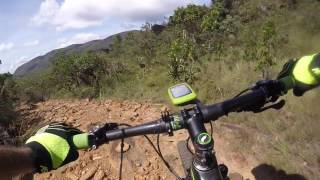
Trilha Sensacional. Visual belíssimo de montanha, muitos rockgardens técnicos, bancos de areia, um verdadeiro desafio conseguir "zerar" os rockgardens sem tirar o pé do pedal. Ela se conecta de um lado com o estradão da Vale pro lado da Escolinha, e do outro ao traçado da Borbolight que conecta ao Morro do Careca.

Tags

Local Trail Association

Recent Activity on Trail

Past Week
  • 0 rides
  •  
6 Months
  • 3 rides
  • 26 miles avg distance
All
  • 42 rides
  • Last: Oct 31, 2026
c1c2c3c4
January
February
March
April
May
June
July
August
September
October
November
December
update trails status or condition

Nova Borbolight Trail Reports

statusdatedescription
Mar 22, 2026 @ 7:49am (America/Sao_Paulo)
Mar 22, 2026
Algumas poças e minando água em alguns locais. No trecho do areal está descendo um curso d'água pelo single mas já abriram linhas paralelas....
Dec 29, 2023 @ 1:17am
Dec 29, 2023
Trilha muito legal e bonita. Presença de Rock Garden
Dec 10, 2023 @ 3:14am
Dec 10, 2023
Oct 6, 2023 @ 2:53am
Oct 6, 2023
Trilha top demais!
Jul 23, 2023 @ 7:46pm
Jul 23, 2023
more »
Status:
on Mar 22, 2026
Wet
Avg: 4.13 (1 votes)
Your vote: 0

view (397)
close
      Directions to nova-borbolight trailhead (-20.098040, -43.694960)

      Photos

      8 more »
      mtb
      103 |
      May 24, 2020 @ 6:23am
      May 24, 2020
      mtb
      90 |
      May 24, 2020 @ 6:23am
      May 24, 2020
      mtb
      99 |
      May 24, 2020 @ 6:23am
      May 24, 2020
      mtb
      91 |
      May 24, 2020 @ 6:23am
      May 24, 2020

      Videos

      2 more »
      Drop Nova Borbolight (Rio Acima)
      mtb
      398 | May 24, 2020 , Nova Lima
      BORBOLIGHT by Casca Grossa
      mtb
      3:18 | 501 | Jun 21, 2018 , Nova Lima

      Routes with this trail

      ★ 5.0 • 35 miles • 5,627 ft • 8 • Loop •
      Percurso Desafio Brou Bruto de MTB em Rio Acima
      42 miles • 6,110 ft • 12 •
      saindo do CAC, subindo Mingu, Eucaliptos, um pedaço da borbolight pra pegar o vale perdido saindo na...
      23 miles • 3,210 ft • 5 • Loop •
      Trilha de nível moderada para quem já tem alguma experiência de trilhas mais técnicas
      5.0 ★★★★★
      1 Ratings
      5 ★ 100%
      4 ★
      3 ★
      2 ★
      1 ★

      1 Review & Comments

      RideOverMountain RideOverMountain
      uma das melhores trilhas da região, a porta de entrada para qualquer rolê na região! porém a classificação é exagerada demais, essa trilha não é tão difícil

      We hope you've been enjoying Trailforks!

      Create a FREE account to view all trail reviews and much more.

      • By gustavoabahTF Pro TFB & contributors
      • #134471 - 1,312 views

      Frequently Asked Questions

      ▼ Where is Nova Borbolight located?
      Nova Borbolight is located in Gandarela, Nova Lima, Brazil. It is part of the Gandarela trail network. The trailhead is located at coordinates -20.09804, -43.69496.
      ▼ How hard is Nova Borbolight?
      Nova Borbolight is rated as Double Black Diamond difficulty. The physical rating is Hard. The average grade is 2.23%. The climb difficulty is rated Black Diamond.
      ▼ What is the elevation gain for Nova Borbolight?
      Nova Borbolight has 126 ft of elevation gain. The trail has 334 ft of elevation descent. The elevation ranges from 4,380 ft to 4,693 ft.
      ▼ Is Nova Borbolight a point to point trail?
      Nova Borbolight is not a point to point trail. The direction is Both Directions. The trail type is singletrack.
      ▼ How long is Nova Borbolight?
      Nova Borbolight is 1.8 miles long. The trail type is singletrack.
      ▼ Are dogs allowed on Nova Borbolight?
      Yes, dogs are allowed on Nova Borbolight. Please keep dogs on a leash where required and clean up after them.
      ▼ When is the best time of year to ride Nova Borbolight?
      Based on activity log data, the most popular months to ride Nova Borbolight are:
      • February (3 activities)
      • March (2 activities)
      • April (2 activities)
      Check the reports page for current trail conditions.
      ▼ How do I access Nova Borbolight? Where is the closest parking trailhead?
      The closest parking and trailhead locations to Nova Borbolight are: View all parking locations in the area.
      ▼ How long does it take to ride Nova Borbolight?
      Based on recorded activities, it takes an average of 20 minutes to ride Nova Borbolight. The trail is 1.8 miles long. Actual times will vary based on fitness level, conditions, and pace. View recent activity logs for more details.
      ▼ How busy is Nova Borbolight?
      Nova Borbolight is a moderately popular trail. There have been 419 recorded activities on this trail. The trail has received 397 check-ins. View recent activity on this trail.

      Hit the Trail

      Open in App

      Get this trail on your phone instantly.

      open trail in app

      Download Trail

      Save to wishlist, Garmin & download.
      save the trail

      Find Related Routes

      Find routes and users activities that include this trail.
      find routes for this trail

      You must enter a description before submitting.