


Open in App
Get this trail on your phone instantly.

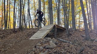
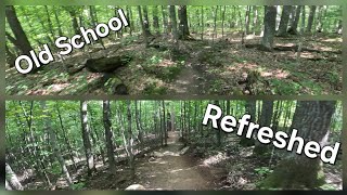
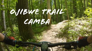
Ojibwe is a blue trail with a good mix of old school hand built rocky sections mixed in with more modern flow sections. There are options to get wheels off the ground as well as test a riders technical ability.
| c1 | c2 | c3 | c4 |
|---|---|---|---|
January | February | March | April |
May | June | July | August |
September | October | November | December |

Service Road Atlas is a free to use, community-driven service for viewing and creating reports on the numerous back-country service roads around B.C. and Alberta.
Save the current map location and zoom level as your default home location whenever this page is loaded.
SaveWe hope you've been enjoying Trailforks!
Create a FREE account to view trail comments and much more.
You must enter a description before submitting.

