

more stats
2.4 miles
Distance
82 ft
Climb
-1,723 ft
Descent
00:26:54
Avg time
-1,642 ft
Altitude change
2,024 ft
Altitude min
3,730 ft
Altitude max
3,690 ft
Altitude start
2,047 ft
Altitude end
-13%
Grade
-74.2%
Grade max
29%
Grade min
833 ft
Distance climb
2 miles
Distance down
295 ft
Distance flat
00:26:54
Avg time

Oltrefinale Details

  • Activities
    • Mountain Bike
    • E-Bike
  • Riding Area
    Finale Outdoor Region
    Finale Ligure
  • Ref Number
    #341
  • AKA
    Oltre Finale
  • Difficulty Rating
  • Voted Difficulty
    Red (7 votes)
  • Local Popularity
    75 in Mountain Biking [+]
    • 75 in E-Biking
  • Global Ranking
    #12046 in Mountain Biking [+]
    • #631 in E-Biking
  • National Ranking
    #1,202 in Mountain Biking · Italy [+]
    • #129 in E-Biking
  • Trail Type
    Singletrack
  • Bike Type
    DH, AM
  • Direction
    Downhill Only
    Popular Direction Shown
  • Climb Difficulty
    Blue
  • Physical Rating
    Moderate
  • Trail Visibility
    Sometimes hard to follow
  • Season
    All-year round
  • Dogs Allowed
    Yes
  • eBike Allowed
    Yes up to Class 1
  • Land Owner
    Finale Outdoor Region

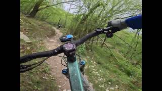
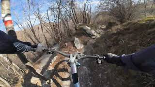
Also called Sentiero delle Caselle, Oltrefinale starts from the switchback before the Giogo di Giustenice. It touches and links pre-existing trails and moves beside old Neviere (holes dug in the ground used in the old days to store snow and ice) and reaches Pian delle Bosse hut before keeping going towards the Cabanun. From the end of this trail, you can reach Giustenice, Ranzi or even Verzi di Loano.

source: ...
Access Info

Exit the E80 highway in Pietra Ligure. Keep going towards the sea and you'll get to Pietra Ligure. You'll then be able to drive toward the mountains in order to reach Val Maremola towns and trails.
Other option would be the E80 exit in Finale Ligure. Keep going towards the sea until you catch the SS1 Via Aurelia and move west until Pietra Ligure.

Disclaimer

Given its nature, the trail can change after weather happenings and season changes. Always pay attention.

Tags
Trail Supporters
Local Trail Association

Recent Activity on Trail

Past Week
  • 7 rides
  • 20 miles average
6 Months
  • 133 rides
  • 26 miles avg distance
All
  • 619 rides
  • Last: Sep 29, 2026
c1c2c3c4
January
February
March
April
May
June
July
August
September
October
November
December
update trails status or condition

Oltrefinale Trail Reports

statusdatedescription
Sep 21, 2026 @ 10:34am (Europe/Rome)
Sep 21, 2026
Pulitissimo. Molto secco e polveroso
Sep 13, 2026 @ 9:39pm (Europe/Rome)
Sep 13, 2026
Sep 6, 2026 @ 9:43pm (Europe/Rome)
Sep 6, 2026
All good, quite dry
Jul 21, 2026 @ 8:30am (Europe/Rome)
Jul 20, 2026
the second part is closed due to excavation works for electrical lines.
Jul 18, 2026 @ 9:52am (Europe/Rome)
Jul 18, 2026
more »
Status:
on Sep 21, 2026
Dry
Avg: 4.34 (50 votes)
Your vote: 0

view (3,292)
close
      Directions to oltrefinale trailhead (44.182280, 8.190480)

      Photos

      36 more »
      mtb
      20 |
      Jul 23, 2026 @ 1:44am
      Jul 23, 2026
      mtb
      116 |
      Dec 20, 2024 @ 12:23am
      Dec 20, 2024
      mtb
      247 |
      May 25, 2024 @ 2:49am
      May 25, 2024
      mtb
      223 |
      May 8, 2024 @ 12:44am
      May 8, 2024

      Videos

      10 more »
      Pietra Ligure eMTBing - Trail Oltrefinale
      mtb
      20:53 | 19 | Sep 20, 2026 , Finale Ligure
      Pietra Ligure - Oltrefinale
      mtb
      8:15 | 115 | May 6, 2026 , Finale Ligure
      Monte Carmo - Oltrefinale
      mtb
      3:28 | 124 | Nov 19, 2025 , Finale Ligure
      Krásne traily Issalo Extasy a Oltrefinale vo...
      mtb
      19:21 | 156 | Aug 26, 2025 , Finale Ligure

      Trail Lists

      Routes with this trail

      ★ 3.0 • 15 miles • 3,848 ft • 10 • Loop •
      Partenza/rientro dal negozio HotBikes. Giro dedicato per E-bike Livello medio/alto Sosta intermedia presso...
      ★ 5.0 • 8 miles • 2,425 ft • 2 • Loop •
      keine Beschreibung vorhanden
      4.4 ★★★★★
      50 Ratings
      5 ★ 54%
      4 ★ 32%
      3 ★ 12%
      2 ★ 2%
      1 ★

      14 Reviews & Comments

      owen777mtb
      A typical red natural trail. Fun, but if you have just one shot in this area, choose Hiroshima Mon Amour instead, which has way more flow and satisfaction but similar difficulty.
      Blakeskii
      Really fun but again feels more like a black. Some pretty rocky sections.
      MarcoXA96u8
      ottime condizioni. pulito e lucidato. divertentissimo

      We hope you've been enjoying Trailforks!

      Create a FREE account to view all trail reviews and much more.

      • By Benq00TF Pro & contributors
      • #135979 - 13,229 views

      Frequently Asked Questions

      ▼ Where is Oltrefinale located?
      Oltrefinale is located in Finale Outdoor Region, Finale Ligure, Italy. It is part of the Finale Outdoor Region trail network. The trailhead is located at coordinates 44.18228, 8.19048.
      ▼ How hard is Oltrefinale?
      Oltrefinale is rated as Blue difficulty. The physical rating is Moderate. The average grade is 13%. The climb difficulty is rated Blue.
      ▼ What is the elevation gain for Oltrefinale?
      Oltrefinale has 82 ft of elevation gain. The trail has 1,723 ft of elevation descent. The elevation ranges from 2,024 ft to 3,730 ft.
      ▼ Is Oltrefinale a point to point trail?
      Yes, Oltrefinale is a point to point trail. The direction is Downhill Only. The trail type is singletrack.
      ▼ How long is Oltrefinale?
      Oltrefinale is 2.4 miles long. The trail type is singletrack.
      ▼ Are dogs allowed on Oltrefinale?
      Yes, dogs are allowed on Oltrefinale. Please keep dogs on a leash where required and clean up after them.
      ▼ When is the best time of year to ride Oltrefinale?
      Oltrefinale is best visited during: All-year round.
      ▼ How do I access Oltrefinale? Where is the closest parking trailhead?
      The closest parking and trailhead locations to Oltrefinale are: View all parking locations in the area.
      ▼ How long does it take to ride Oltrefinale?
      Based on recorded activities, it takes an average of 16 minutes to ride Oltrefinale. The trail is 2.4 miles long. Actual times will vary based on fitness level, conditions, and pace. View recent activity logs for more details.
      ▼ How busy is Oltrefinale?
      Oltrefinale is a very popular trail. There have been 3,061 recorded activities on this trail. The trail has received 3,292 check-ins. View recent activity on this trail.

      Hit the Trail

      Open in App

      Get this trail on your phone instantly.

      open trail in app

      Download Trail

      Save to wishlist, Garmin & download.
      save the trail

      Find Related Routes

      Find routes and users activities that include this trail.
      find routes for this trail

      You must enter a description before submitting.