more stats
12.4 miles
Distance
1,656 ft
Climb
-2,619 ft
Descent
03:07:45
Avg time
-964 ft
Altitude change
1,307 ft
Altitude min
2,429 ft
Altitude max
2,377 ft
Altitude start
1,414 ft
Altitude end
-1.5%
Grade
-65.2%
Grade max
40.2%
Grade min
5 miles
Distance climb
7 miles
Distance down
2,103 ft
Distance flat
03:07:45
Avg time

ONRT - Forche Mountain Details

  • Activities
    • Hike
    • Mountain Bike
    • Trail Running
  • Riding Area
    Mena
    , Arkansas
  • Ref Number
    #1
  • AKA
    Skyline to Foran Gap
  • Difficulty Rating
  • Local Popularity
    5 in Mountain Biking heatmap [+]
    • 5 in Trail Running
    • 5 in Hiking
  • Global Ranking
    #134022 in Mountain Biking [+]
    • #158486 in Trail Running
    • #157924 in Hiking
  • State Ranking
    #801 in Mountain Biking · Arkansas [+]
    • #850 in Trail Running
    • #847 in Hiking
  • Hiking SAC Scale
    T1 Hiking
  • Trail Type
    Mixed
  • Bike Type
    AM, XC
  • Direction
    Both Directions
    Popular Direction Shown
  • Dogs Allowed
    Yes
  • eBike Allowed

The 108-mile stretch between Highway 88 (the Talimena National Scenic Byway) and Scenic Highway 7 north of Hot Springs is open to mountain biking, making it the longest mountain bike trail in the state. The most traveled part of the trail by mountain bikers is a section in Montgomery County used as part of the Ouachita Challenge Mountain Bike Race each spring.

The trail features camping shelters spaced approximately every 10 miles with only a few left to be built. This ride presents a true adventure trip with beautiful views, stream crossings and rugged terrain. Expect to do some hike-a-biking if you decide to take on this trail.

This is the only section of the Ouachita National Recreation Trail currently open to mountain biking. Please respect these boundaries. We hope to include more in the future.

This is a hiking trail which allows mountain biking through remote sections of the Ouachita Mountains. Expect some off the bike traversing but also some fun downhills along the way.

On the western end, lodging, camping and dining are available at Queen Wilhelmina State Park. The trail also connects with the Womble Trail - IMBA Epic in Montgomery County. This area is used as part of the Ouachita Challenge Mountain Bike Race.

Tags
Creek crossingHot springsViews

Trail Supporters

Local Trail Association

Recent Activity on Trail

Past Week
  • 0 rides
  •  
6 Months
  • 0 rides
  •  
All
  • 0 rides
  • Last: Oct 24, 2024
update trails status or condition

ONRT - Forche... Trail Reports

no reports have been added for ONRT - Forche Mountain yet, add a trail report.
Trail reports are used to indicate a trails current condition and inform builders and other users about any issues on a trail.
Status:
Avg: 4.21 (3 votes)
Your vote: 0

view (4)
close
      Directions to onrt-forche-mountain trailhead (34.672050, -94.319150)

      Photos

      No photos have been added for ONRT - Forche Mountain yet, add a photo.

      Videos

      1 more »
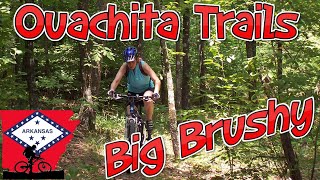
      Ouachita Trail - Big Brushy
      mtb
      5:35 | 459 | Dec 29, 2019 , Mena

      Trail Lists

      4.7 ★★★★★
      3 Ratings
      5 ★ 67%
      4 ★ 33%
      3 ★
      2 ★
      1 ★

      Reviews / Comments

      No reviews yet, be the first to write a review or ask a question.
      Use trail reports to comment on trail conditions.


      We hope you've been enjoying Trailforks!

      Create a FREE account to view all trail reviews and much more.

      Frequently Asked Questions

      ▼ Where is ONRT - Forche Mountain located?
      ONRT - Forche Mountain is located in Mena, Arkansas, United States. It is part of the Mena trail network. The trailhead is located at coordinates 34.67205, -94.31915.
      ▼ How hard is ONRT - Forche Mountain?
      ONRT - Forche Mountain is rated as Black Diamond difficulty. The average grade is 1.5%.
      ▼ What is the elevation gain for ONRT - Forche Mountain?
      ONRT - Forche Mountain has 1,656 ft of elevation gain. The trail has 2,619 ft of elevation descent. The elevation ranges from 1,307 ft to 2,429 ft.
      ▼ Is ONRT - Forche Mountain a point to point trail?
      ONRT - Forche Mountain is not a point to point trail. The direction is Both Directions. The trail type is mixed.
      ▼ How long is ONRT - Forche Mountain?
      ONRT - Forche Mountain is 12.4 miles long. The trail type is mixed.
      ▼ Are dogs allowed on ONRT - Forche Mountain?
      Yes, dogs are allowed on ONRT - Forche Mountain. Please keep dogs on a leash where required and clean up after them.
      ▼ How do I access ONRT - Forche Mountain? Where is the closest parking trailhead?
      The closest parking and trailhead locations to ONRT - Forche Mountain are: View all parking locations in the area.
      ▼ How long does it take to ride ONRT - Forche Mountain?
      The estimated time to ride ONRT - Forche Mountain is approximately 3 hours 8 minutes. The trail is 12.4 miles long. Actual times will vary based on fitness level, conditions, and pace.
      ▼ How busy is ONRT - Forche Mountain?
      ONRT - Forche Mountain is a less popular trail with lighter traffic. There have been 4 recorded activities on this trail. The trail has received 4 check-ins. View recent activity on this trail.

      Hit the Trail

      Open in App

      Get this trail on your phone instantly.

      open trail in app

      Download Trail

      Save to wishlist, Garmin & download.
      save the trail

      Find Related Routes

      Find routes and users activities that include this trail.
      find routes for this trail

      You must enter a description before submitting.