
more stats
3,045 ft
Distance
91 ft
Climb
-71 ft
Descent
00:07:14
Avg time
20 ft
Altitude change
1,365 ft
Altitude min
1,435 ft
Altitude max
1,415 ft
Altitude start
1,434 ft
Altitude end
0.6%
Grade
-16.1%
Grade max
14.5%
Grade min
1,411 ft
Distance climb
869 ft
Distance down
768 ft
Distance flat
00:07:14
Avg time

ORC Details

  • Activities
    • Mountain Bike
    • Winter Fat Bike
    • Hike
    • Trail Running
  • Riding Area
  • Difficulty Rating
  • Local Popularity
    30 in Mountain Biking heatmap [+]
    • 5 in Trail Running
    • 45 in Hiking
    • 5 in Winter Fat Biking
  • Global Ranking
    #116033 in Mountain Biking [+]
    • #339195 in Trail Running
    • #151041 in Hiking
    • #6006 in Winter Fat Biking
  • State Ranking
    #1,697 in Mountain Biking · New York State [+]
    • #5,881 in Trail Running
    • #3,450 in Hiking
    • #161 in Winter Fat Biking
  • Trail Type
    Singletrack
  • Bike Type
    AM, XC, Fat
  • Direction
    One Direction
    Popular Direction Shown
  • Climb Difficulty
    Green
  • Physical Rating
    Moderate
  • Dogs Allowed
    Yes

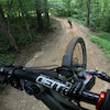
A very nicely laid out, fairly easy trail with a couple of fun skill builder moves. This short trail has some nice sharp ups and downs with some interesting features that will challenge novice and even some intermediate level riders. It makes a nice warm up before heading up the hill to see what else the area has to offer.

Tags

Local Trail Association

Traditionally Indigenous Territory

Recent Activity on Trail

Past Week
  • 0 rides
  •  
6 Months
  • 5 rides
  • 11 miles avg distance
All
  • 76 rides
  • Last: Oct 4, 2026
c1c2c3c4
January
February
March
April
May
June
July
August
September
October
November
December
update trails status or condition

ORC Trail Reports

statusdatedescription
May 18, 2024 @ 4:34am
May 18, 2024
Jun 13, 2021 @ 5:14am
Jun 13, 2021
May 16, 2021 @ 7:01am
May 16, 2021
Tight, twisty green trail with occasional blue-level features. Don’t forget to visit the mossy hubcap castle!
Apr 18, 2021 @ 10:35am
Apr 18, 2021
A few slick spots, should be great this week
Jul 18, 2020 @ 7:07am
Jul 18, 2020
more »
Status:
on May 18, 2024
Variable
Avg: 4.17 (5 votes)
Your vote: 0

view (532)
close
      Directions to orc trailhead (42.338910, -73.473740)

      Photos

      8 more »
      mtb
      ORC
      181 |
      May 16, 2021 @ 7:04am
      May 16, 2021
      report
      mtb
      ORC
      107 |
      May 16, 2021 @ 7:02am
      May 16, 2021
      report
      mtb
      ORC
      84 |
      May 16, 2021 @ 7:02am
      May 16, 2021
      report
      mtb
      ORC
      97 |
      May 16, 2021 @ 7:02am
      May 16, 2021

      Videos

      1 more »
      youtuber Beebe Hill    Trail Check   ORC
      mtb
      1111 | Nov 24, 2017 , Austerlitz

      Routes with this trail

      more »
      14 miles • 2,229 ft • 17 •
      This is a general overview of some of the best of Beebe. It skips Anne Jackson and Barrett Pond (which are...
      19 miles • 3,076 ft • 44 • Loop •
      This route includes most of the trails at Beebe as of Fall 2017. It's a lot of climbing - but the...
      12 miles • 1,725 ft • 32 •
      This route hits some of the best trails at Beebe (but skips a few climbs and more technical trails found...
      4.4 ★★★★★
      5 Ratings
      5 ★ 60%
      4 ★ 20%
      3 ★ 20%
      2 ★
      1 ★

      1 Review & Comments

      scotmtbbeta scotmtbbeta
      This is a super FUN trail. Good features to play on and a great warm up. The roller/jump is really cool.

      We hope you've been enjoying Trailforks!

      Create a FREE account to view all trail reviews and much more.

      • By ClydesAleTF Pro CCMBA & contributors
      • #45223 - 1,784 views

      Frequently Asked Questions

      ▼ Where is ORC located?
      ORC is located in Beebe Hill / Harvey Mountain State Forest, Austerlitz, New York, United States. It is part of the Beebe Hill / Harvey Mountain State Forest trail network. The trailhead is located at coordinates 42.33891, -73.47374.
      ▼ How hard is ORC?
      ORC is rated as Green difficulty. The physical rating is Moderate. The average grade is 0.6%. The climb difficulty is rated Green.
      ▼ What is the elevation gain for ORC?
      ORC has 91 ft of elevation gain. The trail has 71 ft of elevation descent. The elevation ranges from 1,365 ft to 1,435 ft.
      ▼ Is ORC a point to point trail?
      Yes, ORC is a point to point trail. The direction is One Direction. The trail type is singletrack.
      ▼ How long is ORC?
      ORC is 3,045 ft long. The trail type is singletrack.
      ▼ Are dogs allowed on ORC?
      Yes, dogs are allowed on ORC. Please keep dogs on a leash where required and clean up after them.
      ▼ How do I access ORC? Where is the closest parking trailhead?
      The closest parking and trailhead locations to ORC are: View all parking locations in the area.
      ▼ How long does it take to ride ORC?
      Based on recorded activities, it takes an average of 7 minutes to ride ORC. The trail is 3,045 ft long. Actual times will vary based on fitness level, conditions, and pace. View recent activity logs for more details.
      ▼ How busy is ORC?
      ORC is a less popular trail with lighter traffic. There have been 428 recorded activities on this trail. The trail has received 532 check-ins. View recent activity on this trail.

      Hit the Trail

      Open in App

      Get this trail on your phone instantly.

      open trail in app

      Download Trail

      Save to wishlist, Garmin & download.
      save the trail

      Find Related Routes

      Find routes and users activities that include this trail.
      find routes for this trail

      You must enter a description before submitting.

