
more stats
3.7 miles
Distance
107 ft
Climb
-1,177 ft
Descent
01:46:04
Avg time
-1,071 ft
Altitude change
3,940 ft
Altitude min
5,011 ft
Altitude max
5,011 ft
Altitude start
3,940 ft
Altitude end
-5.4%
Grade
-37%
Grade max
21.9%
Grade min
2,523 ft
Distance climb
3 miles
Distance down
1,257 ft
Distance flat
01:46:04
Avg time

Ormazal Details

  • Activities
    • Mountain Bike
    • E-Bike
    • Hike
    • Trail Running
  • Riding Area
    Las Viniegras
    Logroño
  • Difficulty Rating
  • Trail Style
    Freeride
  • Voted Difficulty
    Red (4 votes)
  • Local Popularity
    5 in Mountain Biking [+]
    • 70 in E-Biking
    • 5 in Trail Running
    • 5 in Hiking
  • Global Ranking
    #153827 in Mountain Biking [+]
    • #62687 in E-Biking
    • #310390 in Trail Running
    • #300817 in Hiking
  • National Ranking
    #14,277 in Mountain Biking · Spain [+]
    • #6,888 in E-Biking
    • #32,758 in Trail Running
    • #29,860 in Hiking
  • Hiking SAC Scale
    T2 Mountain Hiking
  • Trail Exposure
    Life Threatening
  • Trail Type
    Singletrack
  • Bike Type
    AM, XC
  • Direction
    Downhill Primary
    Popular Direction Shown
  • Climb Difficulty
    Black Diamond
  • Physical Rating
    Hard
  • Trail Visibility
    Always easy to follow
  • Dogs Allowed
    Yes
  • eBike Allowed
    Yes up to Class 1
  • TTFs on Trail
    Rock Face, Rock Garden

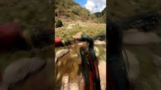
Sendero por el barranco del Rio Ormazal con numerosos pasos tecnicos y expuestos a caidas. Se necesita decision para afrontarlos.

Tags
Rock gardensRock slabs

Recent Activity on Trail

Past Week
  • 0 rides
  •  
6 Months
  • 1 rides
  • 20 miles avg distance
All
  • 3 rides
  • Last: Aug 10, 2026
c1c2c3c4
January
February
March
April
May
June
July
August
September
October
November
December
update trails status or condition

Ormazal Trail Reports

statusdatedescription
Aug 12, 2026 @ 9:19am (Europe/Madrid)
Aug 12, 2026
reporter camino antiguo de acceso a la maontaña, a ratos algo expuesto, tramos de pradera combinados con tramos de piedra con pasos malos. Está recién...
Aug 10, 2026 @ 9:10am (Europe/Madrid)
Aug 10, 2026
reporter Está entre rojo oscuro y negro clarito. Hay que pelear mucho
Aug 8, 2023 @ 2:07am
Aug 8, 2023
reporter
Aug 8, 2023 @ 12:07am
Aug 8, 2023
reporter pasos comprometidos, derrumbes y falta de mantenimiento del camino hacen que haya que desmontarse en algunos puntos. Pero el camino lo merece!!
Jul 6, 2023 @ 2:02am
Jul 6, 2023
reporter el camino es espectacular pero está estropeándose mucho. La llegada a Viniegra de arriba se pierde bastante.
more »
Status:
on Aug 12, 2026
Ideal
Avg: 4.29 (4 votes)
Your vote: 0

view (13)
close
      Directions to ormazal trailhead (42.050460, -2.832890)

      Photos

      10 more »
      mtb
      28 |
      Aug 11, 2026 @ 11:39am
      Aug 11, 2026
      mtb
      86 |
      Nov 12, 2023 @ 11:20am
      Nov 12, 2023
      mtb
      107 |
      Jul 9, 2023 @ 11:49am
      Jul 9, 2023
      mtb
      104 |
      Jul 9, 2023 @ 11:49am
      Jul 9, 2023

      Videos

      1 more »
      Urbion2022 con bici Ciclomontañismo
      mtb
      2:47 | 180 | Sep 11, 2022 , Logroño

      Routes with this trail

      ★ 4.0 • 23 miles • 3,865 ft • 7 •
      Ruton de cicloalpinismo haciendo cima en el pico URBION!! Menos los primeros 4 km que son por carreterilla...
      4.8 ★★★★★
      4 Ratings
      5 ★ 75%
      4 ★ 25%
      3 ★
      2 ★
      1 ★

      1 Review & Comments

      correcamimos
      es un sendero dificil sin duda, muy bonito, claramente marcado, bastantes pasos tecnicos puntuales, a ratos más continuo, a ratos toca empujar un poco, pero en general con buena tecnica es bonito.
      Hay barro incluso a principio de otoño con tiempo seco.

      We hope you've been enjoying Trailforks!

      Create a FREE account to view all trail reviews and much more.

      • By alivemountainTF Pro TFSPAIN Ezkaba & contributors
      • #562158 - 527 views

      Frequently Asked Questions

      ▼ Where is Ormazal located?
      Ormazal is located in Las Viniegras, Logroño, Spain. It is part of the Las Viniegras trail network. The trailhead is located at coordinates 42.05046, -2.83289.
      ▼ How hard is Ormazal?
      Ormazal is rated as Red difficulty. The physical rating is Hard. The average grade is 5.4%. The climb difficulty is rated Black Diamond.
      ▼ What is the elevation gain for Ormazal?
      Ormazal has 107 ft of elevation gain. The trail has 1,177 ft of elevation descent. The elevation ranges from 3,940 ft to 5,011 ft.
      ▼ Is Ormazal a point to point trail?
      Ormazal is not a point to point trail. The direction is Downhill Primary. The trail type is singletrack.
      ▼ How long is Ormazal?
      Ormazal is 3.7 miles long. The trail type is singletrack.
      ▼ Are dogs allowed on Ormazal?
      Yes, dogs are allowed on Ormazal. Please keep dogs on a leash where required and clean up after them.
      ▼ How do I access Ormazal? Where is the closest parking trailhead?
      The closest parking and trailhead locations to Ormazal are: View all parking locations in the area.
      ▼ How long does it take to ride Ormazal?
      The estimated time to ride Ormazal is approximately 1 hour 46 minutes. The trail is 3.7 miles long. Actual times will vary based on fitness level, conditions, and pace.
      ▼ How busy is Ormazal?
      Ormazal is a less popular trail with lighter traffic. There have been 12 recorded activities on this trail. The trail has received 13 check-ins. View recent activity on this trail.

      Hit the Trail

      Open in App

      Get this trail on your phone instantly.

      open trail in app

      Download Trail

      Save to wishlist, Garmin & download.
      save the trail

      Find Related Routes

      Find routes and users activities that include this trail.
      find routes for this trail

      You must enter a description before submitting.

