more stats
2,825 ft
Distance
103 ft
Climb
-12 ft
Descent
00:09:55
Avg time
93 ft
Altitude change
358 ft
Altitude min
452 ft
Altitude max
359 ft
Altitude start
453 ft
Altitude end
3.3%
Grade
-8.4%
Grade max
19.9%
Grade min
1,581 ft
Distance climb
509 ft
Distance down
735 ft
Distance flat
00:09:55
Avg time

Outside Loop Details

  • Activities
    • Mountain Bike
    • Hike
    • Trail Running
  • Riding Area
    Rockville Hills Regional Park
    Fairfield, California
  • Difficulty Rating
  • Local Popularity
    95 in Mountain Biking [+]
    • 85 in Trail Running
    • 85 in Hiking
  • Global Ranking
    #62406 in Mountain Biking [+]
    • #49531 in Trail Running
    • #37586 in Hiking
  • Trail Type
    Singletrack
  • Bike Type
    AM, XC
  • Climb Difficulty
    Green
  • Physical Rating
    Moderate
  • Dogs Allowed
    Yes
  • TTFs on Trail
    Rock Garden, Skinny

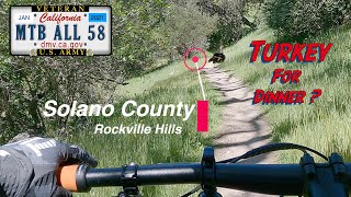
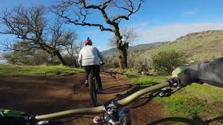
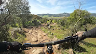
Technical on either end of this trail.The eastbound direction is a slight uphill. Westbound has a flow sensation to it at speed. Excellent views of Green Valley at the Cliff View Trail on the southeast portion. Both directions in use constantly so keep your eyes forward and watch out for other riders and runners/hikers, especially on the weekends. Some sections just recently re-groomed over this last summer.

Traditionally Indigenous Territory

Recent Activity on Trail

Past Week
  • 1 rides
  • 10 miles average
6 Months
  • 41 rides
  • 8 miles avg distance
All
  • 494 rides
  • Last: Jun 22, 2026
c1c2c3c4
January
February
March
April
May
June
July
August
September
October
November
December
Status:
on Mar 13, 2026
Ideal
Avg: 4.15 (7 votes)
Your vote: 0

view (5,035)
close
3D
Trail Conditions
  • Unknown
  • Snow Groomed
  • Snow Packed
  • Snow Covered
  • Snow Cover Partial
  • Freeze/thaw Cycle
  • Icy
  • Prevalent Mud
  • Wet
  • Variable
  • Ideal
  • Dry
  • Very Dry
Trail Flow (Ridden Direction)
Trailforks scans users ridelogs to determine the most popular direction each trail is ridden. A good flowing trail network will have most trails flowing in a single direction according to their intension.
The colour categories are based on what percentage of riders are riding a trail in its intended direction.
  • > 96%
  • > 90%
  • > 80%
  • > 70%
  • > 50%
  • < 50%
  • bi-directional trail
  • no data
Trail Last Ridden
Trailforks scans ridelogs to determine the last time a trail was ridden.
  • < 2 days
  • < 1 week
  • < 2 weeks
  • < 1 month
  • < 6 months
  • > 6 months
Trail Ridden Direction
The intended direction a trail should be ridden.
  • Downhill Only
  • Downhill Primary
  • Both Directions
  • Uphill Primary
  • Uphill Only
  • One Direction
Contribute Details
Colors indicate trail is missing specified detail.
  • Description
  • Photos
  • Description & Photos
  • Videos
Trail Popularity ?
Trailforks scans ridelogs to determine which trails are ridden the most in the last 9 months. Trails are compared with nearby trails in the same city region with a possible 25 colour shades. Think of this as a heatmap, more rides = more kinetic energy = warmer colors.
  • most popular
  • popular
  • less popular
  • not popular
ATV/ORV/OHV Filter
Max Vehicle Width
inches
US Cell Coverage
Legend
cell carrier legend

Radar Time
Activity Recordings
Trailforks uses anonymized public activity data. ?
Activity Recordings
Trailforks uses anonymized public activity data. ?
Personal Heatmap
Activity Types
all / none
Options
2
Date range month
Winter Trails
Warning A routing network for winter maps does not exist. Selecting trails using the winter trails layer has been disabled.
Missing Trails
Most Popular
Least Popular
Trails are colored based on popularity. The more popular a trail is, the more red. Less popular trails trend towards green.
Jump Magnitude Heatmap
Heatmap of where riders jump on trails. Zoom in to see individual jumps, click circles to view jump details.
BC Backroad Status

Service Road Atlas is a free to use, community-driven service for viewing and creating reports on the numerous back-country service roads around B.C. and Alberta.

map legend
Slope Aspect
Direction the slope faces
Flat N NE E SE S SW W NW
Trails Deemphasized
Trails are shown in grey.
disable
Only show trails with no bike usage.
Enable
Suggested Layers
Based on selected activity type

    Save the current map location and zoom level as your default home location whenever this page is loaded.

    Save
        Directions to outside-loop-60937 trailhead (38.247920, -122.146200)

        Photos

        2 more »
        107 |
        Oct 5, 2017 @ 3:07pm
        Oct 5, 2017
        105 |
        Oct 5, 2017 @ 3:07pm
        Oct 5, 2017

        Videos

        3 more »
        Rockville Hills Regional Park - Solano County
        17:01 | 448 | Apr 8, 2021 , Fairfield
        Super Bent Front Wheel | Rockville Hills...
        10:55 | 173 | Feb 8, 2021 , Fairfield
        outside loop, unknown, Tower
        0:26 | | Mar 5, 2023 , Fairfield

        Routes with this trail

        5.0 10 miles 1,269 ft 13 Loop
        Jamuel's Rockville Hills fun ride!
        4.0 10 miles 1,488 ft 25 Loop
        Moderate Route that hits some of the easier single black trails at
        6 miles 1,015 ft 10
        Hit up Lower Tilly counter clockwise, make your way around the lake and up the , ride Outer Loop for the...

        1 Review & Comments


        We hope you've been enjoying Trailforks!

        Create a FREE account to view trail comments and much more.

        • By bkxcTF Pro Everstoke & contributors
        • #60937 - 1,803 views

        Frequently Asked Questions About Outside Loop

        Where is Outside Loop located?
        Outside Loop is located in Rockville Hills Regional Park, Fairfield, California, United States. It is part of the Rockville Hills Regional Park trail network. The trailhead is located at coordinates 38.24792, -122.1462.
        How hard is Outside Loop?
        Outside Loop is rated as Blue difficulty. The physical rating is Moderate. The average grade is 3.3%. The climb difficulty is rated Green.
        What is the elevation gain for Outside Loop?
        Outside Loop has 103 ft of elevation gain. The trail has 12 ft of elevation descent. The elevation ranges from 358 ft to 452 ft.
        How long is Outside Loop?
        Outside Loop is 2,825 ft long. The trail type is singletrack.

        Hit the Trail

        Open in App

        Get this trail on your phone instantly.
        open trail in app

        Download Trail

        Save to wishlist, Garmin & download.
        save the trail

        Find Related Routes

        Find routes and users activities that include this trail.
        find routes for this trail

        You must enter a description before submitting.