
more stats
4,757 ft
Distance
53 ft
Climb
-453 ft
Descent
00:12:43
Avg time
-400 ft
Altitude change
2,785 ft
Altitude min
3,186 ft
Altitude max
3,186 ft
Altitude start
2,785 ft
Altitude end
-8.4%
Grade
-50%
Grade max
16%
Grade min
709 ft
Distance climb
3,488 ft
Distance down
561 ft
Distance flat
00:12:43
Avg time

Ozembuch - vrch Details

  • Activities
    • Mountain Bike
    • E-Bike
    • Hike
    • Trail Running
  • Riding Area
    Kunerad
    Žilina
  • Difficulty Rating
  • Voted Difficulty
    Blue (1 vote)
  • Local Popularity
    50 in Mountain Biking heatmap [+]
    • 60 in E-Biking
    • 5 in Trail Running
    • 5 in Hiking
  • Global Ranking
    #82254 in Mountain Biking [+]
    • #48249 in E-Biking
    • #144970 in Trail Running
    • #300046 in Hiking
  • National Ranking
    #511 in Mountain Biking · Slovakia [+]
    • #253 in E-Biking
    • #525 in Trail Running
    • #968 in Hiking
  • Hiking SAC Scale
    T1 Hiking
  • Trail Type
    Singletrack
  • Bike Type
    DH, AM, XC
  • Direction
    Downhill Primary
    Popular Direction Shown
  • Physical Rating
    Moderate
  • Trail Visibility
    Always easy to follow
  • Dogs Allowed
    Yes
  • eBike Allowed
    Yes up to Class 1
  • Year Opened
    2019

Komplet prečistený starý nepoužívaný poľovnícky chodník

Tags
Water source

Trail Supporters

Recent Activity on Trail

Past Week
  • 0 rides
  •  
6 Months
  • 3 rides
  • 25 miles avg distance
All
  • 40 rides
  • Last: Oct 10, 2026
c1c2c3c4
January
February
March
April
May
June
July
August
September
October
November
December
update trails status or condition

Ozembuch - vrch Trail Reports

statusdatedescription
Sep 9, 2026 @ 5:09pm (Europe/Bratislava)
Sep 9, 2026
Najlepsi trail.
Aug 3, 2026 @ 5:43pm (Europe/Bratislava)
Aug 3, 2026
Prejazdne, obcasne popadane uzsie kmene stromov-prejazd ok
Sep 23, 2025 @ 8:18am (Europe/Bratislava)
Sep 22, 2025
všetko po starom prvá polka bordel druhá zarastená
Sep 20, 2025 @ 7:36pm (Europe/Bratislava)
Sep 20, 2025
Prvá polka zničená po ťažbe, druhá polka zarastená vysokou trávou.
Jul 26, 2025 @ 1:12pm
Jul 26, 2025
Upper part is covered by cutted trees but rest is in good condition. Great trail
more »
Status:
on Sep 9, 2026
Dry
Avg: 4.3 (7 votes)
Your vote: 0

view (431)
close
      Directions to ozembuch-vrch trailhead (49.065640, 18.758720)

      Photos

      7 more »
      mtb
      75 |
      Aug 15, 2023 @ 1:59pm
      Aug 15, 2023
      mtb
      118 |
      May 1, 2023 @ 5:33am
      May 1, 2023
      mtb
      247 |
      Jul 12, 2020 @ 12:06pm
      Jul 12, 2020
      mtb
      254 |
      Jul 12, 2020 @ 12:06pm
      Jul 12, 2020

      Videos

      1 more »
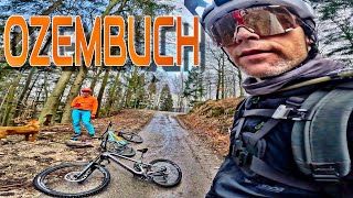
      MTB Kunerad - Ozembuch
      mtb
      15:09 | 228 | Mar 7, 2024 , Žilina

      Routes with this trail

      more »
      34 miles • 7,191 ft • 7 • Loop •
      Trip alternatywne Turie..............................
      4.6 ★★★★★
      7 Ratings
      5 ★ 57%
      4 ★ 43%
      3 ★
      2 ★
      1 ★

      2 Reviews & Comments

      MarekmJ3isJ
      Uplna nuda farbu by som zmenil na zelenú ak je biela decká tak aj na takú.viac slapes ako ideš dole úplne nevyužitý potenciál kopca kdo tam ide nech si ušetrí silu a dá si racej 4 krát ozembuch čierny ten je topka

      We hope you've been enjoying Trailforks!

      Create a FREE account to view all trail reviews and much more.

      • By jurosik & contributors
      • #271034 - 2,036 views

      Frequently Asked Questions

      ▼ Where is Ozembuch - vrch located?
      Ozembuch - vrch is located in Kunerad, Žilina, Slovakia. It is part of the Kunerad trail network. The trailhead is located at coordinates 49.06564, 18.75872.
      ▼ How hard is Ozembuch - vrch?
      Ozembuch - vrch is rated as Blue difficulty. The physical rating is Moderate. The average grade is 8.4%.
      ▼ What is the elevation gain for Ozembuch - vrch?
      Ozembuch - vrch has 53 ft of elevation gain. The trail has 453 ft of elevation descent. The elevation ranges from 2,785 ft to 3,186 ft.
      ▼ Is Ozembuch - vrch a point to point trail?
      Ozembuch - vrch is not a point to point trail. The direction is Downhill Primary. The trail type is singletrack.
      ▼ How long is Ozembuch - vrch?
      Ozembuch - vrch is 4,757 ft long. The trail type is singletrack.
      ▼ Are dogs allowed on Ozembuch - vrch?
      Yes, dogs are allowed on Ozembuch - vrch. Please keep dogs on a leash where required and clean up after them.
      ▼ When is the best time of year to ride Ozembuch - vrch?
      Based on activity log data, the most popular months to ride Ozembuch - vrch are:
      • August (6 activities)
      • May (2 activities)
      • October (2 activities)
      Check the reports page for current trail conditions.
      ▼ How do I access Ozembuch - vrch? Where is the closest parking trailhead?
      The closest parking and trailhead locations to Ozembuch - vrch are: View all parking locations in the area.
      ▼ How long does it take to ride Ozembuch - vrch?
      Based on recorded activities, it takes an average of 13 minutes to ride Ozembuch - vrch. The trail is 4,757 ft long. Actual times will vary based on fitness level, conditions, and pace. View recent activity logs for more details.
      ▼ How busy is Ozembuch - vrch?
      Ozembuch - vrch is a moderately popular trail. There have been 427 recorded activities on this trail. The trail has received 431 check-ins. View recent activity on this trail.

      Hit the Trail

      Open in App

      Get this trail on your phone instantly.

      open trail in app

      Download Trail

      Save to wishlist, Garmin & download.
      save the trail

      Find Related Routes

      Find routes and users activities that include this trail.
      find routes for this trail

      You must enter a description before submitting.

