



more stats
2.9 miles
Distance
-1,364 ft
Descent
00:18:50
Avg time
-1,365 ft
Altitude change
2,698 ft
Altitude min
4,063 ft
Altitude max
4,063 ft
Altitude start
2,697 ft
Altitude end
-9%
Grade
-46.2%
Grade max
0.7%
Grade min
144 ft
Distance climb
3 miles
Distance down
75 ft
Distance flat
00:18:50
Avg time

Panduro Details

  • Activities
    • Mountain Bike
    • E-Bike
    • Hike
    • Trail Running
  • Riding Area
    La Zubia
    Granada
  • AKA
    La Zubia Downhill
  • Difficulty Rating
  • Local Popularity
    80 in Mountain Biking heatmap [+]
    • 90 in E-Biking
    • 5 in Trail Running
    • 5 in Hiking
  • Global Ranking
    #62754 in Mountain Biking [+]
    • #80738 in E-Biking
    • #213953 in Trail Running
    • #205056 in Hiking
  • National Ranking
    #4,290 in Mountain Biking · Spain [+]
    • #15,198 in E-Biking
    • #14,836 in Trail Running
    • #11,917 in Hiking
  • Trail Type
    Singletrack
  • Bike Type
    DH, AM
  • Direction
    Downhill Primary
    Popular Direction Shown
  • Dogs Allowed
    Yes
  • eBike Allowed
  • TTFs on Trail
    Berm, Drop, Jump

No community description for Panduro trail has been added yet!

AI Generated Description

Panduro is a 5 km popular blue difficulty singletrack trail located near Granada. This multi-use trail can be used downhill primary. It features berm, drop and jump. On average it takes 18 minutes to complete this trail.

Tags
BermsDropsJumps

Recent Activity on Trail

Past Week
  • 0 rides
  •  
6 Months
  • 1 rides
  • 61.4 km avg distance
All
  • 18 rides
  • Last: Sep 27, 2026
c1c2c3c4
January
February
March
April
May
June
July
August
September
October
November
December
update trails status or condition

Panduro Trail Reports

statusdatedescription
Nov 12, 2024 @ 11:21am
Nov 12, 2024
El sendero está en muy buenas condiciones. Se han solucionado todos los problemas generados por la tala.
Mar 20, 2023 @ 2:29pm
Mar 20, 2023
Approximately the middle quarter of the trail is gone - the local forestry are doing heavy machine work in there and that section of trail is...
Dec 24, 2022 @ 7:41am
Dec 24, 2022
woodworks for at least 1.5km in the middle section. Track blocked with trees and branches
Feb 19, 2020 @ 1:23pm
Feb 19, 2020
Jan 4, 2019 @ 2:20am
Jan 4, 2019
reporter Supergood
more »
Status:
on Nov 12, 2024
Dry
Avg: 4.26 (5 votes)
Your vote: 0

view (177)
close
      Directions to panduro trailhead (37.093960, -3.537690)

      Photos

      27 more »
      mtb
      129 |
      Jul 24, 2021 @ 9:28am
      Jul 24, 2021
      mtb
      179 |
      Jul 24, 2021 @ 9:29am
      Jul 24, 2021
      mtb
      178 |
      Jul 24, 2021 @ 7:43am
      Jul 24, 2021
      mtb
      144 |
      Jul 24, 2021 @ 7:43am
      Jul 24, 2021

      Videos

      6 more »
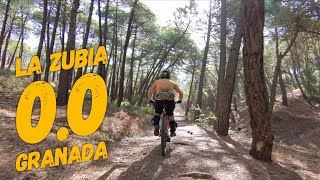
      youtuber ‍♂️⛰ La Zubia 0.0 | La Zubia (Granada)...
      mtb
      11:39 | 255 | Oct 3, 2024 , Granada
      youtuber ‍♀️⛰ DH La Zubia (Cumbres Verdes) | La...
      mtb
      9:41 | 404 | Nov 10, 2023 , Granada
      DH La Zubia // Downhill Spain - Wild Bikes shop
      mtb
      3:19 | 387 | Mar 12, 2019 , Granada
      DMR Bolt Long in La Zubia
      mtb
      0:40 | 6295 | Aug 21, 2018 , Granada
      4.6 ★★★★★
      5 Ratings
      5 ★ 80%
      4 ★
      3 ★ 20%
      2 ★
      1 ★

      7 Reviews & Comments

      mikeysolis mikeysolis
      Disfruto de este sendero. No es muy técnico, pero a la velocidad a la que vas, la tecnología que tiene lo hace divertido. Es largo. Sigue y sigue. Comienza rápido y fluido, luego se ralentiza un poco en el medio, pero tiene muchas rocas para divertirse. El último tercio se vuelve más empinado con características más técnicas, un desnivel y mucha velocidad.
      allmountrailmtb allmountrailmtb
      Como dice el último compañero el track tal y como está no corresponde al DH, si se siguen exactamente los puntos del track es una bajada single track muy sencilla, diría que es incluso verde (se puede ver en un vídeo que he titulado 0.0.

      El DH, que es el que se ve en otros vídeos va más pegado a la carretera por el cañón o cauce del arroyo y tiene saltos que son dignos de una pista negra. No lo subo porque no es mi zona por respeto a los locales.
      AndrewGCcQML
      The trail marked here is incorrect and misses most of the actual trail down the gulley. Found this out the hard way

      We hope you've been enjoying Trailforks!

      Create a FREE account to view all trail reviews and much more.

      • By lightlivesTF Pro & contributors
      • #78272 - 4,936 views

      Frequently Asked Questions

      ▼ Where is Panduro located?
      Panduro is located in La Zubia, Granada, Spain. It is part of the La Zubia trail network. The trailhead is located at coordinates 37.09396, -3.53769.
      ▼ How hard is Panduro?
      Panduro is rated as Blue difficulty. The average grade is 9%.
      ▼ What is the elevation gain for Panduro?
      The trail has 1,364 ft of elevation descent. The elevation ranges from 2,698 ft to 4,063 ft.
      ▼ Is Panduro a point to point trail?
      Panduro is not a point to point trail. The direction is Downhill Primary. The trail type is singletrack.
      ▼ How long is Panduro?
      Panduro is 2.9 miles long. The trail type is singletrack.
      ▼ Are dogs allowed on Panduro?
      Yes, dogs are allowed on Panduro. Please keep dogs on a leash where required and clean up after them.
      ▼ When is the best time of year to ride Panduro?
      Based on activity log data, the most popular months to ride Panduro are:
      • November (4 activities)
      • May (3 activities)
      • September (2 activities)
      Check the reports page for current trail conditions.
      ▼ How long does it take to ride Panduro?
      Based on recorded activities, it takes an average of 19 minutes to ride Panduro. The trail is 2.9 miles long. Actual times will vary based on fitness level, conditions, and pace. View recent activity logs for more details.
      ▼ How busy is Panduro?
      Panduro is a very popular trail. There have been 160 recorded activities on this trail. The trail has received 177 check-ins. View recent activity on this trail.

      Hit the Trail

      Open in App

      Get this trail on your phone instantly.

      open trail in app

      Download Trail

      Save to wishlist, Garmin & download.
      save the trail

      Find Related Routes

      Find routes and users activities that include this trail.
      find routes for this trail

      You must enter a description before submitting.

