more stats
1.1 miles
Distance
-870 ft
Descent
00:16:10
Avg time
-870 ft
Altitude change
1,375 ft
Altitude min
2,245 ft
Altitude max
2,245 ft
Altitude start
1,375 ft
Altitude end
-15%
Grade
-68.3%
Grade max
-2%
Grade min
1 mile
Distance down
30 ft
Distance flat
00:16:10
Avg time

Parpage Details

  • Activities
    • Mountain Bike
    • Hike
    • Trail Running
  • Riding Area
  • AKA
    Parpatrail
  • Difficulty Rating
  • Voted Difficulty
    Blue (1 vote)
  • Local Popularity
    35 in Mountain Biking [+]
    • 5 in Trail Running
    • 5 in Hiking
  • Global Ranking
    #62229 in Mountain Biking [+]
    • #123404 in Trail Running
    • #117327 in Hiking
  • Hiking SAC Scale
    T1 Hiking
  • Trail Type
    Singletrack
  • Bike Type
    AM
  • Physical Rating
    Hard
  • Trail Visibility
    Always easy to follow
  • Dogs Allowed
    Yes
  • eBike Allowed
    Yes up to Class 1
  • TTFs on Trail
    Berm, Drop, Jump, Rock Garden
  • Year Opened
    2020

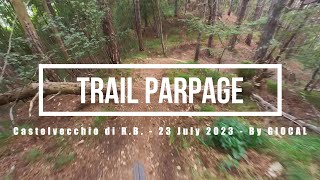
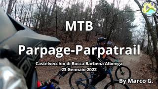
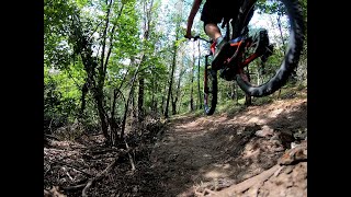
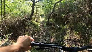
A fantastic new trail in the amazing area of Castelvecchio di Rocca Barbena. Starts at Pian dei Prati with some pedalling and eases you into the descent with some natural trail and a couple of small jumps. There is a mix of short pedal sections and flowing fast descents. The middle section, called Pietre Sciolte, is all out speed and rock Be careful of the road at the end. After that the trail drops into terraced terrain and wooded gullys with lots of fun trail features and ends in a steeper section with a big smile on your face! Enjoy!

Local Trail Association

Recent Activity on Trail

Past Week
  • 0 rides
  •  
6 Months
  • 57 rides
  • 32 miles avg distance
All
  • 134 rides
  • Last: Jun 27, 2026
c1c2c3c4
January
February
March
April
May
June
July
August
September
October
November
December
update trails status or condition

Parpage Trail Reports

Status:
on May 21, 2026
Ideal
Avg: 4.42 (13 votes)
Your vote: 0

view (960)
close
3D
Trail Conditions
  • Unknown
  • Snow Groomed
  • Snow Packed
  • Snow Covered
  • Snow Cover Partial
  • Freeze/thaw Cycle
  • Icy
  • Prevalent Mud
  • Wet
  • Variable
  • Ideal
  • Dry
  • Very Dry
Trail Flow (Ridden Direction)
Trailforks scans users ridelogs to determine the most popular direction each trail is ridden. A good flowing trail network will have most trails flowing in a single direction according to their intension.
The colour categories are based on what percentage of riders are riding a trail in its intended direction.
  • > 96%
  • > 90%
  • > 80%
  • > 70%
  • > 50%
  • < 50%
  • bi-directional trail
  • no data
Trail Last Ridden
Trailforks scans ridelogs to determine the last time a trail was ridden.
  • < 2 days
  • < 1 week
  • < 2 weeks
  • < 1 month
  • < 6 months
  • > 6 months
Trail Ridden Direction
The intended direction a trail should be ridden.
  • Downhill Only
  • Downhill Primary
  • Both Directions
  • Uphill Primary
  • Uphill Only
  • One Direction
Contribute Details
Colors indicate trail is missing specified detail.
  • Description
  • Photos
  • Description & Photos
  • Videos
Trail Popularity ?
Trailforks scans ridelogs to determine which trails are ridden the most in the last 9 months. Trails are compared with nearby trails in the same city region with a possible 25 colour shades. Think of this as a heatmap, more rides = more kinetic energy = warmer colors.
  • most popular
  • popular
  • less popular
  • not popular
ATV/ORV/OHV Filter
Max Vehicle Width
inches
US Cell Coverage
Legend
cell carrier legend

Radar Time
Activity Recordings
Trailforks uses anonymized public activity data. ?
Activity Recordings
Trailforks uses anonymized public activity data. ?
Personal Heatmap
Activity Types
all / none
Options
2
Date range month
Winter Trails
Warning A routing network for winter maps does not exist. Selecting trails using the winter trails layer has been disabled.
Missing Trails
Most Popular
Least Popular
Trails are colored based on popularity. The more popular a trail is, the more red. Less popular trails trend towards green.
Jump Magnitude Heatmap
Heatmap of where riders jump on trails. Zoom in to see individual jumps, click circles to view jump details.
BC Backroad Status

Service Road Atlas is a free to use, community-driven service for viewing and creating reports on the numerous back-country service roads around B.C. and Alberta.

map legend
Slope Aspect
Direction the slope faces
Flat N NE E SE S SW W NW
Trails Deemphasized
Trails are shown in grey.
disable
Only show trails with no bike usage.
Enable
Suggested Layers
Based on selected activity type

    Save the current map location and zoom level as your default home location whenever this page is loaded.

    Save
        Directions to parpage trailhead (44.135580, 8.131220)

        Photos

        34 more »
        53 |
        Dec 15, 2022 @ 3:56am
        Dec 15, 2022
        72 |
        Nov 10, 2022 @ 5:37am
        Nov 10, 2022
        109 |
        Nov 10, 2022 @ 5:37am
        Nov 10, 2022
        137 |
        Nov 19, 2021 @ 9:22am
        Nov 19, 2021

        Videos

        4 more »
        Castelvecchio di Rocca Barbena eMTBing - Trail...
        12:09 | 326 | Jul 31, 2023 , Castelvecchio di Rocca Barbena
        MTB Parpage/Parpa Trail - Castelvecchio di...
        5:27 | 418 | Jan 29, 2022 , Castelvecchio di Rocca Barbena
        New section and jump at the top of...
        0:01 | 427 | Aug 31, 2020 , Castelvecchio di Rocca Barbena
        First top to bottom ride of Parpatrail/Parpage...
        5:09 | 689 | Aug 9, 2020 , Castelvecchio di Rocca Barbena

        Routes with this trail

        37 miles 6,086 ft 7 Loop
        IT : Percorso di una giornata intera ad anello. Trasferimento da Albenga a campochiesa, primo tratto...

        12 Reviews & Comments


        We hope you've been enjoying Trailforks!

        Create a FREE account to view trail comments and much more.

        • By tancTF Pro & contributors
        • #314329 - 4,043 views

        Frequently Asked Questions About Parpage

        Where is Parpage located?
        Parpage is located in Castelvecchio di Rocca Barbena, Italy. It is part of the Castelvecchio di Rocca Barbena trail network. The trailhead is located at coordinates 44.13558, 8.13122.
        How hard is Parpage?
        Parpage is rated as Blue difficulty. The physical rating is Hard. The average grade is 15%.
        What is the elevation gain for Parpage?
        The trail has 265 m of elevation descent. The elevation ranges from 419 m to 684 m.
        How long is Parpage?
        Parpage is 1.8 km long. The trail type is singletrack.

        Hit the Trail

        Open in App

        Get this trail on your phone instantly.
        open trail in app

        Download Trail

        Save to wishlist, Garmin & download.
        save the trail

        Find Related Routes

        Find routes and users activities that include this trail.
        find routes for this trail

        You must enter a description before submitting.