more stats
1.5 miles
Distance
250 ft
Climb
-566 ft
Descent
00:16:14
Avg time
-316 ft
Altitude change
3,886 ft
Altitude min
4,419 ft
Altitude max
4,202 ft
Altitude start
3,885 ft
Altitude end
-4%
Grade
-43.5%
Grade max
38.3%
Grade min
1,949 ft
Distance climb
1 mile
Distance down
233 ft
Distance flat
00:16:14
Avg time

Pasque Details

  • Activities
    • Mountain Bike
    • Winter Fat Bike
    • Hike
    • Trail Running
    • Snowshoe
  • Riding Area
    Sturgis Trail System
    Sturgis, South Dakota
  • Difficulty Rating
  • Local Popularity
    70 in Mountain Biking [+]
    • 5 in Trail Running
    • 95 in Hiking
    • 5 in Snowshoeing
  • Global Ranking
    #41676 in Mountain Biking [+]
    • #84807 in Trail Running
    • #9380 in Hiking
    • #1568 in Snowshoeing
  • Hiking SAC Scale
    T2 Mountain Hiking
  • Trail Type
    Singletrack
  • Bike Type
    AM, XC, Fat
  • Direction
    Both Directions
  • Climb Difficulty
    Blue
  • Physical Rating
    Moderate
  • Dogs Allowed
    Yes
  • eBike Allowed

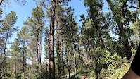
This is a great trail for both hiking and mountain bike. The bottom near the reservoir gets a bit steep and is the last to dry out as it is in a deep green forested gully. If you are climbing up from the reservoir it is a stout climb up through switchbacks to the ridge. From the ridge the descent is awesome. It starts out with a lot of straight line speed, but quickly turns into whoops in succession before and after turns. You can boost them, drift them, or just go full enduro line roll.

For hiking this is a good climb up and over to the reservoir, with a great little bridge that you can hang your feet over and watch the trout jump.

Trail Supporters
Local Trail Association
Traditionally Indigenous Territory

Recent Activity on Trail

Past Week
  • 0 rides
  •  
6 Months
  • 4 rides
  • 17 miles avg distance
All
  • 77 rides
  • Last: May 24, 2026
c1c2c3c4
January
February
March
April
May
June
July
August
September
October
November
December
Status:
on May 25, 2026
Dry
Avg: 4.21 (3 votes)
Your vote: 0

view (529)
close
3D
Trail Conditions
  • Unknown
  • Snow Groomed
  • Snow Packed
  • Snow Covered
  • Snow Cover Partial
  • Freeze/thaw Cycle
  • Icy
  • Prevalent Mud
  • Wet
  • Variable
  • Ideal
  • Dry
  • Very Dry
Trail Flow (Ridden Direction)
Trailforks scans users ridelogs to determine the most popular direction each trail is ridden. A good flowing trail network will have most trails flowing in a single direction according to their intension.
The colour categories are based on what percentage of riders are riding a trail in its intended direction.
  • > 96%
  • > 90%
  • > 80%
  • > 70%
  • > 50%
  • < 50%
  • bi-directional trail
  • no data
Trail Last Ridden
Trailforks scans ridelogs to determine the last time a trail was ridden.
  • < 2 days
  • < 1 week
  • < 2 weeks
  • < 1 month
  • < 6 months
  • > 6 months
Trail Ridden Direction
The intended direction a trail should be ridden.
  • Downhill Only
  • Downhill Primary
  • Both Directions
  • Uphill Primary
  • Uphill Only
  • One Direction
Contribute Details
Colors indicate trail is missing specified detail.
  • Description
  • Photos
  • Description & Photos
  • Videos
Trail Popularity ?
Trailforks scans ridelogs to determine which trails are ridden the most in the last 9 months. Trails are compared with nearby trails in the same city region with a possible 25 colour shades. Think of this as a heatmap, more rides = more kinetic energy = warmer colors.
  • most popular
  • popular
  • less popular
  • not popular
ATV/ORV/OHV Filter
Max Vehicle Width
inches
US Cell Coverage
Legend
cell carrier legend

Radar Time
Activity Recordings
Trailforks uses anonymized public activity data. ?
Activity Recordings
Trailforks uses anonymized public activity data. ?
Personal Heatmap
Activity Types
all / none
Options
2
Date range month
Winter Trails
Warning A routing network for winter maps does not exist. Selecting trails using the winter trails layer has been disabled.
Missing Trails
Most Popular
Least Popular
Trails are colored based on popularity. The more popular a trail is, the more red. Less popular trails trend towards green.
Jump Magnitude Heatmap
Heatmap of where riders jump on trails. Zoom in to see individual jumps, click circles to view jump details.
BC Backroad Status

Service Road Atlas is a free to use, community-driven service for viewing and creating reports on the numerous back-country service roads around B.C. and Alberta.

map legend
Slope Aspect
Direction the slope faces
Flat N NE E SE S SW W NW
Trails Deemphasized
Trails are shown in grey.
disable
Only show trails with no bike usage.
Enable
Suggested Layers
Based on selected activity type

    Save the current map location and zoom level as your default home location whenever this page is loaded.

    Save
        Directions to pasque trailhead (44.356130, -103.521010)

        Photos

        32 more »
        135 |
        Jun 6, 2021 @ 10:21am
        Jun 6, 2021
        109 |
        Jun 18, 2020 @ 6:14pm
        Jun 18, 2020
        99 |
        Jun 18, 2020 @ 6:14pm
        Jun 18, 2020
        150 |
        Jun 18, 2020 @ 6:13pm
        Jun 18, 2020

        Videos

        1 more »
        0:42 | 126 | Sep 20, 2019 , Sturgis

        Routes with this trail

        24 miles 4,026 ft 9 Loop
        Loop covering some of the best descending trails in the Black Hills region (Deadman and Bulldog). Take...
        23 miles 3,579 ft 9
        25 mile loop to Sturgis City Dams. Friday and Sunday
        22 miles 4,313 ft 15
        Route linking up some of the best climbs and descents that the sturgis area has to offer. Watch out for...

        1 Review & Comments


        We hope you've been enjoying Trailforks!

        Create a FREE account to view trail comments and much more.

        • By k4esterTF Pro BHT & contributors
        • #174490 - 1,379 views

        Frequently Asked Questions About Pasque

        Where is Pasque located?
        Pasque is located in Sturgis Trail System, Sturgis, South Dakota, United States. It is part of the Sturgis Trail System trail network. The trailhead is located at coordinates 44.35613, -103.52101.
        How hard is Pasque?
        Pasque is rated as Blue difficulty. The physical rating is Moderate. The average grade is 4%. The climb difficulty is rated Blue.
        What is the elevation gain for Pasque?
        Pasque has 250 ft of elevation gain. The trail has 566 ft of elevation descent. The elevation ranges from 3,886 ft to 4,419 ft.
        Is Pasque a point to point trail?
        Pasque is not a point to point trail. The direction is Both Directions. The trail type is singletrack.

        Hit the Trail

        Open in App

        Get this trail on your phone instantly.
        open trail in app

        Download Trail

        Save to wishlist, Garmin & download.
        save the trail

        Find Related Routes

        Find routes and users activities that include this trail.
        find routes for this trail

        You must enter a description before submitting.