


more stats
4.8 miles
Distance
24 ft
Climb
-1,535 ft
Descent
00:16:54
Avg time
-1,511 ft
Altitude change
4,457 ft
Altitude min
5,968 ft
Altitude max
5,968 ft
Altitude start
4,459 ft
Altitude end
-6%
Grade
-43.5%
Grade max
6.9%
Grade min
1,936 ft
Distance climb
4 miles
Distance down
656 ft
Distance flat
00:16:54
Avg time

Peak Flowline Details

  • Activities
    • Mountain Bike
    • E-Bike
  • Riding Area
    Bikepark Schladming
    Schladming
  • Ref Number
    #402
  • Difficulty Rating
  • Local Popularity
    50 in Mountain Biking heatmap [+]
    • 50 in E-Biking
  • Global Ranking
    #86185 in Mountain Biking [+]
    • #56755 in E-Biking
  • National Ranking
    #582 in Mountain Biking · Austria [+]
    • #392 in E-Biking
  • Trail Type
    Machine Groomed
  • Bike Type
    DH, AM
  • Direction
    Downhill Only
    Popular Direction Shown
  • Physical Rating
    Moderate
  • Trail Visibility
    Always easy to follow
  • Family Friendly
    Yes
  • eBike Allowed
    Yes up to Class 1

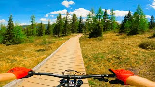
Flowline (Nr. 402) (einfach) startet bei der Bergstation und führt mit geringem Gefälle zuerst durch eine wunderschöne Schwarzbeerheide und dann durch Lärchen- und Fichtenwälder direkt zur Mittelstation der Planaibahn.

Tags
Family friendlySummit

Bike Park

Recent Activity on Trail

Past Week
  • 0 rides
  •  
6 Months
  • 106 rides
  • 30 miles avg distance
All
  • 385 rides
  • Last: Oct 31, 2026
update trails status or condition

Peak Flowline Trail Reports

statusdatedescription
Sep 14, 2026 @ 12:26pm (Europe/Vienna)
Sep 14, 2026
Jul 28, 2026 @ 2:04pm (Europe/Ljubljana)
Jul 28, 2026
Jan 6, 2026 @ 7:16pm (Europe/Vienna)
Jan 6, 2026
Gesperrt. Skisaison jetzt. Vorraussichtliche Öffnung des Bikeparks laut aktuellem Stand am 14.Mai 2026
Jan 6, 2026 @ 7:16pm (Europe/Vienna)
Jan 6, 2026
Gesperrt. Skisaison jetzt. Vorraussichtliche Öffnung des Bikeparks laut aktuellem Stand am 14.Mai 2026
Aug 7, 2025 @ 12:52pm
Aug 7, 2025
more »
Status:
on Sep 14, 2026
Variable
Avg: 4.29 (19 votes)
Your vote: 0

view (4,849)
close
      Directions to peak-flowline trailhead (47.372280, 13.725090)

      Photos

      3 more »
      mtb
      220 |
      Jul 31, 2020 @ 8:36am
      Jul 31, 2020
      mtb
      235 |
      Jul 31, 2020 @ 8:35am
      Jul 31, 2020
      mtb
      324 |
      Jul 10, 2020 @ 1:13pm
      Jul 10, 2020

      Videos

      3 more »
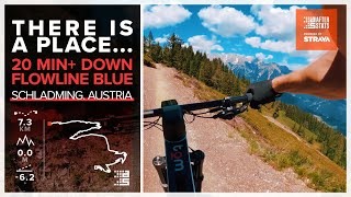
      Schladming Planai Bike Park - Flowline Blue on...
      mtb
      21:51 | 450 | Oct 11, 2022 , Schladming
      FLOWLINE, Schladming .. THIS TRAIL IS SH!T
      mtb
      8:59 | 583 | Jun 12, 2022 , Schladming
      Bikepark Schladming | Flowline | 2020
      mtb
      20:52 | 871 | Sep 7, 2020 , Schladming
      4.4 ★★★★★
      19 Ratings
      5 ★ 53%
      4 ★ 32%
      3 ★ 16%
      2 ★
      1 ★

      3 Reviews & Comments

      westiebestie westiebestie
      Very nicely shaped with perfect gradient so there is little braking needed. One of the better easy flow trails I have ridden. Super for families and beginners.
      grim007 grim007
      One of the best flow trails I've ridden. Everything flows really well, you can pick up speed really fast. Very fun trail with easy features, be careful not to overshoot.
      When I rode it, it was in excellent condition with no breaking bumps. I rode is several times, it is super fun.
      ktm-boy-69 ktm-boy-69
      Very easy track – more "family-line" than "flow-line" – ("S0").

      But probably the best family-track i have ever ridden. Even okay with some fun-sections for better riders. Perfect shaped curves!

      Respect to the perfect work @trailbuilders! :-)

      We hope you've been enjoying Trailforks!

      Create a FREE account to view all trail reviews and much more.

      Frequently Asked Questions

      ▼ Where is Peak Flowline located?
      Peak Flowline is located in Bikepark Schladming, Schladming, Austria. It is part of the Bikepark Schladming trail network. The trailhead is located at coordinates 47.37228, 13.72509.
      ▼ How hard is Peak Flowline?
      Peak Flowline is rated as Blue difficulty. The physical rating is Moderate. The average grade is 6%.
      ▼ What is the elevation gain for Peak Flowline?
      Peak Flowline has 24 ft of elevation gain. The trail has 1,535 ft of elevation descent. The elevation ranges from 4,457 ft to 5,968 ft.
      ▼ Is Peak Flowline a point to point trail?
      Yes, Peak Flowline is a point to point trail. The direction is Downhill Only. The trail type is machine groomed.
      ▼ How long is Peak Flowline?
      Peak Flowline is 4.8 miles long. The trail type is machine groomed.
      ▼ Are dogs allowed on Peak Flowline?
      There is no information about dogs being allowed on Peak Flowline. Check with local trail managers or the trail page for the latest access rules.
      ▼ How do I access Peak Flowline? Where is the closest parking trailhead?
      The closest parking and trailhead locations to Peak Flowline are: View all parking locations in the area.
      ▼ How long does it take to ride Peak Flowline?
      Based on recorded activities, it takes an average of 17 minutes to ride Peak Flowline. The trail is 4.8 miles long. Actual times will vary based on fitness level, conditions, and pace. View recent activity logs for more details.
      ▼ How busy is Peak Flowline?
      Peak Flowline is a moderately popular trail. There have been 2,433 recorded activities on this trail. The trail has received 4,849 check-ins. View recent activity on this trail.

      Hit the Trail

      Open in App

      Get this trail on your phone instantly.

      open trail in app

      Download Trail

      Save to wishlist, Garmin & download.
      save the trail

      Find Related Routes

      Find routes and users activities that include this trail.
      find routes for this trail

      You must enter a description before submitting.

