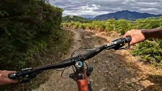
more stats
4,557 ft
Distance
60 ft
Climb
-276 ft
Descent
00:05:48
Avg time
-216 ft
Altitude change
1,076 ft
Altitude min
1,308 ft
Altitude max
1,292 ft
Altitude start
1,076 ft
Altitude end
-4.7%
Grade
-41.2%
Grade max
15.1%
Grade min
1,240 ft
Distance climb
2,822 ft
Distance down
492 ft
Distance flat
00:05:48
Avg time

Phoenix Details

  • Activities
    • Mountain Bike
    • Hike
    • Trail Running
  • Riding Area
    7 Mile Riding Area
    Queenstown
  • AKA
    Moke Lake/Lake Dispute Circuit
  • Difficulty Rating
  • Local Popularity
    55 in Mountain Biking heatmap [+]
    • 5 in Trail Running
    • 5 in Hiking
  • Global Ranking
    #75151 in Mountain Biking [+]
    • #347440 in Trail Running
    • #333529 in Hiking
  • National Ranking
    #1,664 in Mountain Biking · New Zealand [+]
    • #4,121 in Trail Running
    • #3,438 in Hiking
  • Hiking SAC Scale
    T1 Hiking
  • Trail Type
    Singletrack
  • Bike Type
    AM, XC
  • Climb Difficulty
    Blue
  • Physical Rating
    Easy
  • Trail Visibility
    Always easy to follow
  • Season
    Year Round
  • Dogs Allowed
    Yes
  • TTFs on Trail
    Berm, Drop, Roller Coaster
  • Year Opened
    2014
  • Land Owner

Mountain bike-specific singletrack built and maintained by the Queenstown Mountain Bike Club to link Lake Dispute to the 7 Mile Riding Area, while avoiding the tarmac road section.

Traverses across the face of the hill affording some great views of Lake Wakatipu and the Remarkables before dropping into a fun roller coaster section and finally into some native bush with switchbacks.

Take care if riding in the wet or after heavy rain.

Access Info

Can be ridden as part of the Moke Lake/Lake Dispute circuit.

Alternatively ride up the DoC Lake Dispute Track (aka Pheonix Climb) from Glenorchy Road and turn off at the QMTBC Phoenix sign.

Tags
BermsDropsLakeRollersViews

Local Trail Association

Traditionally Indigenous Territory

Recent Activity on Trail

Past Week
  • 0 rides
  •  
6 Months
  • 7 rides
  • 16 miles avg distance
All
  • 154 rides
  • Last: Nov 8, 2026
c1c2c3c4
January
February
March
April
May
June
July
August
September
October
November
December
update trails status or condition

Phoenix Trail Reports

statusdatedescription
Oct 21, 2026 @ 7:58am (Pacific/Auckland)
Oct 20, 2026
reporter Bracken cleared and sprayed
Sep 18, 2026 @ 9:04pm (Pacific/Auckland)
Sep 18, 2026
reporter Pipe fixed up top
Sep 7, 2026 @ 2:56pm (Pacific/Auckland)
Sep 6, 2026
reporter Pipe washed away at top
Aug 12, 2026 @ 11:21am (Pacific/Auckland)
Aug 11, 2026
reporter Drains cleared ready for springs rain, wet coroner rebuilt
May 29, 2026 @ 3:47pm (Pacific/Auckland)
May 28, 2026
Full trail cleared, leaves blown, drainage cleaned out ready for winter. Riding well go get it!
more »
Status:
on Oct 21, 2026
Ideal
Avg: 4.46 (10 votes)
Your vote: 0

view (1,204)
close
      Directions to phoenix-25555 trailhead (-45.061090, 168.554750)

      Photos

      29 more »
      mtb
      459 |
      Dec 16, 2021 @ 1:53am
      Dec 16, 2021
      mtb
      214 |
      Dec 15, 2021 @ 11:27pm
      Dec 15, 2021
      mtb
      473 |
      Dec 15, 2021 @ 11:27pm
      Dec 15, 2021
      mtb
      144 |
      Feb 29, 2020 @ 10:08pm
      Feb 29, 2020

      Videos

      2 more »
      youtuber Phoenix @ 7 Mile, Queenstown
      mtb
      4:59 | 45 | Sep 14, 2026 , Queenstown
      7 Mile - Kachoong/Jack B Nimble/Grin &...
      mtb
      11:24 | 720 | Apr 14, 2021 , Queenstown

      Routes with this trail

      more »
      ★ 1.0 • 15 miles • 2,342 ft • 7 • Loop •
      Classic Queenstown backountry loop sometimes called the 'Four Lakes' ride, start at either Wilson Bay or 7...
      4.5 ★★★★★
      10 Ratings
      5 ★ 70%
      4 ★ 20%
      3 ★
      2 ★ 10%
      1 ★

      2 Reviews & Comments

      Kickdenys18
      Overgrown and not maintained well. It’s runs but not super fun for that reason. The lower trails seemed like better options to check out.
      elevatetrails
      Vegetation clearance completed, riding well.
      Check culverts and drains are running clear, some drainage pipes need to be overlaid with fresh dirt.

      We hope you've been enjoying Trailforks!

      Create a FREE account to view all trail reviews and much more.

      • By BrendhanTF Pro & contributors
      • #25555 - 8,003 views

      Frequently Asked Questions

      ▼ Where is Phoenix located?
      Phoenix is located in 7 Mile Riding Area, Queenstown, New Zealand. It is part of the 7 Mile Riding Area trail network. The trailhead is located at coordinates -45.06109, 168.55475.
      ▼ How hard is Phoenix?
      Phoenix is rated as Blue difficulty. The physical rating is Easy. The average grade is 4.7%. The climb difficulty is rated Blue.
      ▼ What is the elevation gain for Phoenix?
      Phoenix has 60 ft of elevation gain. The trail has 276 ft of elevation descent. The elevation ranges from 1,076 ft to 1,308 ft.
      ▼ How long is Phoenix?
      Phoenix is 4,557 ft long. The trail type is singletrack.
      ▼ Are dogs allowed on Phoenix?
      Yes, dogs are allowed on Phoenix. Please keep dogs on a leash where required and clean up after them.
      ▼ When is the best time of year to ride Phoenix?
      Based on activity log data, the most popular months to ride Phoenix are:
      • January (13 activities)
      • March (12 activities)
      • February (9 activities)
      Check the reports page for current trail conditions.
      ▼ How do I access Phoenix? Where is the closest parking trailhead?
      The closest parking and trailhead locations to Phoenix are: View all parking locations in the area.
      ▼ How long does it take to ride Phoenix?
      Based on recorded activities, it takes an average of 6 minutes to ride Phoenix. The trail is 4,557 ft long. Actual times will vary based on fitness level, conditions, and pace. View recent activity logs for more details.
      ▼ How busy is Phoenix?
      Phoenix is a moderately popular trail. There have been 1,330 recorded activities on this trail. The trail has received 1,204 check-ins. View recent activity on this trail.

      Hit the Trail

      Open in App

      Get this trail on your phone instantly.

      open trail in app

      Download Trail

      Save to wishlist, Garmin & download.
      save the trail

      Find Related Routes

      Find routes and users activities that include this trail.
      find routes for this trail

      You must enter a description before submitting.