



more stats
1.3 miles
Distance
219 ft
Climb
-1,035 ft
Descent
00:08:17
Avg time
-818 ft
Altitude change
509 ft
Altitude min
1,410 ft
Altitude max
1,347 ft
Altitude start
531 ft
Altitude end
-11.6%
Grade
-115%
Grade max
38.2%
Grade min
1,627 ft
Distance climb
5,246 ft
Distance down
171 ft
Distance flat
00:08:17
Avg time

Pico dos Bodes Details

  • Activities
    • Mountain Bike
    • Adaptive Bike
    • Winter Fat Bike
    • Hike
    • Trail Running
  • Riding Area
  • Difficulty Rating
  • Local Popularity
    90 in Mountain Biking [+]
    • 5 in Trail Running
    • 5 in Hiking
    • 5 in Winter Fat Biking
    • 5 in Adaptive Biking
  • Global Ranking
    #43704 in Mountain Biking [+]
    • #321461 in Trail Running
    • #341108 in Hiking
    • #5028 in Winter Fat Biking
    • #1837 in Adaptive Biking
  • National Ranking
    #305 in Mountain Biking · Portugal [+]
    • #1,012 in Trail Running
    • #895 in Hiking
    • #8 in Winter Fat Biking
    • #9 in Adaptive Biking
  • Trail Type
    Singletrack
  • Bike Type
    DH, AM, XC, Fat, Adaptive MTB
  • Direction
    Downhill Primary
    Popular Direction Shown
  • Physical Rating
    Moderate
  • Season
    All Year
  • Dogs Allowed
    Yes
  • Ride in Rain
    Yes

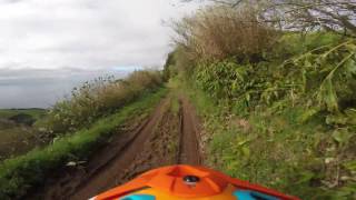
The trail start on a double track, than continue on a single track all the way down. The track is loamy with some slippery rocks in between. The final part is really fast ending on a tight combination of switchbacks.

This trail is unsanctioned.

Adaptive Bike Info
aMTB Green Rating: Beginner features and moderate terrain.
Tags
Loamy

Recent Activity on Trail

Past Week
  • 0 rides
  •  
6 Months
  • 1 rides
  • 9 miles avg distance
All
  • 6 rides
  • Last: Aug 8, 2026
c1c2c3c4
January
February
March
April
May
June
July
August
September
October
November
December
update trails status or condition

Pico dos Bodes Trail Reports

statusdatedescription
Apr 24, 2025 @ 11:24am
Apr 24, 2025
Divertente e scassato il giusto. Alterna parti flow a parti da guidare e trovare la linea giusta
Sep 3, 2022 @ 2:14pm
Sep 3, 2022
Clear all around
Jun 26, 2019 @ 1:23am
Jun 26, 2019
All running clear
Jun 21, 2018 @ 3:37pm
Jun 21, 2018
Aug 26, 2017 @ 4:05pm
Aug 26, 2017
Nice flowy trail with a stunning view on Povoaçao! Good condition!
more »
Status:
on Apr 24, 2025
Ideal
Avg: 4.24 (2 votes)
Your vote: 0

view (131)
close
      Directions to pico-dos-bodes trailhead (37.747030, -25.215980)

      Photos

      25 more »
      mtb
      162 |
      Mar 14, 2018 @ 8:40am
      Mar 14, 2018
      mtb
      146 |
      Mar 14, 2018 @ 8:39am
      Mar 14, 2018
      mtb
      125 |
      Mar 12, 2018 @ 8:32am
      Mar 12, 2018
      mtb
      103 |
      Mar 12, 2018 @ 8:31am
      Mar 12, 2018

      Videos

      47 more »
      MTB RAW | Pico dos Bodes AZORES w/ Henrique Cabral
      mtb
      2:15 | 223 | Sep 3, 2022 , Ponta Delgada
      Downhill riding with friends in Azores Portugal
      mtb
      5:59 | 320 | Jul 20, 2021 , Ponta Delgada
      5AM Dreamers / an MTB short film
      mtb
      11:27 | 329 | Sep 23, 2020 , Ponta Delgada
      youtuber Faial da Terra - 'pico dos bodes' - MTB Azores
      mtb
      6:24 | 613 | Jun 9, 2018 , Ponta Delgada

      Routes with this trail

      ★ 5.0 • 24 miles • 6,221 ft • 8 • Loop • Race •
      Route of day 1 of the Faial da Terra Enduro Fest 2017 4 timed Stages of 8 total and finishing the weekend...
      5.0 ★★★★★
      2 Ratings
      5 ★ 100%
      4 ★
      3 ★
      2 ★
      1 ★

      1 Review & Comments

      NERyder
      This trail is fun and fast and rough. I would not call it loamy like the description. It has lots of continuous rock gardens. Fun trail but I would not call it loamy

      We hope you've been enjoying Trailforks!

      Create a FREE account to view all trail reviews and much more.

      • #7264 - 2,625 views

      Frequently Asked Questions

      ▼ Where is Pico dos Bodes located?
      Pico dos Bodes is located in Ponta Delgada, Portugal. It is part of the Ponta Delgada trail network. The trailhead is located at coordinates 37.74703, -25.21598.
      ▼ How hard is Pico dos Bodes?
      Pico dos Bodes is rated as Red difficulty. The physical rating is Moderate. The average grade is 11.6%.
      ▼ What is the elevation gain for Pico dos Bodes?
      Pico dos Bodes has 219 ft of elevation gain. The trail has 1,035 ft of elevation descent. The elevation ranges from 509 ft to 1,410 ft.
      ▼ Is Pico dos Bodes a point to point trail?
      Pico dos Bodes is not a point to point trail. The direction is Downhill Primary. The trail type is singletrack.
      ▼ How long is Pico dos Bodes?
      Pico dos Bodes is 1.3 miles long. The trail type is singletrack.
      ▼ Are dogs allowed on Pico dos Bodes?
      Yes, dogs are allowed on Pico dos Bodes. Please keep dogs on a leash where required and clean up after them.
      ▼ When is the best time of year to ride Pico dos Bodes?
      Based on activity log data, the most popular months to ride Pico dos Bodes are:
      • April (2 activities)
      • June (2 activities)
      • August (1 activities)
      Check the reports page for current trail conditions.
      ▼ How do I access Pico dos Bodes? Where is the closest parking trailhead?
      The closest parking and trailhead locations to Pico dos Bodes are: View all parking locations in the area.
      ▼ How long does it take to ride Pico dos Bodes?
      Based on recorded activities, it takes an average of 8 minutes to ride Pico dos Bodes. The trail is 1.3 miles long. Actual times will vary based on fitness level, conditions, and pace. View recent activity logs for more details.
      ▼ How busy is Pico dos Bodes?
      Pico dos Bodes is a very popular trail. There have been 112 recorded activities on this trail. The trail has received 131 check-ins. View recent activity on this trail.

      Hit the Trail

      Open in App

      Get this trail on your phone instantly.

      open trail in app

      Download Trail

      Save to wishlist, Garmin & download.
      save the trail

      Find Related Routes

      Find routes and users activities that include this trail.
      find routes for this trail

      You must enter a description before submitting.

