

more stats
2,848 ft
Distance
-407 ft
Descent
00:02:43
Avg time
-407 ft
Altitude change
320 ft
Altitude min
727 ft
Altitude max
727 ft
Altitude start
322 ft
Altitude end
-14.3%
Grade
-56.7%
Grade max
-1.5%
Grade min
2,805 ft
Distance down
43 ft
Distance flat
00:02:43
Avg time

Piñata Details

  • Activities
    • Mountain Bike
    • Hike
    • Trail Running
  • Riding Area
    Calvario
    Gorizia
  • Difficulty Rating
  • Voted Difficulty
    Blue (2 votes)
  • Local Popularity
    85 in Mountain Biking [+]
    • 85 in Trail Running
    • 5 in Hiking
  • Global Ranking
    #31272 in Mountain Biking [+]
    • #144387 in Trail Running
    • #207198 in Hiking
  • National Ranking
    #3,026 in Mountain Biking · Italy [+]
    • #4,619 in Trail Running
    • #6,037 in Hiking
  • Trail Type
    Singletrack
  • Bike Type
    DH, AM, XC
  • Direction
    Downhill Primary
    Popular Direction Shown
  • Dogs Allowed
    Yes
  • TTFs on Trail
    Berm, Bridge, Drop, Jump

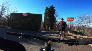
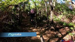
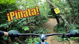
Flowly dirt trail with berms, little jumps, steep chutes and compressions. Most technical features are just some roots.

Access Info

in the middle of the fire road between the mounument on the top of the hill and the "3 Croci" monumental area you will see two little berms on the sides and then the trail starts straight on the right. Keep always the left at the forks, otherwise you will follow the other twon line "Easy DH"

Tags
BermsBridgesDropsJumps
Local Trail Association

Recent Activity on Trail

Past Week
  • 0 rides
  •  
6 Months
  • 24 rides
  • 13 miles avg distance
All
  • 289 rides
  • Last: Oct 7, 2026
c1c2c3c4
January
February
March
April
May
June
July
August
September
October
November
December
Status:
on May 2, 2026
Dry
Avg: 4.49 (9 votes)
Your vote: 0

view (2,600)
close
      Directions to pinata trailhead (45.944010, 13.590190)

      Photos

      2 more »
      report
      mtb
      195 |
      May 29, 2020 @ 4:57am
      May 29, 2020
      report
      mtb
      209 |
      May 29, 2020 @ 4:57am
      May 29, 2020

      Videos

      5 more »
      Monte Calvario trails Piñata, Easy DH, Tre Croci
      mtb
      9:09 | 308 | Mar 30, 2022 , Gorizia
      Monte Calvario trails Piñata, Easy DH, Tre Croci
      mtb
      9:09 | 253 | Feb 21, 2022 , Gorizia
      Piñata
      mtb
      7:09 | 135 | Feb 18, 2022 , Gorizia
      Piñata trail 2021
      mtb
      4:18 | 307 | May 30, 2021 , Gorizia

      Trail Lists

      Routes with this trail

      13 miles • 2,880 ft • 13 • Race •
      Go Enduro 4Fun/Friuli Venezia Giulia Regional Championship 2019
      4.9 ★★★★★
      9 Ratings
      5 ★ 89%
      4 ★ 11%
      3 ★
      2 ★
      1 ★

      1 Review & Comments

      H19CX0
      Il trail e segnato come verde a secondo me è più un blu, non tanto per la tipologia di terreno che di fatto e il trail più ‘pulito’ e flow della zona ma più che altro per i rilanci finali che sono belli veloci, però ammetto che se si segue la linea principale il grip e buono.

      We hope you've been enjoying Trailforks!

      Create a FREE account to view all trail reviews and much more.

      • By riccardop & contributors
      • #168885 - 2,236 views

      Frequently Asked Questions

      ▼ Where is Piñata located?
      Piñata is located in Calvario, Gorizia, Italy. It is part of the Calvario trail network. The trailhead is located at coordinates 45.94401, 13.59019.
      ▼ How hard is Piñata?
      Piñata is rated as Green difficulty. The average grade is 14.3%.
      ▼ What is the elevation gain for Piñata?
      The trail has 407 ft of elevation descent. The elevation ranges from 320 ft to 727 ft.
      ▼ Is Piñata a point to point trail?
      Piñata is not a point to point trail. The direction is Downhill Primary. The trail type is singletrack.
      ▼ How long is Piñata?
      Piñata is 2,848 ft long. The trail type is singletrack.
      ▼ Are dogs allowed on Piñata?
      Yes, dogs are allowed on Piñata. Please keep dogs on a leash where required and clean up after them.
      ▼ When is the best time of year to ride Piñata?
      Based on activity log data, the most popular months to ride Piñata are:
      • March (45 activities)
      • December (25 activities)
      • November (21 activities)
      Check the reports page for current trail conditions.
      ▼ How do I access Piñata? Where is the closest parking trailhead?
      The closest parking and trailhead locations to Piñata are: View all parking locations in the area.
      ▼ How long does it take to ride Piñata?
      Based on recorded activities, it takes an average of 3 minutes to ride Piñata. The trail is 2,848 ft long. Actual times will vary based on fitness level, conditions, and pace. View recent activity logs for more details.
      ▼ How busy is Piñata?
      Piñata is a very popular trail. There have been 1,972 recorded activities on this trail. The trail has received 2,600 check-ins. View recent activity on this trail.

      Hit the Trail

      Open in App

      Get this trail on your phone instantly.

      open trail in app

      Download Trail

      Save to wishlist, Garmin & download.
      save the trail

      Find Related Routes

      Find routes and users activities that include this trail.
      find routes for this trail

      You must enter a description before submitting.


